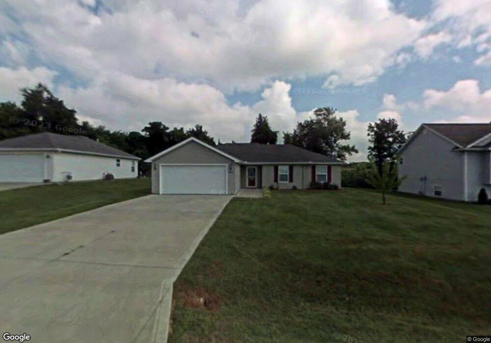
581 SE 110th Rd Warrensburg, MO 64093
Estimated Value: $242,569 - $306,000
3
Beds
2
Baths
1,354
Sq Ft
$201/Sq Ft
Est. Value
About This Home
This home is located at 581 SE 110th Rd, Warrensburg, MO 64093 and is currently estimated at $272,392, approximately $201 per square foot. 581 SE 110th Rd is a home located in Johnson County with nearby schools including Maple Grove Elementary School, Martin Warren Elementary School, and Warrensburg Middle School.
Ownership History
Date
Name
Owned For
Owner Type
Purchase Details
Closed on
Oct 3, 2016
Sold by
Meyer Jacob B and Meyer Amanda R
Bought by
Schmitz Joseph J
Current Estimated Value
Home Financials for this Owner
Home Financials are based on the most recent Mortgage that was taken out on this home.
Original Mortgage
$127,059
Outstanding Balance
$100,383
Interest Rate
3.43%
Mortgage Type
VA
Estimated Equity
$172,009
Purchase Details
Closed on
Nov 19, 2010
Sold by
Stewart Duane R and Stewart Elizabeth G
Bought by
Meyer Jacob B and Meyer Amanda R
Home Financials for this Owner
Home Financials are based on the most recent Mortgage that was taken out on this home.
Original Mortgage
$130,241
Interest Rate
4.23%
Mortgage Type
VA
Purchase Details
Closed on
Apr 3, 2008
Sold by
Coats Kristopher S and Coats Catherine M
Bought by
Stewart Duane R
Create a Home Valuation Report for This Property
The Home Valuation Report is an in-depth analysis detailing your home's value as well as a comparison with similar homes in the area
Purchase History
We collect this data history from publicly available records. To have your information removed, we recommend requesting removal directly through your county’s website.
| Date | Buyer | Sale Price | Title Company |
|---|---|---|---|
| Schmitz Joseph J | -- | Jctc | |
| Meyer Jacob B | -- | None Available | |
| Stewart Duane R | -- | -- |
Source: Public Records
Mortgage History
We collect this data history from publicly available records. To have your information removed, we recommend requesting removal directly through your county’s website.
| Date | Status | Borrower | Loan Amount |
|---|---|---|---|
| Open | Schmitz Joseph J | $127,059 | |
| Previous Owner | Meyer Jacob B | $130,241 |
Source: Public Records
Tax History
| Year | Tax Paid | Tax Assessment Tax Assessment Total Assessment is a certain percentage of the fair market value that is determined by local assessors to be the total taxable value of land and additions on the property. | Land | Improvement |
|---|---|---|---|---|
| 2025 | $1,551 | $21,674 | $0 | $0 |
| 2024 | $1,456 | $19,992 | $0 | $0 |
| 2023 | $1,456 | $19,992 | $0 | $0 |
| 2022 | $1,406 | $19,218 | $0 | $0 |
| 2021 | $1,401 | $19,218 | $0 | $0 |
| 2020 | $1,361 | $18,440 | $0 | $0 |
| 2019 | $1,360 | $18,440 | $0 | $0 |
| 2017 | $1,312 | $18,529 | $0 | $0 |
| 2016 | $1,309 | $18,529 | $0 | $0 |
| 2015 | $1,348 | $18,529 | $0 | $0 |
| 2014 | -- | $18,529 | $0 | $0 |
Source: Public Records
Map
Nearby Homes
- 141 SE 611 Rd
- 139 SE 621 Rd
- 120 SE 471st Rd
- 467 SE 90th Rd
- 97 SE 451st Rd
- 72 SE 461st Rd
- 80 SE 451st Rd
- 109 SE 421st Rd
- 179 SE 431st Rd
- 143 SE 411th Rd Unit 12
- 91 SE 381st Rd Unit A
- 76A SE 361st Rd
- 356 SE 85th Rd
- Tbd Tract C Se 400th Rd
- Tbd Tract B Se 400th Rd
- 0 SE Tract C 400th Rd
- Tbd Southeast 400th Rd
- Tbd Tract A Se 400th Rd
- 0 SE Tract B 400th Rd
- 0 SE Tract A 400th Rd
- 581 SE 110 Rd
- 583 SE 110th Rd
- 579 SE 110th Rd
- 577 SE 110 Rd
- 577 SE 110th Rd
- 585 SE 110th Rd
- 584 SE 110th Rd
- 582 SE 110th Rd
- 580 SE 110 Rd
- 575 SE 110th Rd
- 587 SE 110th Rd
- 586 SE 110th Rd
- 587 SE 110 Rd
- 569 SE 115th Rd
- 564 SE 115th Rd
- 101 SE 581st Rd
- 105 SE 581st Rd
- 566 SE 115th Rd
- 573 SE 115th Rd
- 575 SE 115th Rd
Your Personal Tour Guide
Ask me questions while you tour the home.