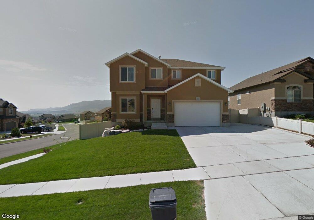
581 W Crenshaw Ct Saratoga Springs, UT 84045
Estimated Value: $587,000 - $684,000
5
Beds
4
Baths
3,061
Sq Ft
$204/Sq Ft
Est. Value
About This Home
This home is located at 581 W Crenshaw Ct, Saratoga Springs, UT 84045 and is currently estimated at $623,920, approximately $203 per square foot. 581 W Crenshaw Ct is a home located in Utah County with nearby schools including Harvest Elementary School, Vista Heights Middle School, and Westlake High School.
Ownership History
Date
Name
Owned For
Owner Type
Purchase Details
Closed on
Dec 5, 2018
Sold by
Garrett Phil
Bought by
Garrett Phil and Garrett Marci
Current Estimated Value
Home Financials for this Owner
Home Financials are based on the most recent Mortgage that was taken out on this home.
Original Mortgage
$357,575
Outstanding Balance
$315,031
Interest Rate
4.8%
Mortgage Type
New Conventional
Estimated Equity
$308,889
Purchase Details
Closed on
Dec 4, 2018
Sold by
Jones Scott F and Jones Tiffany
Bought by
Garrett Phil
Home Financials for this Owner
Home Financials are based on the most recent Mortgage that was taken out on this home.
Original Mortgage
$357,575
Outstanding Balance
$315,031
Interest Rate
4.8%
Mortgage Type
New Conventional
Estimated Equity
$308,889
Purchase Details
Closed on
Mar 26, 2015
Sold by
Jones Scott and Jones Tiffany
Bought by
Jones Scott F and Jones Tiffany
Home Financials for this Owner
Home Financials are based on the most recent Mortgage that was taken out on this home.
Original Mortgage
$257,600
Interest Rate
3.65%
Mortgage Type
New Conventional
Purchase Details
Closed on
Feb 21, 2012
Sold by
The Secretary Of Housing & Urban Develop
Bought by
Jones Scott and Jones Tiffany
Home Financials for this Owner
Home Financials are based on the most recent Mortgage that was taken out on this home.
Original Mortgage
$206,949
Interest Rate
3.68%
Mortgage Type
FHA
Purchase Details
Closed on
Mar 18, 2011
Sold by
Us Bank National Association
Bought by
The Secretary Of Housing & Urban Develop
Purchase Details
Closed on
Mar 7, 2011
Sold by
Maxfield C Tyler
Bought by
Us Bank National Association
Purchase Details
Closed on
Apr 16, 2009
Sold by
Maxfield C Tyler
Bought by
Maxfield C Tyler and Maxfield Kera
Home Financials for this Owner
Home Financials are based on the most recent Mortgage that was taken out on this home.
Original Mortgage
$238,293
Interest Rate
4.99%
Mortgage Type
FHA
Create a Home Valuation Report for This Property
The Home Valuation Report is an in-depth analysis detailing your home's value as well as a comparison with similar homes in the area
Home Values in the Area
Average Home Value in this Area
Purchase History
| Date | Buyer | Sale Price | Title Company |
|---|---|---|---|
| Garrett Phil | -- | Accommodation | |
| Garrett Phil | -- | Inwest Title | |
| Jones Scott F | -- | Affiliated First Title Co | |
| Jones Scott | -- | Monument Title Insurance Inc | |
| The Secretary Of Housing & Urban Develop | -- | None Available | |
| Us Bank National Association | $251,073 | None Available | |
| Maxfield C Tyler | -- | Provo Land Title Company | |
| Maxfield C Tyler | -- | Provo Land Title Company |
Source: Public Records
Mortgage History
| Date | Status | Borrower | Loan Amount |
|---|---|---|---|
| Open | Garrett Phil | $357,575 | |
| Previous Owner | Jones Scott F | $257,600 | |
| Previous Owner | Jones Scott | $206,949 | |
| Previous Owner | Maxfield C Tyler | $238,293 |
Source: Public Records
Tax History Compared to Growth
Tax History
| Year | Tax Paid | Tax Assessment Tax Assessment Total Assessment is a certain percentage of the fair market value that is determined by local assessors to be the total taxable value of land and additions on the property. | Land | Improvement |
|---|---|---|---|---|
| 2025 | $2,185 | $519,300 | $215,900 | $303,400 |
| 2024 | $2,185 | $262,460 | $0 | $0 |
| 2023 | $2,075 | $268,015 | $0 | $0 |
| 2022 | $2,306 | $290,455 | $0 | $0 |
| 2021 | $2,112 | $397,100 | $128,900 | $268,200 |
| 2020 | $2,020 | $373,000 | $115,100 | $257,900 |
| 2019 | $1,815 | $347,000 | $108,300 | $238,700 |
| 2018 | $1,719 | $310,200 | $101,600 | $208,600 |
| 2017 | $1,743 | $168,245 | $0 | $0 |
| 2016 | $1,707 | $152,955 | $0 | $0 |
| 2015 | $1,681 | $142,890 | $0 | $0 |
| 2014 | $1,607 | $135,080 | $0 | $0 |
Source: Public Records
Map
Nearby Homes
- 602 W Crenshaw Ct
- 2292 N Elderberry Dr
- 2299 N Wild Hyacinth Dr Unit 601
- 2163 N Wild Hyacinth Dr
- 471 Pumpkin Patch Dr
- 527 W Flora Dr
- 376 W Indian Summer Dr
- 543 W Flora Dr
- 2503 N Velvet Moon Dr
- 2132 N Elderberry Dr
- 2123 N Wallflower Dr
- 2514 N Geranium Dr Unit 247
- 2103 N Elderberry Dr Unit 222
- 2543 N Velvet Moon Dr
- 2437 N Nectar Way
- 652 W Pimlico Dr
- Evans Plan at Wildflower - Toll Brothers at Wildflower
- Collet Plan at Wildflower - Toll Brothers at Wildflower
- Brooke Plan at Wildflower - Toll Brothers at Wildflower
- Fairbanks Plan at Wildflower - Toll Brothers at Wildflower
- 589 W Crenshaw Ct
- 597 W Crenshaw Ct
- 578 W Crenshaw Ct
- 572 W Crenshaw Ct
- 592 W Cantelope Ct
- 584 W Crenshaw Ct
- 598 W Cantelope Ct
- 2274 N Muskmelon Way
- 603 W Crenshaw Ct
- 594 W Crenshaw Ct
- 596 W Crenshaw Ct
- 596 W Crenshaw Ct
- 2262 N Muskmelon Way
- 554 W Crenshaw Way
- 608 W Cantelope Ct
- 598 W Crenshaw Ct
- 591 W Cantelope Ct
- 551 W Crenshaw Way
- 544 W Crenshaw Way
- 618 W Cantelope Ct