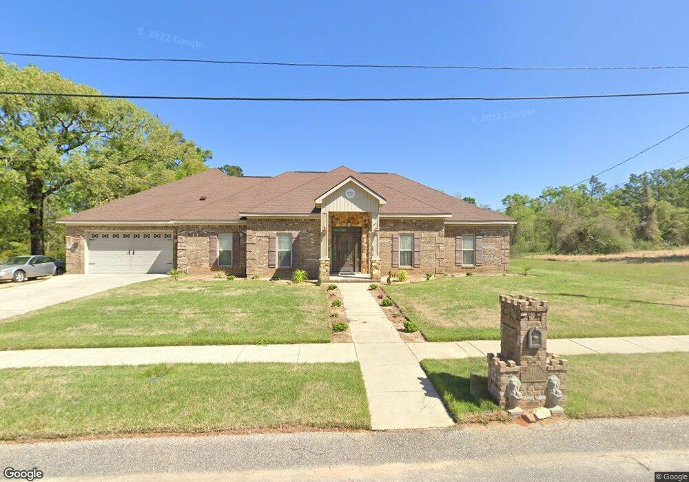
5810 Monica Dr Unit 5 Eight Mile, AL 36613
Mohawk NeighborhoodEstimated Value: $262,971 - $274,000
--
Bed
--
Bath
3,034
Sq Ft
$89/Sq Ft
Est. Value
About This Home
This home is located at 5810 Monica Dr Unit 5, Eight Mile, AL 36613 and is currently estimated at $270,243, approximately $89 per square foot. 5810 Monica Dr Unit 5 is a home located in Mobile County with nearby schools including Indian Springs Elementary School, Semmes Middle School, and Mattie T Blount High School.
Ownership History
Date
Name
Owned For
Owner Type
Purchase Details
Closed on
Feb 29, 2016
Sold by
Wells Fargo Bank N A
Bought by
Porter Lawrence and Porter Shuandretta
Current Estimated Value
Home Financials for this Owner
Home Financials are based on the most recent Mortgage that was taken out on this home.
Original Mortgage
$176,467
Interest Rate
3.73%
Mortgage Type
VA
Purchase Details
Closed on
Nov 12, 2013
Sold by
The Secretary Of Veterans Affairs
Bought by
Wells Fargo Bank N A
Purchase Details
Closed on
Apr 18, 2013
Sold by
Wells Fargo Bank Na
Bought by
The Secretary Of Veterans Affairs
Purchase Details
Closed on
Feb 8, 2013
Sold by
Porter Lawrence D and Porter Shaundretta S
Bought by
Wells Fargo Bank Na
Purchase Details
Closed on
May 12, 2009
Sold by
George D Knapp Contracting Inc
Bought by
Porter Lawrence and Porter Shaundretta S
Create a Home Valuation Report for This Property
The Home Valuation Report is an in-depth analysis detailing your home's value as well as a comparison with similar homes in the area
Home Values in the Area
Average Home Value in this Area
Purchase History
| Date | Buyer | Sale Price | Title Company |
|---|---|---|---|
| Porter Lawrence | $176,467 | None Available | |
| Wells Fargo Bank N A | -- | None Available | |
| The Secretary Of Veterans Affairs | -- | None Available | |
| Wells Fargo Bank Na | $167,447 | None Available | |
| Porter Lawrence | -- | None Available |
Source: Public Records
Mortgage History
| Date | Status | Borrower | Loan Amount |
|---|---|---|---|
| Previous Owner | Porter Lawrence | $176,467 |
Source: Public Records
Tax History Compared to Growth
Tax History
| Year | Tax Paid | Tax Assessment Tax Assessment Total Assessment is a certain percentage of the fair market value that is determined by local assessors to be the total taxable value of land and additions on the property. | Land | Improvement |
|---|---|---|---|---|
| 2024 | -- | $22,970 | $2,000 | $20,970 |
| 2023 | $0 | $26,290 | $2,000 | $24,290 |
| 2022 | $0 | $23,930 | $2,000 | $21,930 |
| 2021 | $1,211 | $24,170 | $2,000 | $22,170 |
| 2020 | $1,211 | $24,640 | $2,200 | $22,440 |
| 2019 | $1,211 | $26,100 | $0 | $0 |
| 2018 | $1,211 | $26,360 | $0 | $0 |
| 2017 | $1,224 | $26,620 | $0 | $0 |
| 2016 | $2,607 | $53,760 | $0 | $0 |
| 2013 | $1,293 | $26,420 | $0 | $0 |
Source: Public Records
Map
Nearby Homes
- 3415 Angelas Ct
- 3401 Angelas Ct
- 3377 Angelas Ct
- 3433 Angelas Ct
- 0 Jarrett Rd Unit 7648509
- 0 Jarrett Rd Unit 18128365
- 0 Jarrett Rd Unit 7268924
- 5015 Golfway Dr
- 5626 Jarrett Rd
- 3362 Lacoste Rd
- 4803 Outlaw Rd
- 3401 Lacoste Rd
- 4417 Highpoint Blvd
- 0 Bear Fork Rd Unit 7280325
- 0 Bear Fork Rd Unit 352171
- 0 Bear Fork Rd Unit 6 330217
- 0 Bear Fork Rd Unit 7042644
- 3250 Lacoste Rd
- 4527 Brunswick Dr
- 3373 Kings Gate Dr W
- 5810 Monica Dr
- 5790 Monica Dr Unit 4
- 5780 Monica Dr Unit 3
- 5830 Monica Dr
- 5820 Monica Dr
- 5750 Monica Dr
- 5750 Monica Dr Unit 1
- 5780 Monica Dr Unit 5
- 5820 Monica Dr Unit 6
- 5751 Monica Dr Unit 8
- 5830 Monica Dr Unit 7
- 0 Monica Dr Unit 7192325
- 0 Monica Dr Unit 7192261
- 0 Monica Dr Unit Lot 7 343417
- 0 Monica Dr Unit Lot 6 343416
- 0 Monica Dr
- 38 Lots Monica Dr
- 5801 Monica Dr
- 3439 Chandler Ct
- 5787 Monica Dr Unit 13