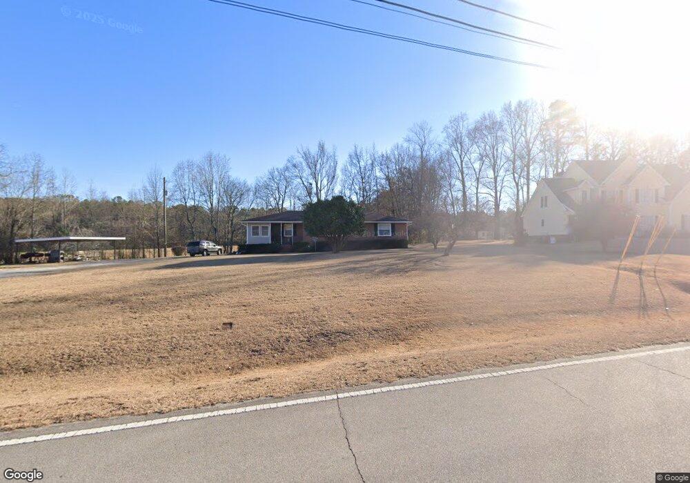
5810 Nichols Rd Powder Springs, GA 30127
West Cobb NeighborhoodEstimated Value: $320,000 - $378,917
3
Beds
1
Bath
1,324
Sq Ft
$269/Sq Ft
Est. Value
About This Home
This home is located at 5810 Nichols Rd, Powder Springs, GA 30127 and is currently estimated at $355,979, approximately $268 per square foot. 5810 Nichols Rd is a home located in Cobb County with nearby schools including Vaughan Elementary School, Lost Mountain Middle School, and Harrison High School.
Ownership History
Date
Name
Owned For
Owner Type
Purchase Details
Closed on
Jun 15, 2007
Sold by
William Anderson Camp Trust
Bought by
Chastain James D and Chastain Mary E
Current Estimated Value
Home Financials for this Owner
Home Financials are based on the most recent Mortgage that was taken out on this home.
Original Mortgage
$146,000
Outstanding Balance
$88,759
Interest Rate
6.16%
Mortgage Type
New Conventional
Estimated Equity
$267,220
Create a Home Valuation Report for This Property
The Home Valuation Report is an in-depth analysis detailing your home's value as well as a comparison with similar homes in the area
Home Values in the Area
Average Home Value in this Area
Purchase History
| Date | Buyer | Sale Price | Title Company |
|---|---|---|---|
| Chastain James D | -- | -- |
Source: Public Records
Mortgage History
| Date | Status | Borrower | Loan Amount |
|---|---|---|---|
| Open | Chastain James D | $146,000 |
Source: Public Records
Tax History Compared to Growth
Tax History
| Year | Tax Paid | Tax Assessment Tax Assessment Total Assessment is a certain percentage of the fair market value that is determined by local assessors to be the total taxable value of land and additions on the property. | Land | Improvement |
|---|---|---|---|---|
| 2025 | $3,277 | $133,228 | $91,756 | $41,472 |
| 2024 | $3,280 | $133,228 | $91,756 | $41,472 |
| 2023 | $2,461 | $120,476 | $85,536 | $34,940 |
| 2022 | $2,537 | $98,148 | $68,428 | $29,720 |
| 2021 | $2,537 | $98,148 | $68,428 | $29,720 |
| 2020 | $2,173 | $81,520 | $55,988 | $25,532 |
| 2019 | $2,173 | $81,520 | $55,988 | $25,532 |
| 2018 | $1,998 | $74,848 | $51,320 | $23,528 |
| 2017 | $1,895 | $74,848 | $51,320 | $23,528 |
| 2016 | $1,583 | $63,964 | $40,436 | $23,528 |
| 2015 | $1,471 | $58,780 | $38,880 | $19,900 |
| 2014 | $1,484 | $58,780 | $0 | $0 |
Source: Public Records
Map
Nearby Homes
- 128 Courtland Cir
- 5904 Clairmont Way
- 5954 Henley Dr
- 5585 Lavender Farms Rd
- 846 Holland Rd
- 154 Gold Leaf Trail
- 260 Rockledge Bend SW
- 284 Rockledge Bend SW
- 306 Rockledge Bend SW
- 280 Rockledge Bend SW
- 276 Rockledge Bend SW
- 288 Rockledge Bend SW
- 725 Holland Rd
- 252 Rockledge Bend SW
- 21 Nuttail Ln
- Riverton Plan at Ashworth Estates
- Woodward Plan at Ashworth Estates
- Fieldcrest Plan at Ashworth Estates
- Continental Plan at Ashworth Estates
- 5865 Nichols Rd
- 5895 Nichols Rd
- 5800 Nichols Rd
- 5896 Clairmont Ct
- 5897 Clairmont Ct
- 0 Clairmont Ct Unit 7167469
- 0 Clairmont Ct
- 134 Courtland Cir
- 5760 Nichols Rd
- 130 Courtland Cir
- 136 Courtland Cir
- 138 Courtland Cir
- 5850 Nichols Rd
- 5645 Pickens Rd
- 5792 Nichols Rd
- 131 Courtland Cir
- 133 Courtland Cir
- 135 Courtland Cir
- 126 Courtland Cir
- 140 Courtland Cir