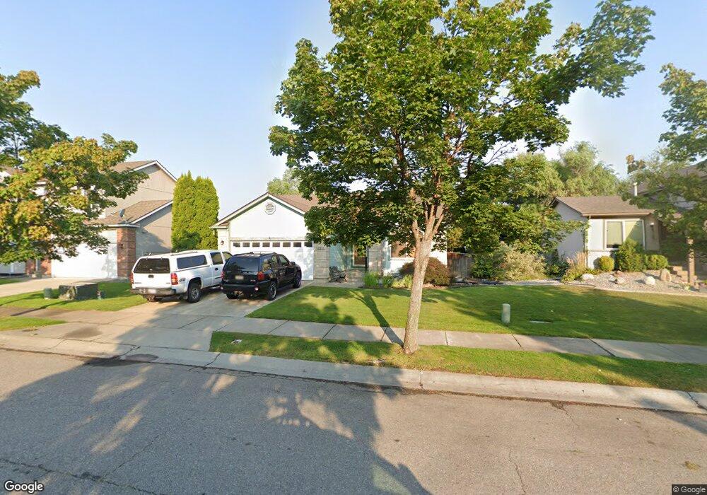
5811 N Carlisle Rd Coeur D'Alene, ID 83815
Ramsey-Woodland NeighborhoodEstimated Value: $462,000 - $583,000
2
Beds
2
Baths
2,346
Sq Ft
$222/Sq Ft
Est. Value
About This Home
This home is located at 5811 N Carlisle Rd, Coeur D'Alene, ID 83815 and is currently estimated at $521,771, approximately $222 per square foot. 5811 N Carlisle Rd is a home located in Kootenai County with nearby schools including Skyway Elementary School, Woodland Middle School, and Lake City High School.
Ownership History
Date
Name
Owned For
Owner Type
Purchase Details
Closed on
Nov 8, 2011
Sold by
Martin Thomas H and Bogardus Nancie B
Bought by
Martin Thomas Hugh and Bogardus Nancie Berwick
Current Estimated Value
Purchase Details
Closed on
Nov 8, 2006
Sold by
Anderson M Gene
Bought by
Anderson M Gene and Falk Bethany
Purchase Details
Closed on
Mar 24, 2006
Sold by
Anderson M Gene
Bought by
Anderson M Gene and Falk Bethany
Home Financials for this Owner
Home Financials are based on the most recent Mortgage that was taken out on this home.
Original Mortgage
$189,750
Interest Rate
6.25%
Mortgage Type
New Conventional
Create a Home Valuation Report for This Property
The Home Valuation Report is an in-depth analysis detailing your home's value as well as a comparison with similar homes in the area
Home Values in the Area
Average Home Value in this Area
Purchase History
| Date | Buyer | Sale Price | Title Company |
|---|---|---|---|
| Martin Thomas Hugh | -- | Alliance Title And Escrow Co | |
| Anderson M Gene | -- | -- | |
| Anderson M Gene | -- | -- | |
| Anderson M Gene | -- | -- |
Source: Public Records
Mortgage History
| Date | Status | Borrower | Loan Amount |
|---|---|---|---|
| Previous Owner | Anderson M Gene | $189,750 |
Source: Public Records
Tax History Compared to Growth
Tax History
| Year | Tax Paid | Tax Assessment Tax Assessment Total Assessment is a certain percentage of the fair market value that is determined by local assessors to be the total taxable value of land and additions on the property. | Land | Improvement |
|---|---|---|---|---|
| 2025 | $1,599 | $437,471 | $185,000 | $252,471 |
| 2024 | $1,599 | $441,075 | $185,000 | $256,075 |
| 2023 | $1,599 | $467,149 | $184,500 | $282,649 |
| 2022 | $2,100 | $516,638 | $205,000 | $311,638 |
| 2021 | $1,763 | $324,831 | $107,525 | $217,306 |
| 2020 | $1,641 | $280,953 | $93,500 | $187,453 |
| 2019 | $1,665 | $251,153 | $85,000 | $166,153 |
| 2018 | $1,447 | $216,229 | $77,963 | $138,266 |
| 2017 | $1,250 | $182,429 | $64,969 | $117,460 |
| 2016 | $1,251 | $173,145 | $61,875 | $111,270 |
| 2015 | $1,236 | $166,230 | $56,250 | $109,980 |
| 2013 | $1,257 | $154,920 | $37,800 | $117,120 |
Source: Public Records
Map
Nearby Homes
- 5887 N Harcourt Dr
- 2187 W Windermere Ave
- 2122 W Windermere Ave
- 2154 W Windermere Ave
- 2214 W Windermere Ave
- 2189 W Yorkshire Ave
- 1815 W Dartmouth Cir
- 2099 W Plymouth Cir
- 5880 N Magellan Ct
- 2055 W Dartmouth Cir
- 1686 W Dartmouth Cir
- 1840 Westminster Ave
- 1710 Westminster Ave
- 2489 W Plymouth Cir
- 5723 N Christopher Dr
- 2243 W Oxford Cir
- 1615 W Marlborough Ave
- 1630 W Windsor Ave
- 5969 N Belleville Dr
- 6522 N Idlewood Dr
- 5823 N Carlisle Rd
- 5781 N Carlisle Rd
- 5812 N Stafford Rd
- 5773 N Carlisle Rd
- 5845 N Carlisle Rd
- 5834 N Stafford Rd
- 5772 N Stafford Rd
- 1765 W Tullis Dr
- 5860 N Stafford Rd
- 5765 N Carlisle Rd
- 5764 N Stafford Rd
- 5861 N Carlisle Rd
- 5760 N Stafford Rd
- 1762 W Tullis Dr
- 1757 Tullis Dr
- 1760 W Durham Dr
- 5902 N Stafford Rd
- 5883 N Carlisle Rd
- 1754 W Tullis Dr
- 5815 N Stafford Rd