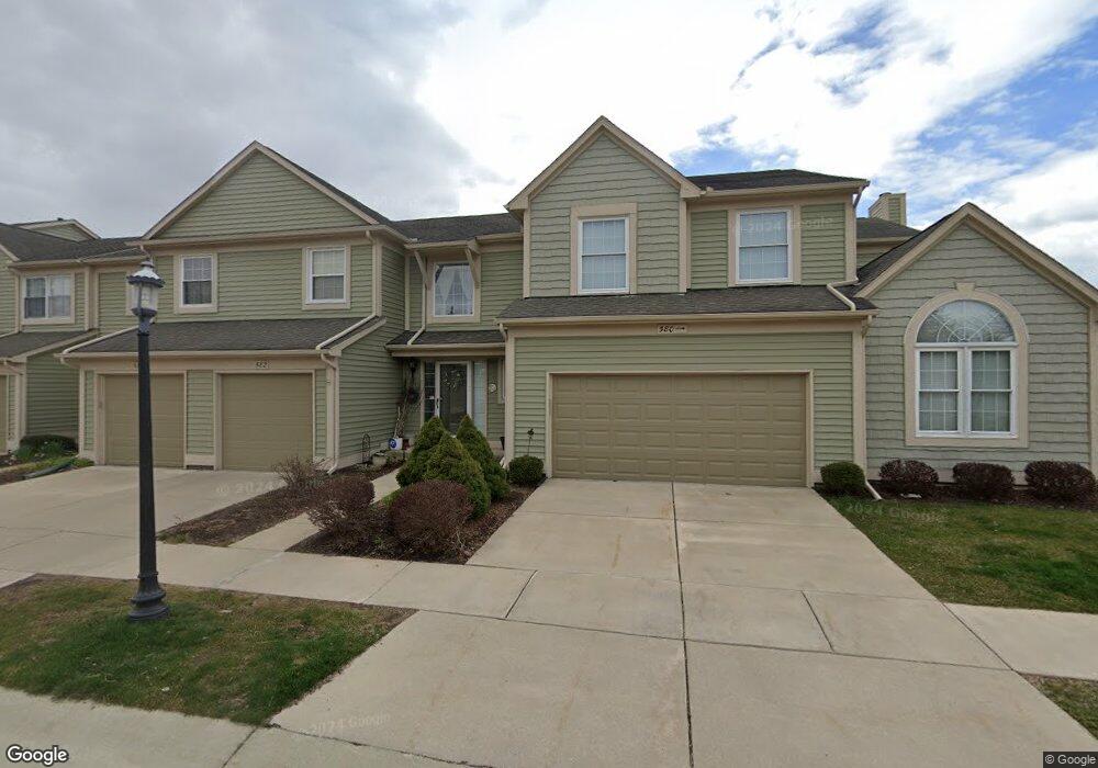
582 Liberty Pointe Dr Unit 61 Ann Arbor, MI 48103
Liberty Glen NeighborhoodEstimated Value: $331,261 - $362,000
3
Beds
1
Bath
1,378
Sq Ft
$251/Sq Ft
Est. Value
About This Home
This home is located at 582 Liberty Pointe Dr Unit 61, Ann Arbor, MI 48103 and is currently estimated at $345,315, approximately $250 per square foot. 582 Liberty Pointe Dr Unit 61 is a home located in Washtenaw County with nearby schools including Lakewood Elementary School, Forsythe Middle School, and Skyline High School.
Ownership History
Date
Name
Owned For
Owner Type
Purchase Details
Closed on
Oct 26, 2007
Sold by
Leland Janet
Bought by
Leland Janet K and 582 Liberty Pointe Dr
Current Estimated Value
Purchase Details
Closed on
Jun 6, 2003
Sold by
Leland Janet
Bought by
Leland Janet K and The Janet K Leland Living Trus
Purchase Details
Closed on
Mar 18, 2003
Sold by
Banegas Filander D and Banegas Camille A
Bought by
Leland Janet
Purchase Details
Closed on
Feb 28, 2002
Sold by
Kim Young Hwan
Bought by
Banegas Filander D
Create a Home Valuation Report for This Property
The Home Valuation Report is an in-depth analysis detailing your home's value as well as a comparison with similar homes in the area
Home Values in the Area
Average Home Value in this Area
Purchase History
| Date | Buyer | Sale Price | Title Company |
|---|---|---|---|
| Leland Janet K | -- | None Available | |
| Leland Janet K | -- | -- | |
| Leland Janet | $205,000 | -- | |
| Banegas Filander D | $187,500 | -- |
Source: Public Records
Mortgage History
| Date | Status | Borrower | Loan Amount |
|---|---|---|---|
| Closed | Banegas Filander D | -- |
Source: Public Records
Tax History Compared to Growth
Tax History
| Year | Tax Paid | Tax Assessment Tax Assessment Total Assessment is a certain percentage of the fair market value that is determined by local assessors to be the total taxable value of land and additions on the property. | Land | Improvement |
|---|---|---|---|---|
| 2025 | $4,477 | $164,100 | $0 | $0 |
| 2024 | $4,169 | $164,200 | $0 | $0 |
| 2023 | $3,844 | $156,800 | $0 | $0 |
| 2022 | $4,189 | $144,600 | $0 | $0 |
| 2021 | $4,090 | $137,900 | $0 | $0 |
| 2020 | $4,008 | $136,100 | $0 | $0 |
| 2019 | $3,814 | $126,000 | $126,000 | $0 |
| 2018 | $3,761 | $117,600 | $0 | $0 |
| 2017 | $3,658 | $112,100 | $0 | $0 |
| 2016 | $3,116 | $73,152 | $0 | $0 |
| 2015 | $3,361 | $72,934 | $0 | $0 |
| 2014 | $3,361 | $70,656 | $0 | $0 |
| 2013 | -- | $70,656 | $0 | $0 |
Source: Public Records
Map
Nearby Homes
- 609 Liberty Pointe Dr Unit 45
- 813 E Summerfield Glen Cir
- 922 W Summerfield Glen Cir Unit 110
- 2564 W Towne St
- 2509 W Liberty St
- 324 Highlake Ave
- 570 S Maple Rd
- 1053 Bluestem Ln
- 3177 Sunnywood Dr
- 1235 S Maple Rd Unit 202
- 1225 S Maple Rd Unit 307
- 2149 Fair St
- 3224 Lakewood Dr
- 1265 S Maple Rd Unit 207
- 2120 Pauline Blvd Unit 305
- 1366 N Bay Dr Unit 144
- 2052 Liberty Heights
- 2104 Pauline Blvd Unit 305
- 2126 Pauline Blvd Unit 104
- 1419 N Bay Dr Unit 73
- 584 Liberty Pointe Dr Unit 60
- 586 Liberty Point
- 580 Liberty Pointe Dr
- 586 Liberty Pointe Dr Unit 59
- 588 Liberty Pointe Dr
- 2907 Philadelphia Dr
- 2902 Salem Dr
- 585 Liberty Pointe Dr Unit 55
- 587 Liberty Pointe Dr
- 583 Liberty Pointe Dr Unit 56
- 2917 Philadelphia Dr
- 2917 Philadelphia Dr Unit 36
- 0 Liberty Pointe Dr
- 589 Liberty Pointe Dr
- 581 Liberty Pointe Dr
- 2912 Salem Dr Unit 22
- 2927 Philadelphia Dr
- 2904 Philadelphia Dr
- 640 Liberty Pointe Dr Unit 28
- 534 Liberty Pointe Dr