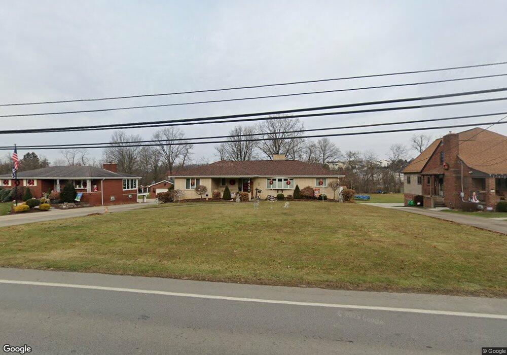
582 W Mcmurray Rd Canonsburg, PA 15317
Estimated Value: $353,000 - $401,280
3
Beds
2
Baths
2,281
Sq Ft
$170/Sq Ft
Est. Value
About This Home
This home is located at 582 W Mcmurray Rd, Canonsburg, PA 15317 and is currently estimated at $387,070, approximately $169 per square foot. 582 W Mcmurray Rd is a home located in Washington County with nearby schools including Canon-Mcmillan Senior High School.
Ownership History
Date
Name
Owned For
Owner Type
Purchase Details
Closed on
Sep 19, 2007
Sold by
Est Of Martha R Hamschin
Bought by
Sedora Thomas
Current Estimated Value
Home Financials for this Owner
Home Financials are based on the most recent Mortgage that was taken out on this home.
Original Mortgage
$200,000
Outstanding Balance
$127,145
Interest Rate
6.65%
Mortgage Type
New Conventional
Estimated Equity
$259,925
Create a Home Valuation Report for This Property
The Home Valuation Report is an in-depth analysis detailing your home's value as well as a comparison with similar homes in the area
Home Values in the Area
Average Home Value in this Area
Purchase History
| Date | Buyer | Sale Price | Title Company |
|---|---|---|---|
| Sedora Thomas | $200,000 | -- |
Source: Public Records
Mortgage History
| Date | Status | Borrower | Loan Amount |
|---|---|---|---|
| Open | Sedora Thomas | $200,000 |
Source: Public Records
Tax History Compared to Growth
Tax History
| Year | Tax Paid | Tax Assessment Tax Assessment Total Assessment is a certain percentage of the fair market value that is determined by local assessors to be the total taxable value of land and additions on the property. | Land | Improvement |
|---|---|---|---|---|
| 2025 | $3,780 | $221,100 | $83,900 | $137,200 |
| 2024 | $3,529 | $221,100 | $83,900 | $137,200 |
| 2023 | $3,529 | $221,100 | $83,900 | $137,200 |
| 2022 | $3,518 | $221,100 | $83,900 | $137,200 |
| 2021 | $3,518 | $221,100 | $83,900 | $137,200 |
| 2020 | $3,341 | $221,100 | $83,900 | $137,200 |
| 2019 | $3,286 | $221,100 | $83,900 | $137,200 |
| 2018 | $3,217 | $221,100 | $83,900 | $137,200 |
| 2017 | $694 | $221,100 | $83,900 | $137,200 |
| 2016 | $694 | $19,910 | $1,980 | $17,930 |
| 2015 | $2,251 | $19,910 | $1,980 | $17,930 |
| 2014 | $724 | $19,910 | $1,980 | $17,930 |
| 2013 | $724 | $19,910 | $1,980 | $17,930 |
Source: Public Records
Map
Nearby Homes
- 1029 Woodlawn Dr
- 151 Liberty Blvd
- 118 Maple Ridge Dr
- 113 Maple Ridge Ct
- 205 Maple Ridge Dr
- 235 Liberty Blvd
- The Franklin Plan at Southpointe
- The Betsy Ross Plan at Southpointe
- The Washington Plan at Southpointe
- The Grant Plan at Southpointe
- The Hancock Plan at Southpointe
- 153 Twilight Dr
- 238 Maple Ridge Dr
- 1009 Waterford Ct W
- 454 Independence Way
- 612 Hunting Creek Rd
- 1047 Waterford Ct E
- 304 Maple Ridge Dr
- 310 Maple Ridge Dr
- 93 Skyview Dr
- 580 W Mcmurray Rd
- 584 W Mcmurray Rd
- 586 W Mcmurray Rd
- 578 W Mcmurray Rd
- 588 W Mcmurray Rd
- 109 Enclave Dr
- 101 Enclave Dr
- 304 Azalea Ct
- 103 Enclave Dr
- 300 Azalea Ct
- 590 W Mcmurray Rd
- 302 Azalea Ct
- 574 W Mcmurray Rd
- 105 Enclave Dr
- 107 Enclave Dr
- 1359 Morgan Cir
- 306 Azalea Ct
- 308 Azalea Ct
- 592 W Mcmurray Rd
- 309 Azalea Ct