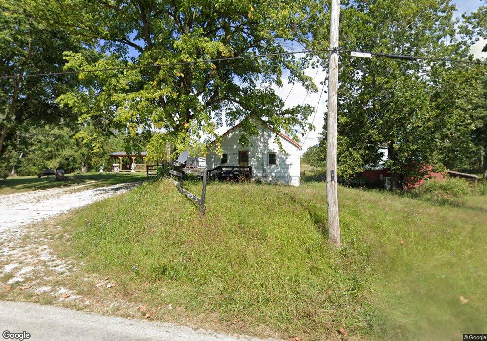
5820 W Hill Rd Decatur, IL 62522
Estimated Value: $88,000 - $361,000
4
Beds
1
Bath
916
Sq Ft
$214/Sq Ft
Est. Value
About This Home
This home is located at 5820 W Hill Rd, Decatur, IL 62522 and is currently estimated at $195,589, approximately $213 per square foot. 5820 W Hill Rd is a home located in Macon County.
Ownership History
Date
Name
Owned For
Owner Type
Purchase Details
Closed on
Jul 1, 1996
Current Estimated Value
Create a Home Valuation Report for This Property
The Home Valuation Report is an in-depth analysis detailing your home's value as well as a comparison with similar homes in the area
Home Values in the Area
Average Home Value in this Area
Purchase History
| Date | Buyer | Sale Price | Title Company |
|---|---|---|---|
| -- | $25,000 | -- |
Source: Public Records
Tax History Compared to Growth
Tax History
| Year | Tax Paid | Tax Assessment Tax Assessment Total Assessment is a certain percentage of the fair market value that is determined by local assessors to be the total taxable value of land and additions on the property. | Land | Improvement |
|---|---|---|---|---|
| 2024 | $1,515 | $26,887 | $6,129 | $20,758 |
| 2023 | $1,130 | $22,666 | $5,926 | $16,740 |
| 2022 | $1,020 | $20,960 | $5,480 | $15,480 |
| 2021 | $960 | $19,909 | $5,205 | $14,704 |
| 2020 | $773 | $17,500 | $4,905 | $12,595 |
| 2019 | $773 | $17,500 | $4,905 | $12,595 |
| 2018 | $738 | $17,085 | $4,789 | $12,296 |
| 2017 | $754 | $17,157 | $4,809 | $12,348 |
| 2016 | $761 | $17,136 | $4,803 | $12,333 |
| 2015 | $709 | $16,637 | $4,663 | $11,974 |
| 2014 | $681 | $16,472 | $4,617 | $11,855 |
| 2013 | $731 | $16,472 | $4,617 | $11,855 |
Source: Public Records
Map
Nearby Homes
- 5180 W Cantrell St
- 445 S Wyckles Rd
- 0 W Wood St
- 0 W Harristown Blvd Unit 6251050
- 7450 W William St
- 3247 Nevada Rd
- 275 N Camp St
- 3335 Nevada Rd
- 468 N Megan Dr
- 170 S Hillcrest Blvd
- 480 N Hillcrest Blvd
- 635 N Virginia Ave
- 3889 W Division St
- 2529 W Alice Ln
- 2207 Forest Crest Dr
- 1135 N Moffet Ln
- 1720 N Sunnyside Rd
- 1650 N Sunnyside Rd
- 345 S Westdale Ave
- 231 S Redwood Ln
- 5840 W Hill Rd
- 5890 W Hill Rd
- 1355 S Joynt Rd
- 5990 W Hill Rd
- 5995 W Hill Rd
- 5895 W Hill Rd
- 6040 W Hill Rd
- 6055 W Hill Rd
- 5685 W Hill Rd
- 1300 S Joynt Rd
- 6090 W Hill Rd
- 6075 W Hill Rd
- 6115 W Hill Rd
- 6095 W Hill Rd
- 5707 W Hill Rd
- 6130 W Hill Rd
- 1190 S Joynt Rd
- 6155 W Hill Rd
- 1105 S Joynt Rd
- 6195 W Hill Rd