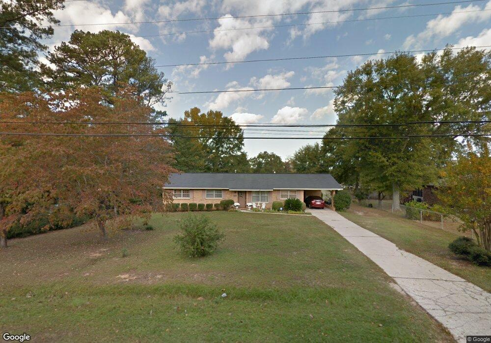
5821 Highpoint Dr Columbus, GA 31909
North Columbus NeighborhoodEstimated Value: $201,000 - $219,000
3
Beds
2
Baths
1,954
Sq Ft
$108/Sq Ft
Est. Value
About This Home
This home is located at 5821 Highpoint Dr, Columbus, GA 31909 and is currently estimated at $211,564, approximately $108 per square foot. 5821 Highpoint Dr is a home located in Muscogee County with nearby schools including Waddell Elementary School, Midland Middle School, and Shaw High School.
Ownership History
Date
Name
Owned For
Owner Type
Purchase Details
Closed on
Sep 14, 2020
Sold by
Hendrix Geraldine B
Bought by
Sparks Ivy Laraine
Current Estimated Value
Home Financials for this Owner
Home Financials are based on the most recent Mortgage that was taken out on this home.
Original Mortgage
$111,440
Outstanding Balance
$98,896
Interest Rate
2.9%
Mortgage Type
New Conventional
Estimated Equity
$112,668
Purchase Details
Closed on
Nov 9, 2015
Sold by
Hendrix V Woodie
Bought by
Hendrix V Woodie and Hendrix Geraldine B
Create a Home Valuation Report for This Property
The Home Valuation Report is an in-depth analysis detailing your home's value as well as a comparison with similar homes in the area
Home Values in the Area
Average Home Value in this Area
Purchase History
| Date | Buyer | Sale Price | Title Company |
|---|---|---|---|
| Sparks Ivy Laraine | $139,300 | -- | |
| Hendrix V Woodie | -- | -- |
Source: Public Records
Mortgage History
| Date | Status | Borrower | Loan Amount |
|---|---|---|---|
| Open | Sparks Ivy Laraine | $111,440 |
Source: Public Records
Tax History
| Year | Tax Paid | Tax Assessment Tax Assessment Total Assessment is a certain percentage of the fair market value that is determined by local assessors to be the total taxable value of land and additions on the property. | Land | Improvement |
|---|---|---|---|---|
| 2025 | $2,946 | $75,264 | $10,596 | $64,668 |
| 2024 | $2,946 | $75,264 | $10,596 | $64,668 |
| 2023 | $2,965 | $75,264 | $10,596 | $64,668 |
| 2022 | $2,377 | $58,216 | $10,596 | $47,620 |
| 2021 | $2,263 | $55,412 | $10,596 | $44,816 |
| 2020 | $207 | $45,096 | $10,596 | $34,500 |
| 2019 | $209 | $45,096 | $10,596 | $34,500 |
| 2018 | $209 | $45,096 | $10,596 | $34,500 |
| 2017 | $211 | $45,096 | $10,596 | $34,500 |
| 2016 | $213 | $44,200 | $5,257 | $38,943 |
| 2015 | $86 | $44,200 | $5,257 | $38,943 |
| 2014 | $87 | $44,200 | $5,257 | $38,943 |
| 2013 | -- | $44,200 | $5,257 | $38,943 |
Source: Public Records
Map
Nearby Homes
- 5824 Bishop Dr
- 4017 Shade Valley Dr
- 6100 Stony Creek Dr
- 5258 Cunningham Dr
- 5621 Hodges Dr
- 5623 Hodges Dr
- 6016 Warm Springs Ct
- 5619 Hodges Dr
- 6068 Bear Creek Ct
- 5741 Eastside Dr
- 4847 Warm Springs Rd
- 5045 Old Post Rd
- 6502 Tidewater Ct
- 5926 Frazier Dr
- 5042 Foxfire Dr
- 6236 Olde Towne Dr
- 6303 Lemans Ln
- 6528 Yellow Stone Ct
- 4437 Ansley Ave
- 5041 Montego Dr
- 5829 Highpoint Dr
- 5819 Highpoint Dr
- 5856 Fornof Rd
- 5846 Fornof Rd
- 5864 Fornof Rd
- 5837 Highpoint Dr
- 5811 Highpoint Dr
- 5820 Highpoint Dr
- 5838 Fornof Rd
- 5818 Highpoint Dr
- 5828 Highpoint Dr
- 5814 Highpoint Dr
- 5872 Fornof Rd
- 5830 Fornof Rd
- 5836 Highpoint Dr
- 5845 Highpoint Dr
- 5810 Highpoint Dr
- 5803 Highpoint Dr
- 5806 Highpoint Dr
- 5880 Fornof Rd
Your Personal Tour Guide
Ask me questions while you tour the home.