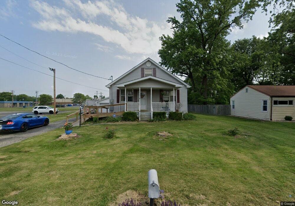
5825 Memory Ln Belleville, IL 62226
Estimated Value: $114,000 - $120,478
Studio
--
Bath
896
Sq Ft
$130/Sq Ft
Est. Value
About This Home
This home is located at 5825 Memory Ln, Belleville, IL 62226 and is currently estimated at $116,620, approximately $130 per square foot. 5825 Memory Ln is a home located in St. Clair County with nearby schools including Union Elementary School, West Jr High School, and Our Lady Queen Of Peace Catholic School.
Ownership History
Date
Name
Owned For
Owner Type
Purchase Details
Closed on
Sep 7, 2022
Sold by
Wright Michael
Bought by
Wright Michael J and Michael J Wright Living Trust
Current Estimated Value
Purchase Details
Closed on
Aug 21, 2003
Sold by
Vogt Michael E and Vogt Teresa M
Bought by
Wright Michael
Home Financials for this Owner
Home Financials are based on the most recent Mortgage that was taken out on this home.
Original Mortgage
$60,000
Interest Rate
5.62%
Mortgage Type
Purchase Money Mortgage
Create a Home Valuation Report for This Property
The Home Valuation Report is an in-depth analysis detailing your home's value as well as a comparison with similar homes in the area
Home Values in the Area
Average Home Value in this Area
Purchase History
| Date | Buyer | Sale Price | Title Company |
|---|---|---|---|
| Wright Michael J | -- | None Available | |
| Wright Michael | $88,000 | Town & Country Title Co |
Source: Public Records
Mortgage History
| Date | Status | Borrower | Loan Amount |
|---|---|---|---|
| Previous Owner | Wright Michael | $60,000 |
Source: Public Records
Tax History
| Year | Tax Paid | Tax Assessment Tax Assessment Total Assessment is a certain percentage of the fair market value that is determined by local assessors to be the total taxable value of land and additions on the property. | Land | Improvement |
|---|---|---|---|---|
| 2024 | $2,017 | $38,111 | $4,677 | $33,434 |
| 2023 | $1,973 | $36,019 | $4,611 | $31,408 |
| 2022 | $1,763 | $32,804 | $4,199 | $28,605 |
| 2021 | $2,122 | $31,458 | $4,027 | $27,431 |
| 2020 | $2,035 | $29,297 | $3,751 | $25,546 |
| 2019 | $1,856 | $27,937 | $3,828 | $24,109 |
| 2018 | $1,813 | $27,223 | $3,730 | $23,493 |
| 2017 | $1,769 | $26,498 | $3,631 | $22,867 |
| 2016 | $1,772 | $25,585 | $3,506 | $22,079 |
| 2014 | $1,893 | $29,860 | $3,381 | $26,479 |
| 2013 | $1,816 | $29,860 | $3,381 | $26,479 |
Source: Public Records
Map
Nearby Homes
- 2819 Frank Scott Pkwy W
- 22 Kensington Heights Rd Unit 22 & 24
- 22 Elizabeth Dr
- 3311 S Belt W
- 128 Freedom Dr
- 112 Freedom Dr
- 6100 N Belt W
- 305 Fredericksburg Dr
- 141 Hickory Lake
- 2264 Frank Scott Pkwy W
- 2241 Frank Scott Pkwy W
- 2245 Frank Scott Pkwy W
- 508 Rosewood Dr
- 213 Springdale Dr
- 5 Parkridge
- 6 Parkridge Unit 6
- 21 S 57th St
- 4521 N Belt W
- 125 Chevy Chase Dr
- 408 Southgate Dr
- 5817 Memory Ln
- 5813 Memory Ln
- 5805 Memory Ln
- 167 Paulette Dr
- 5743 Memory Ln
- 165 Paulette Dr
- 163 Paulette Dr
- 2726 Frank Scott Pkwy W
- 2810 Frank Scott Pkwy W
- 2810 Frank Scott Pkwy W Unit 800
- 2810 Frank Scott Pkwy W
- 2810 Frank Scott Pkwy W Unit 812
- 135 Kensington Heights Rd
- 2712 Frank Scott Pkwy W
- 5735 Memory Ln
- 157 Paulette Dr
- 2900 Frank Scott Pkwy W
- 2900 Frank Scott Pkwy W Unit 920B
- 2900 Frank Scott Pkwy W Unit 930
Your Personal Tour Guide
Ask me questions while you tour the home.