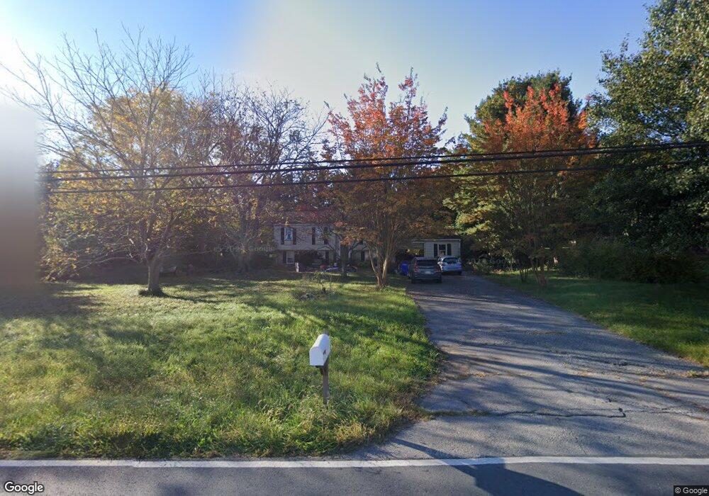
5829 Adamstown Rd Adamstown, MD 21710
Estimated Value: $344,865 - $464,000
--
Bed
1
Bath
1,092
Sq Ft
$363/Sq Ft
Est. Value
About This Home
This home is located at 5829 Adamstown Rd, Adamstown, MD 21710 and is currently estimated at $396,716, approximately $363 per square foot. 5829 Adamstown Rd is a home located in Frederick County with nearby schools including Carroll Manor Elementary School, Ballenger Creek Middle School, and Tuscarora High School.
Ownership History
Date
Name
Owned For
Owner Type
Purchase Details
Closed on
Nov 10, 2016
Sold by
Glatfelter Arthur A and Glatfelter Gail
Bought by
Glatfelter Arthur A
Current Estimated Value
Purchase Details
Closed on
Apr 11, 1994
Sold by
Mayne M F
Bought by
Glatfelter Arthur A
Home Financials for this Owner
Home Financials are based on the most recent Mortgage that was taken out on this home.
Original Mortgage
$130,500
Interest Rate
7.27%
Create a Home Valuation Report for This Property
The Home Valuation Report is an in-depth analysis detailing your home's value as well as a comparison with similar homes in the area
Home Values in the Area
Average Home Value in this Area
Purchase History
| Date | Buyer | Sale Price | Title Company |
|---|---|---|---|
| Glatfelter Arthur A | -- | Frederick Title Group | |
| Glatfelter Arthur A | $145,000 | -- |
Source: Public Records
Mortgage History
| Date | Status | Borrower | Loan Amount |
|---|---|---|---|
| Closed | Glatfelter Arthur A | $130,500 |
Source: Public Records
Tax History Compared to Growth
Tax History
| Year | Tax Paid | Tax Assessment Tax Assessment Total Assessment is a certain percentage of the fair market value that is determined by local assessors to be the total taxable value of land and additions on the property. | Land | Improvement |
|---|---|---|---|---|
| 2025 | $3,413 | $296,133 | -- | -- |
| 2024 | $3,413 | $274,600 | $101,300 | $173,300 |
| 2023 | $3,134 | $262,267 | $0 | $0 |
| 2022 | $2,991 | $249,933 | $0 | $0 |
| 2021 | $2,848 | $237,600 | $92,900 | $144,700 |
| 2020 | $2,848 | $237,600 | $92,900 | $144,700 |
| 2019 | $2,847 | $237,600 | $92,900 | $144,700 |
| 2018 | $2,889 | $239,000 | $92,900 | $146,100 |
| 2017 | $2,815 | $239,000 | $0 | $0 |
| 2016 | $2,990 | $230,600 | $0 | $0 |
| 2015 | $2,990 | $226,400 | $0 | $0 |
| 2014 | $2,990 | $226,400 | $0 | $0 |
Source: Public Records
Map
Nearby Homes
- 5798 Morland Dr N
- 5880 Union Ridge Dr
- 5523 Modly Ct
- 2735 Tuscarora St
- 2731 Tuscarora St
- 2730 Tuscarora St
- 2734 Tuscarora St
- Macon II Plan at The Enclave at Carrollton Manor
- Adamstown Plan at The Enclave at Carrollton Manor
- Fayetteville Plan at The Enclave at Carrollton Manor
- Oban Plan at The Enclave at Carrollton Manor
- 000 Modly Ct
- 00 Modly Ct
- 00000 Modly Ct
- 0000 Modly Ct
- 2727 Bill Dorsey Blvd
- 2730 John Mills Rd
- 2422 Doubs Ct
- 6230 Manor Woods Rd
- 3039 Ballenger Creek Pike
- 5650 Denfield Place
- 5839 Adamstown Rd
- 5648 Denfield Place
- 5825 Adamstown Rd
- 5646 Denfield Place
- 5647 Denfield Place
- 5644 Denfield Place
- 5642 Denfield Place
- 5819 Adamstown Rd
- 5645 Denfield Place
- 5641 Denfield Place
- 5640 Denfield Place
- 5639 Denfield Place
- 5637 Denfield Place
- 5643 Denfield Place
- 2829 New Design Rd
- 5635 Denfield Place
- 5638 Denfield Place
- 2919 New Design Rd
- 5813 Adamstown Rd