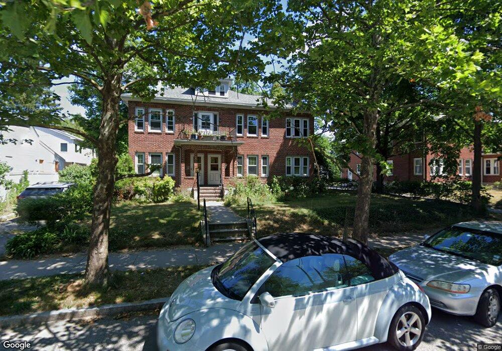
583 Commonwealth Ave Unit 585 Newton Center, MA 02459
Newton Centre NeighborhoodEstimated Value: $2,196,000 - $2,419,000
6
Beds
3
Baths
4,506
Sq Ft
$512/Sq Ft
Est. Value
About This Home
This home is located at 583 Commonwealth Ave Unit 585, Newton Center, MA 02459 and is currently estimated at $2,305,086, approximately $511 per square foot. 583 Commonwealth Ave Unit 585 is a home located in Middlesex County with nearby schools including Ward Elementary School, Bigelow Middle School, and Newton North High School.
Ownership History
Date
Name
Owned For
Owner Type
Purchase Details
Closed on
Dec 30, 2005
Sold by
Pareles Bernice
Bought by
Paasche Carol L and Gottfried Paasche J
Current Estimated Value
Home Financials for this Owner
Home Financials are based on the most recent Mortgage that was taken out on this home.
Original Mortgage
$359,650
Outstanding Balance
$203,583
Interest Rate
6.39%
Mortgage Type
Purchase Money Mortgage
Estimated Equity
$2,101,503
Create a Home Valuation Report for This Property
The Home Valuation Report is an in-depth analysis detailing your home's value as well as a comparison with similar homes in the area
Home Values in the Area
Average Home Value in this Area
Purchase History
| Date | Buyer | Sale Price | Title Company |
|---|---|---|---|
| Paasche Carol L | $1,110,000 | -- |
Source: Public Records
Mortgage History
| Date | Status | Borrower | Loan Amount |
|---|---|---|---|
| Open | Paasche Carol L | $359,650 |
Source: Public Records
Tax History Compared to Growth
Tax History
| Year | Tax Paid | Tax Assessment Tax Assessment Total Assessment is a certain percentage of the fair market value that is determined by local assessors to be the total taxable value of land and additions on the property. | Land | Improvement |
|---|---|---|---|---|
| 2025 | $20,182 | $2,059,400 | $1,103,300 | $956,100 |
| 2024 | $19,514 | $1,999,400 | $1,071,200 | $928,200 |
| 2023 | $18,908 | $1,857,400 | $867,700 | $989,700 |
| 2022 | $18,092 | $1,719,800 | $803,400 | $916,400 |
| 2021 | $16,977 | $1,577,800 | $737,100 | $840,700 |
| 2020 | $16,472 | $1,577,800 | $737,100 | $840,700 |
| 2019 | $15,410 | $1,474,600 | $688,900 | $785,700 |
| 2018 | $15,710 | $1,451,900 | $647,600 | $804,300 |
| 2017 | $14,812 | $1,332,000 | $594,100 | $737,900 |
| 2016 | $13,906 | $1,222,000 | $545,000 | $677,000 |
| 2015 | $13,260 | $1,142,100 | $509,300 | $632,800 |
Source: Public Records
Map
Nearby Homes
- 44 Irving St
- 1004 Centre St
- 21 Francis St Unit 21A
- 23 Francis St Unit 23-1
- 92 Grant Ave
- 31 W Boulevard Rd
- 73 Elmore St
- 28 Exmoor Rd
- 9 The Ledges Rd
- 173-175 Warren St
- 145 Warren St Unit 4
- 3 Cedar St
- Lot 3 Chapin Rd
- Lot 2 Chapin Rd
- Lots 2 & 3 Chapin Rd
- 154 Langley Rd Unit 1
- 5 Merrill Rd
- 9 Ripley St Unit 1
- 5 Hammond St
- 34 Morton Rd
- 583-585 Commonwealth Ave
- 579 Commonwealth Ave Unit 2
- 579 Commonwealth Ave Unit 579
- 579 Commonwealth Ave
- 577-579 Commonwealth Ave
- 48 Sumner St
- 42 Sumner St Unit 44
- 42 Sumner St Unit 1
- 577 Commonwealth Ave Unit 579
- 577 Commonwealth Ave Unit 1
- 577 Commonwealth Ave Unit 577
- 577 Commonwealth Ave Unit 2
- 41 Wessex Rd
- 41 Wessex Rd Unit 1
- 38 Sumner St
- 40 Sumner St Unit 40 Sumner Street
- 571 Commonwealth Ave Unit 1
- 571 Commonwealth Ave Unit 2
- 37 Wessex Rd
- 569-571 Commonwealth Ave