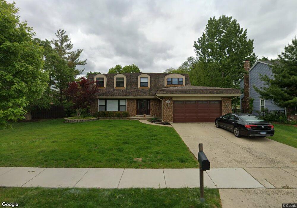
583 Coveside Ln Schaumburg, IL 60193
South Schaumburg NeighborhoodEstimated Value: $547,419 - $601,000
4
Beds
3
Baths
2,515
Sq Ft
$228/Sq Ft
Est. Value
About This Home
This home is located at 583 Coveside Ln, Schaumburg, IL 60193 and is currently estimated at $573,355, approximately $227 per square foot. 583 Coveside Ln is a home located in Cook County with nearby schools including Edwin Aldrin Elementary School, Robert Frost Junior High School, and Schaumburg High School.
Ownership History
Date
Name
Owned For
Owner Type
Purchase Details
Closed on
Jul 12, 2017
Sold by
Reynolds Walter A and Reynolds Lynn D
Bought by
Reynolds Walter A and Reynolds Lynn D
Current Estimated Value
Purchase Details
Closed on
Oct 29, 1998
Sold by
Arthur Roger and Arthur Janice
Bought by
Reynolds Walter A and Reynolds Lynn D
Home Financials for this Owner
Home Financials are based on the most recent Mortgage that was taken out on this home.
Original Mortgage
$140,000
Interest Rate
6.78%
Create a Home Valuation Report for This Property
The Home Valuation Report is an in-depth analysis detailing your home's value as well as a comparison with similar homes in the area
Home Values in the Area
Average Home Value in this Area
Purchase History
| Date | Buyer | Sale Price | Title Company |
|---|---|---|---|
| Reynolds Walter A | -- | Attorney | |
| Reynolds Walter A | $288,000 | 1St American Title |
Source: Public Records
Mortgage History
| Date | Status | Borrower | Loan Amount |
|---|---|---|---|
| Closed | Reynolds Walter A | $140,000 |
Source: Public Records
Tax History
| Year | Tax Paid | Tax Assessment Tax Assessment Total Assessment is a certain percentage of the fair market value that is determined by local assessors to be the total taxable value of land and additions on the property. | Land | Improvement |
|---|---|---|---|---|
| 2025 | $10,877 | $58,000 | $10,920 | $47,080 |
| 2024 | $10,877 | $41,426 | $9,360 | $32,066 |
| 2023 | $10,496 | $44,796 | $9,360 | $35,436 |
| 2022 | $10,496 | $44,796 | $9,360 | $35,436 |
| 2021 | $8,551 | $34,207 | $7,020 | $27,187 |
| 2020 | $8,526 | $34,207 | $7,020 | $27,187 |
| 2019 | $9,512 | $41,659 | $7,020 | $34,639 |
| 2018 | $8,860 | $35,707 | $5,980 | $29,727 |
| 2017 | $8,753 | $35,707 | $5,980 | $29,727 |
| 2016 | $8,980 | $36,789 | $5,980 | $30,809 |
| 2015 | $8,111 | $31,608 | $5,200 | $26,408 |
| 2014 | $9,455 | $34,524 | $5,200 | $29,324 |
| 2013 | $9,195 | $34,524 | $5,200 | $29,324 |
Source: Public Records
Map
Nearby Homes
- 220 Mountain Interval Rd Unit 6224
- 234 Mary Dr Unit 5320
- 242 Mary Dr Unit 5118
- 201 Mountain Interval Rd Unit 7129
- 244 Warren Ln Unit 11249
- 228 Warren Ln Unit 11645
- 226 Mary Dr Unit 5522
- 238 Mary Dr Unit 5219
- 212 Mountain Interval Rd Unit 6325
- 219 Mountain Interval Rd Unit 7432
- 200 Mountain Interval Rd Unit 6628
- 231 Mary Dr Unit 14168
- 216 Mountain Interval Rd Unit 6224
- 236 Warren Ln Unit 11447
- 248 Warren Ln Unit 11150
- 829 Sienna Dr
- 618 Boxwood Dr
- 635 Verona Ct
- 235 Quincy Ct
- 820 Sudbury Ct
- 587 Coveside Ln
- 579 Coveside Ln
- 984 Spring Cove Dr
- 591 Coveside Ln
- 582 Coveside Ln
- 854 Spring Cove Dr
- 988 Spring Cove Dr
- 586 Coveside Ln
- 595 Coveside Ln
- 851 Beacon Dr
- 981 Spring Cove Dr
- 992 Spring Cove Dr
- 985 Spring Cove Dr
- 847 Beacon Dr
- 851 Spring Cove Dr
- 599 Coveside Ln
- 571 Tarpon Ct
- 996 Spring Cove Dr
- 989 Spring Cove Dr
- 575 Tarpon Ct
Your Personal Tour Guide
Ask me questions while you tour the home.