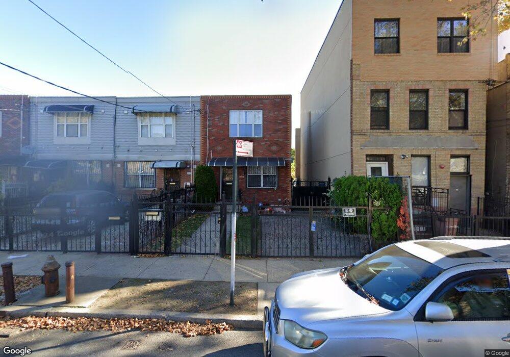
583 Snediker Ave Brooklyn, NY 11207
Brownsville NeighborhoodEstimated Value: $580,592 - $705,000
--
Bed
--
Bath
1,332
Sq Ft
$500/Sq Ft
Est. Value
About This Home
This home is located at 583 Snediker Ave, Brooklyn, NY 11207 and is currently estimated at $666,148, approximately $500 per square foot. 583 Snediker Ave is a home located in Kings County with nearby schools including P.S. 190 - Sheffield, Achievement First - East New York School, and Hyde Leadership Charter School-Brooklyn.
Ownership History
Date
Name
Owned For
Owner Type
Purchase Details
Closed on
May 1, 2002
Sold by
Nehemiah Housing Develop
Bought by
Charles Jeffrey J
Current Estimated Value
Home Financials for this Owner
Home Financials are based on the most recent Mortgage that was taken out on this home.
Original Mortgage
$85,000
Outstanding Balance
$36,094
Interest Rate
7.01%
Estimated Equity
$630,054
Create a Home Valuation Report for This Property
The Home Valuation Report is an in-depth analysis detailing your home's value as well as a comparison with similar homes in the area
Home Values in the Area
Average Home Value in this Area
Purchase History
| Date | Buyer | Sale Price | Title Company |
|---|---|---|---|
| Charles Jeffrey J | -- | -- |
Source: Public Records
Mortgage History
| Date | Status | Borrower | Loan Amount |
|---|---|---|---|
| Open | Charles Jeffrey J | $85,000 |
Source: Public Records
Tax History Compared to Growth
Tax History
| Year | Tax Paid | Tax Assessment Tax Assessment Total Assessment is a certain percentage of the fair market value that is determined by local assessors to be the total taxable value of land and additions on the property. | Land | Improvement |
|---|---|---|---|---|
| 2025 | $3,072 | $36,780 | $13,440 | $23,340 |
| 2024 | $3,072 | $41,340 | $13,440 | $27,900 |
| 2023 | $2,914 | $36,540 | $13,440 | $23,100 |
| 2022 | $2,680 | $34,080 | $13,440 | $20,640 |
| 2021 | $2,655 | $29,880 | $13,440 | $16,440 |
| 2020 | $1,991 | $28,080 | $13,440 | $14,640 |
| 2019 | $2,617 | $28,080 | $13,440 | $14,640 |
| 2018 | $2,378 | $13,125 | $4,689 | $8,436 |
| 2017 | $2,225 | $12,383 | $6,123 | $6,260 |
| 2016 | $2,026 | $11,683 | $6,398 | $5,285 |
| 2015 | $1,189 | $11,683 | $6,206 | $5,477 |
| 2014 | $1,189 | $11,594 | $5,420 | $6,174 |
Source: Public Records
Map
Nearby Homes
- 442 Newport St
- 584 Hinsdale St
- 589 Hinsdale St
- 541 Hinsdale St
- 582 Williams Ave
- 578 Williams Ave
- 533 Snediker Ave
- 576 Williams Ave
- 650 Williams Ave
- 660 Williams Ave Unit 142
- 610 Alabama Ave
- 606 Alabama Ave
- 563 Powell St
- 1753 Linden Blvd
- 1755 Linden Blvd
- 546 Powell St
- 699 Sackman St
- 1825 Linden Blvd
- 679 Georgia Ave
- 555 Christopher Ave
- 581 Snediker Ave
- 585 Snediker Ave
- 579 Snediker Ave
- 589 Snediker Ave
- 577 Snediker Ave
- 591 Snediker Ave
- 575 Snediker Ave
- 593 Snediker Ave
- 446 Newport St
- 571 Snediker Ave
- 580 Hinsdale St
- 582 Hinsdale St
- 597 Snediker Ave
- 448 Newport St
- 448 Newport St Unit 2
- 586 Hinsdale St
- 588 Hinsdale St
- 599 Snediker Ave
- 430 Newport St
- 450 Newport St