Estimated Value: $176,353 - $288,000
--
Bed
--
Bath
1,420
Sq Ft
$172/Sq Ft
Est. Value
About This Home
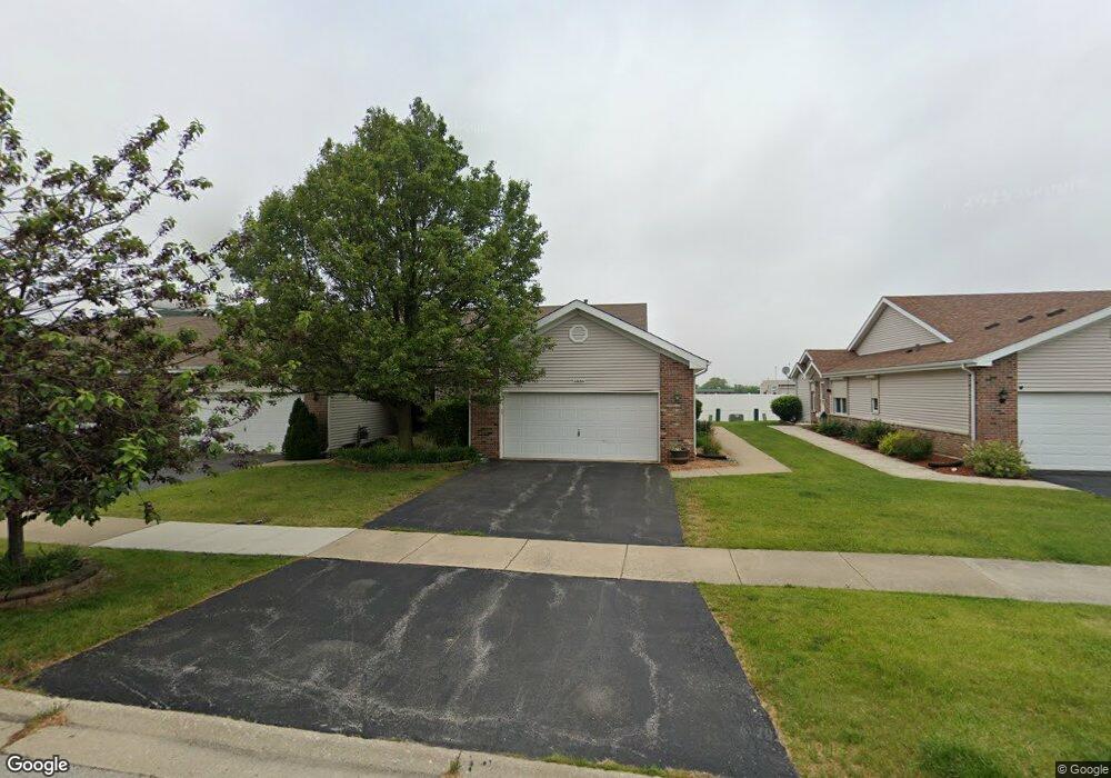
This home is located at 5830 W Roosevelt St, Monee, IL 60449 and is currently estimated at $243,838, approximately $171 per square foot. 5830 W Roosevelt St is a home located in Will County with nearby schools including Monee Elementary School, Crete-Monee Middle School, and Crete-Monee High School.
Ownership History
Date
Name
Owned For
Owner Type
Purchase Details
Closed on
Nov 17, 2015
Sold by
Boland Lois E
Bought by
Boland Lois E and Lois E Boland Living Trust
Current Estimated Value
Purchase Details
Closed on
Oct 5, 2004
Sold by
First National Bank
Bought by
Boland Lois E
Home Financials for this Owner
Home Financials are based on the most recent Mortgage that was taken out on this home.
Original Mortgage
$70,000
Interest Rate
5.93%
Mortgage Type
Purchase Money Mortgage
Create a Home Valuation Report for This Property
The Home Valuation Report is an in-depth analysis detailing your home's value as well as a comparison with similar homes in the area
Home Values in the Area
Average Home Value in this Area
Purchase History
| Date | Buyer | Sale Price | Title Company |
|---|---|---|---|
| Boland Lois E | -- | Attorney | |
| Boland Lois E | $146,000 | -- |
Source: Public Records
Mortgage History
| Date | Status | Borrower | Loan Amount |
|---|---|---|---|
| Closed | Boland Lois E | $70,000 |
Source: Public Records
Tax History Compared to Growth
Tax History
| Year | Tax Paid | Tax Assessment Tax Assessment Total Assessment is a certain percentage of the fair market value that is determined by local assessors to be the total taxable value of land and additions on the property. | Land | Improvement |
|---|---|---|---|---|
| 2024 | $3,021 | $67,330 | $6,161 | $61,169 |
| 2023 | $3,021 | $58,043 | $5,311 | $52,732 |
| 2022 | $4,011 | $51,058 | $4,672 | $46,386 |
| 2021 | $4,217 | $46,472 | $4,291 | $42,181 |
| 2020 | $4,995 | $44,966 | $4,152 | $40,814 |
| 2019 | $4,831 | $42,642 | $3,937 | $38,705 |
| 2018 | $4,720 | $41,276 | $3,827 | $37,449 |
| 2017 | $4,669 | $40,080 | $3,750 | $36,330 |
| 2016 | $4,455 | $37,921 | $3,613 | $34,308 |
| 2015 | $3,847 | $34,619 | $3,292 | $31,327 |
| 2014 | $3,847 | $34,141 | $3,247 | $30,894 |
| 2013 | $3,847 | $35,750 | $3,400 | $32,350 |
Source: Public Records
Map
Nearby Homes
- 5692 W Roosevelt St
- 5661 W Roosevelt St
- 25927 Derby Dr
- Lot 4 S Governors Hwy
- 5421 W Main St
- 5420 W Main St
- 25958 S Locust Place
- 25601 S Linden Ave
- 25545 S Mccorkle Ave Unit 3
- 26149 S Locust Place
- 25530 Shinnecock Dr Unit 440
- 5203 W Court St
- 25740 Baltusrol Dr
- 26256 S Plum Tree Ln
- 5112 Sawgrass Dr Unit 433
- 5063 Augusta Blvd Unit 127
- 25604 S Medinah Dr Unit 391
- 5320 W Orchard Trail
- 5046 W Sawgrass Dr Unit 388
- 5042 W Sawgrass Dr Unit 387
- 5832 W Roosevelt St
- 5828 W Roosevelt St
- 5834 W Roosevelt St
- 5836 W Roosevelt St
- 5824 W Roosevelt St
- 25703 S Sunrise Dr
- 25702 S Truman St
- 25705 S Sunrise Dr
- 25705 S Sunrise Dr
- 25707 S Sunrise Dr
- 25704 S Truman St
- 25711 S Sunrise Dr
- 25701 S Truman St
- 25715 S Sunrise Dr
- 25715 S Sunrise Dr Unit 1
- 25712 S Truman St
- 25717 S Sunrise Dr
- 25707 S Truman St
- 25721 S Sunrise Dr
- 25721 S Sunrise Dr