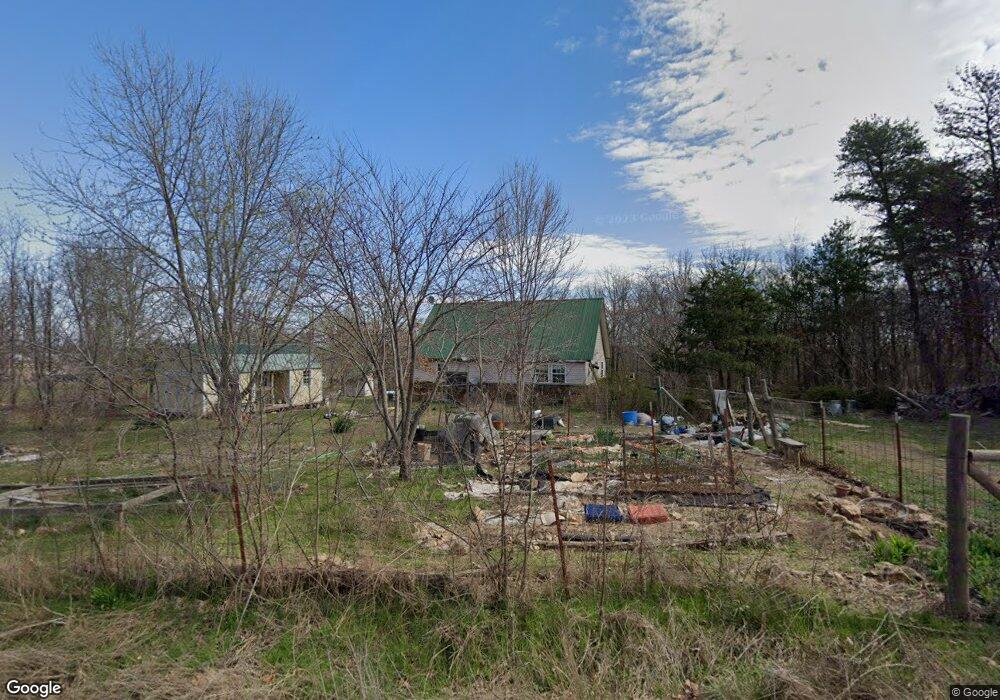
5836 N 522 Rd Tahlequah, OK 74464
Estimated Value: $144,020 - $253,000
3
Beds
2
Baths
1,440
Sq Ft
$130/Sq Ft
Est. Value
About This Home
This home is located at 5836 N 522 Rd, Tahlequah, OK 74464 and is currently estimated at $187,505, approximately $130 per square foot. 5836 N 522 Rd is a home located in Cherokee County with nearby schools including Lowrey School.
Ownership History
Date
Name
Owned For
Owner Type
Purchase Details
Closed on
Oct 19, 2006
Sold by
Homesales Inc
Bought by
Hardman David E
Current Estimated Value
Home Financials for this Owner
Home Financials are based on the most recent Mortgage that was taken out on this home.
Original Mortgage
$47,167
Outstanding Balance
$27,854
Interest Rate
6.46%
Mortgage Type
New Conventional
Estimated Equity
$159,651
Purchase Details
Closed on
Aug 1, 2003
Sold by
Larry and Jana Burkart
Bought by
Suzanna and Robin Sly
Purchase Details
Closed on
Jun 25, 1999
Sold by
Robert Lewis Audd
Bought by
Larry and Jana Burkart
Create a Home Valuation Report for This Property
The Home Valuation Report is an in-depth analysis detailing your home's value as well as a comparison with similar homes in the area
Home Values in the Area
Average Home Value in this Area
Purchase History
| Date | Buyer | Sale Price | Title Company |
|---|---|---|---|
| Hardman David E | $70,000 | Heritage Title | |
| Suzanna | $82,000 | -- | |
| Larry | $69,000 | -- |
Source: Public Records
Mortgage History
| Date | Status | Borrower | Loan Amount |
|---|---|---|---|
| Open | Hardman David E | $47,167 |
Source: Public Records
Tax History Compared to Growth
Tax History
| Year | Tax Paid | Tax Assessment Tax Assessment Total Assessment is a certain percentage of the fair market value that is determined by local assessors to be the total taxable value of land and additions on the property. | Land | Improvement |
|---|---|---|---|---|
| 2025 | $818 | $10,699 | $186 | $10,513 |
| 2024 | $787 | $10,189 | $186 | $10,003 |
| 2023 | $787 | $9,704 | $186 | $9,518 |
| 2022 | $725 | $9,242 | $358 | $8,884 |
| 2021 | $722 | $9,242 | $358 | $8,884 |
| 2020 | $661 | $9,242 | $358 | $8,884 |
| 2019 | $737 | $9,242 | $358 | $8,884 |
| 2018 | $740 | $9,242 | $358 | $8,884 |
| 2017 | $746 | $9,208 | $124 | $9,084 |
| 2016 | $724 | $8,913 | $120 | $8,793 |
| 2015 | $562 | $8,490 | $516 | $7,974 |
| 2014 | $562 | $8,085 | $516 | $7,569 |
Source: Public Records
Map
Nearby Homes
- 0 N 510 Rd Unit 2543283
- 0 N 510 Rd Unit 2543284
- 0 N 510 Rd Unit 2543190
- 0 N 510 Rd Unit 2547590
- 0 N 510 Rd Unit 2543294
- 0 N 510 Rd Unit 2543293
- 0 N 510 Rd Unit 2546232
- 0 N 510 Rd Unit 2543297
- 4422 Highway 82a
- 8195 Hwy 82 A
- 00000 E 660 Rd
- 7002 N 559 Rd
- 8119 N 544 Rd
- 16246 E 647 Rd
- 9133 Oklahoma 10
- 7373 N 485 Rd
- 14000 Highway 82c
- 17844 E 688 Rd
- Hwy 82a Lot Unit WP001
- 0000 S Hwy 82 A