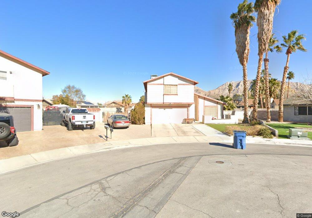
5838 Thames Way Las Vegas, NV 89110
Estimated Value: $390,986 - $440,000
3
Beds
3
Baths
1,898
Sq Ft
$223/Sq Ft
Est. Value
About This Home
This home is located at 5838 Thames Way, Las Vegas, NV 89110 and is currently estimated at $423,247, approximately $222 per square foot. 5838 Thames Way is a home located in Clark County with nearby schools including Stanford Elementary School, Duane D. Keller Middle School, and Eldorado High School.
Ownership History
Date
Name
Owned For
Owner Type
Purchase Details
Closed on
Jan 9, 1994
Sold by
Hildenbrand John Alan and Hildenbrand Hae Yon
Bought by
Magallanez Daniel and Magallanez Sylvia R
Current Estimated Value
Home Financials for this Owner
Home Financials are based on the most recent Mortgage that was taken out on this home.
Original Mortgage
$19,210
Interest Rate
7.21%
Mortgage Type
Seller Take Back
Create a Home Valuation Report for This Property
The Home Valuation Report is an in-depth analysis detailing your home's value as well as a comparison with similar homes in the area
Home Values in the Area
Average Home Value in this Area
Purchase History
| Date | Buyer | Sale Price | Title Company |
|---|---|---|---|
| Magallanez Daniel | $30,500 | Old Republic Title Co |
Source: Public Records
Mortgage History
| Date | Status | Borrower | Loan Amount |
|---|---|---|---|
| Closed | Magallanez Daniel | $19,210 |
Source: Public Records
Tax History Compared to Growth
Tax History
| Year | Tax Paid | Tax Assessment Tax Assessment Total Assessment is a certain percentage of the fair market value that is determined by local assessors to be the total taxable value of land and additions on the property. | Land | Improvement |
|---|---|---|---|---|
| 2025 | $1,046 | $62,172 | $30,135 | $32,037 |
| 2024 | $1,016 | $62,172 | $30,135 | $32,037 |
| 2023 | $1,016 | $64,689 | $33,075 | $31,614 |
| 2022 | $986 | $56,225 | $26,828 | $29,397 |
| 2021 | $958 | $52,737 | $24,255 | $28,482 |
| 2020 | $927 | $51,883 | $23,153 | $28,730 |
| 2019 | $900 | $47,931 | $19,110 | $28,821 |
| 2018 | $874 | $44,295 | $16,450 | $27,845 |
| 2017 | $1,320 | $44,995 | $16,450 | $28,545 |
| 2016 | $829 | $40,289 | $10,850 | $29,439 |
| 2015 | $826 | $38,179 | $8,750 | $29,429 |
| 2014 | $802 | $26,519 | $7,000 | $19,519 |
Source: Public Records
Map
Nearby Homes
- 910 N Sloan Ln Unit 201
- 5923 Halehaven Dr
- 5717 Christchurch Ave
- 5802 Queenstown Way
- 6030 Halehaven Dr
- 741 Round Table Dr
- 740 Santree Cir
- 0 Washington Unit 2360795
- 6218 Sapporo Cir
- 796 Ringwood Ln
- 730 N Christy Ln
- 6235 Sapporo Cir
- 1345 Stokes St
- 656 N Christy Ln
- 5772 Cinnabar Ave
- 563 Moon Chase St
- 5754 Cinnabar Ave
- 5529 Cedar Ave
- 1325 Fairchild St
- 6165 Stanley Park Ave
- 5828 Thames Way
- 935 Palmerston St
- 925 Palmerston St
- 5837 Cargill Ave
- 5837 Thames Way
- 5827 Cargill Ave
- 915 Palmerston St
- 5847 Cargill Ave
- 5818 Thames Way
- 5827 Thames Way
- 905 Palmerston St
- 5817 Cargill Ave
- 914 Stonehenge St
- 936 Palmerston St
- 926 Palmerston St
- 5826 Dunedin Ct
- 904 Stonehenge St
- 946 Palmerston St
- 5836 Cargill Ave
- 916 Palmerston St