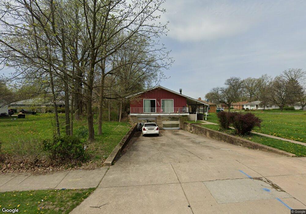
5840 Dunham Rd Maple Heights, OH 44137
Estimated Value: $186,000 - $208,000
4
Beds
2
Baths
1,568
Sq Ft
$125/Sq Ft
Est. Value
About This Home
This home is located at 5840 Dunham Rd, Maple Heights, OH 44137 and is currently estimated at $196,642, approximately $125 per square foot. 5840 Dunham Rd is a home located in Cuyahoga County with nearby schools including Abraham Lincoln Elementary School, Rockside/ J.F. Kennedy School, and Barack Obama School.
Ownership History
Date
Name
Owned For
Owner Type
Purchase Details
Closed on
Mar 20, 2015
Sold by
Saleem Lestine
Bought by
Lauderdale Maurice
Current Estimated Value
Purchase Details
Closed on
May 6, 2005
Sold by
Wells Fargo Bank Na
Bought by
Saleem Lestine
Home Financials for this Owner
Home Financials are based on the most recent Mortgage that was taken out on this home.
Original Mortgage
$115,070
Interest Rate
8.94%
Mortgage Type
Purchase Money Mortgage
Purchase Details
Closed on
Mar 28, 2005
Sold by
Evans Peter R and Evans Sandra R
Bought by
Wells Fargo Home Mortgage Inc
Home Financials for this Owner
Home Financials are based on the most recent Mortgage that was taken out on this home.
Original Mortgage
$115,070
Interest Rate
8.94%
Mortgage Type
Purchase Money Mortgage
Purchase Details
Closed on
Jan 17, 2003
Sold by
Feckner Arthur and Feckner Alisha
Bought by
Evans Peter R and Evans Sandra R
Home Financials for this Owner
Home Financials are based on the most recent Mortgage that was taken out on this home.
Original Mortgage
$103,200
Interest Rate
11.87%
Purchase Details
Closed on
Jul 7, 2000
Sold by
Feckner Arthur
Bought by
Feckner Arthur and Feckner Alisha
Home Financials for this Owner
Home Financials are based on the most recent Mortgage that was taken out on this home.
Original Mortgage
$112,500
Interest Rate
8.18%
Purchase Details
Closed on
Jun 1, 2000
Sold by
Comrie Ronald E and Ged Comrie Brenda J
Bought by
Feckner Arthur
Home Financials for this Owner
Home Financials are based on the most recent Mortgage that was taken out on this home.
Original Mortgage
$112,500
Interest Rate
8.18%
Purchase Details
Closed on
Jul 21, 1988
Sold by
Starr Edward T and Starr Jean
Bought by
Comrie Ronald E
Purchase Details
Closed on
Aug 31, 1983
Sold by
Trafis Ronald
Bought by
Starr Edward T and Starr Jean
Purchase Details
Closed on
Feb 21, 1979
Sold by
Trafis Ronald E and D M
Bought by
Trafis Ronald
Purchase Details
Closed on
Jan 1, 1975
Bought by
Trafis Ronald E and D M
Create a Home Valuation Report for This Property
The Home Valuation Report is an in-depth analysis detailing your home's value as well as a comparison with similar homes in the area
Home Values in the Area
Average Home Value in this Area
Purchase History
| Date | Buyer | Sale Price | Title Company |
|---|---|---|---|
| Lauderdale Maurice | $16,332 | None Available | |
| Saleem Lestine | $112,500 | Chicago Title Insurance C | |
| Wells Fargo Home Mortgage Inc | $90,000 | Attorney | |
| Evans Peter R | $129,900 | Multiple | |
| Feckner Arthur | -- | Insignia Title Agency Ltd | |
| Feckner Arthur | $125,000 | Insignia Title Agency Ltd | |
| Comrie Ronald E | $72,100 | -- | |
| Starr Edward T | $5,400 | -- | |
| Trafis Ronald | -- | -- | |
| Trafis Ronald E | -- | -- |
Source: Public Records
Mortgage History
| Date | Status | Borrower | Loan Amount |
|---|---|---|---|
| Previous Owner | Saleem Lestine | $115,070 | |
| Previous Owner | Evans Peter R | $103,200 | |
| Previous Owner | Feckner Arthur | $112,500 |
Source: Public Records
Tax History
| Year | Tax Paid | Tax Assessment Tax Assessment Total Assessment is a certain percentage of the fair market value that is determined by local assessors to be the total taxable value of land and additions on the property. | Land | Improvement |
|---|---|---|---|---|
| 2024 | $5,413 | $61,915 | $9,905 | $52,010 |
| 2023 | $3,499 | $33,600 | $7,560 | $26,040 |
| 2022 | $3,486 | $33,600 | $7,560 | $26,040 |
| 2021 | $3,722 | $33,600 | $7,560 | $26,040 |
| 2020 | $3,389 | $27,550 | $6,200 | $21,350 |
| 2019 | $3,369 | $78,700 | $17,700 | $61,000 |
| 2018 | $3,864 | $27,550 | $6,200 | $21,350 |
| 2017 | $4,872 | $24,330 | $5,460 | $18,870 |
| 2016 | $3,036 | $24,330 | $5,460 | $18,870 |
| 2015 | -- | $24,330 | $5,460 | $18,870 |
| 2014 | -- | $25,100 | $5,640 | $19,460 |
Source: Public Records
Map
Nearby Homes
- 14808 James Ave
- 14708 Brunswick Ave
- 14509 Rockside Rd
- 15803 Maplewood Ave
- 16111 #A8 Maple Park Dr
- 15800 Northwood Ave
- 14320 Janice Dr
- 15305 Steinway Blvd
- 15817 Northwood Ave
- 14619 Tokay Ave
- 14012 Wheeler Rd
- 6089 Dunham Rd
- 14404 Tokay Ave
- 14214 Tabor Ave
- 15712 Morning Star Ave
- 14956 Carol Dr
- 14203 Tabor Ave
- 14818 Reddington Ave
- 15701 Walvern Blvd
- 15800 Steinway Blvd
- 5834 Dunham Rd
- 14816 Wheeler Rd
- 5860 Dunham Rd
- 15063 James Ave
- 14812 Wheeler Rd
- 5824 Dunham Rd
- 15061 James Ave
- 5831 Dunham Rd
- 14808 Wheeler Rd
- 5829 Dunham Rd
- 5835 Dunham Rd
- S/L B-2 Dunham Rd
- 15053 James Ave
- 5820 Dunham Rd
- 5837 Dunham Rd
- 14804 Wheeler Rd
- 5816 Dunham Rd
- 14813 Wheeler Rd
- 15003 James Ave
- 5876 Dunham Rd
Your Personal Tour Guide
Ask me questions while you tour the home.