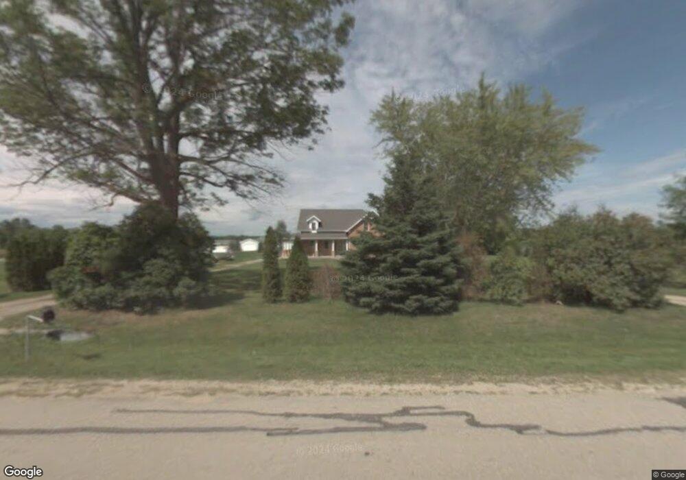
5842 Allen Rd Little Suamico, WI 54141
Estimated Value: $380,000 - $515,000
4
Beds
2
Baths
1,500
Sq Ft
$294/Sq Ft
Est. Value
About This Home
This home is located at 5842 Allen Rd, Little Suamico, WI 54141 and is currently estimated at $441,063, approximately $294 per square foot. 5842 Allen Rd is a home located in Oconto County with nearby schools including Sunnyside Elementary School, Pulaski Community Middle School, and Pulaski High School.
Ownership History
Date
Name
Owned For
Owner Type
Purchase Details
Closed on
Jun 7, 2021
Sold by
Franklin F F
Bought by
Lamay Benjamin J
Current Estimated Value
Home Financials for this Owner
Home Financials are based on the most recent Mortgage that was taken out on this home.
Interest Rate
2.93%
Purchase Details
Closed on
Apr 27, 2021
Sold by
Walton David J
Bought by
Franklin F F
Home Financials for this Owner
Home Financials are based on the most recent Mortgage that was taken out on this home.
Interest Rate
2.93%
Create a Home Valuation Report for This Property
The Home Valuation Report is an in-depth analysis detailing your home's value as well as a comparison with similar homes in the area
Home Values in the Area
Average Home Value in this Area
Purchase History
| Date | Buyer | Sale Price | Title Company |
|---|---|---|---|
| Lamay Benjamin J | $285,000 | -- | |
| Lamay Benjamin J | $285,000 | -- | |
| Franklin F F | $24,800 | -- | |
| Franklin F F | $24,800 | -- |
Source: Public Records
Mortgage History
| Date | Status | Borrower | Loan Amount |
|---|---|---|---|
| Closed | Lamay Benjamin J | -- | |
| Previous Owner | Franklin F F | -- |
Source: Public Records
Tax History Compared to Growth
Tax History
| Year | Tax Paid | Tax Assessment Tax Assessment Total Assessment is a certain percentage of the fair market value that is determined by local assessors to be the total taxable value of land and additions on the property. | Land | Improvement |
|---|---|---|---|---|
| 2024 | $3,890 | $362,800 | $46,700 | $316,100 |
| 2023 | $4,106 | $362,800 | $46,700 | $316,100 |
| 2022 | $3,666 | $252,700 | $30,000 | $222,700 |
| 2021 | $3,075 | $227,200 | $30,000 | $197,200 |
| 2020 | $3,253 | $227,200 | $30,000 | $197,200 |
| 2019 | $3,282 | $227,200 | $30,000 | $197,200 |
| 2018 | $3,548 | $213,400 | $29,200 | $184,200 |
| 2017 | $3,325 | $213,400 | $29,200 | $184,200 |
| 2016 | $3,288 | $213,400 | $29,200 | $184,200 |
| 2015 | $3,321 | $213,400 | $29,200 | $184,200 |
| 2013 | $2,836 | $213,400 | $29,200 | $184,200 |
Source: Public Records
Map
Nearby Homes
- 1115 Union Ln
- 6117 Kawula Ln
- 6149 Kawula Ln
- 0 River St
- 425 Hill Haven Ct
- 5362 Bramschreiber Rd
- 668 White Pine Ct
- 0 Autumn Blaze Trail
- 0 Ball Park Rd
- 5086 Ball Park Rd
- 6705 Elizabeth Ln
- 1895 Wildwood Dr
- 6886 S Chase Rd
- 0 Velp Ave Unit 50315411
- 1917 Sandalwood Rd
- 7068 Lone Oak Ln
- 1705 Sundew Rd
- 1334 Norfield Rd
- 4188 Sunny Meadow Place
- 4208 Summerlin Ct
- 5848 Allen Rd
- 5816 Allen Rd
- 5808 Allen Rd
- 5875 Allen Rd
- 979 Creek Ct
- 5815 Creek Crest Ln
- 5809 Creek Crest Ln
- 975 Creek Ct
- 919 Riverview Dr
- 5783 Allen Rd
- 5814 Creek Crest Ln
- 980 Creek Ct
- 5920 Allen Rd
- 916 Riverview Dr
- 925 Riverview Dr
- 5802 Creek Crest Ln
- 988 Creek Ct
- 5786 Creek Crest Ln
- 955 Union Ln
- 5895 Allen Rd