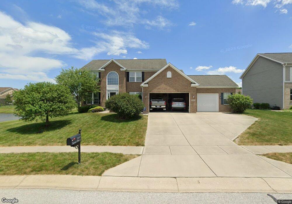
5849 Somerset Blvd E Bargersville, IN 46106
Estimated Value: $548,000 - $648,000
4
Beds
4
Baths
4,483
Sq Ft
$132/Sq Ft
Est. Value
About This Home
This home is located at 5849 Somerset Blvd E, Bargersville, IN 46106 and is currently estimated at $591,434, approximately $131 per square foot. 5849 Somerset Blvd E is a home with nearby schools including Maple Grove Elementary School, Center Grove Middle School Central, and Center Grove High School.
Ownership History
Date
Name
Owned For
Owner Type
Purchase Details
Closed on
Oct 31, 2011
Sold by
Nvr Inc
Bought by
Taggart Ryan B and Taggart Krista
Current Estimated Value
Home Financials for this Owner
Home Financials are based on the most recent Mortgage that was taken out on this home.
Original Mortgage
$306,527
Outstanding Balance
$209,022
Interest Rate
4.02%
Mortgage Type
New Conventional
Estimated Equity
$382,412
Purchase Details
Closed on
Jul 1, 2011
Sold by
Sutton Farms Llc
Bought by
Nvr Inc
Create a Home Valuation Report for This Property
The Home Valuation Report is an in-depth analysis detailing your home's value as well as a comparison with similar homes in the area
Home Values in the Area
Average Home Value in this Area
Purchase History
| Date | Buyer | Sale Price | Title Company |
|---|---|---|---|
| Taggart Ryan B | -- | None Available | |
| Nvr Inc | -- | None Available |
Source: Public Records
Mortgage History
| Date | Status | Borrower | Loan Amount |
|---|---|---|---|
| Open | Taggart Ryan B | $306,527 |
Source: Public Records
Tax History Compared to Growth
Tax History
| Year | Tax Paid | Tax Assessment Tax Assessment Total Assessment is a certain percentage of the fair market value that is determined by local assessors to be the total taxable value of land and additions on the property. | Land | Improvement |
|---|---|---|---|---|
| 2025 | $4,958 | $622,500 | $69,400 | $553,100 |
| 2024 | $4,958 | $495,800 | $69,400 | $426,400 |
| 2023 | $4,842 | $484,200 | $69,400 | $414,800 |
| 2022 | $4,719 | $471,900 | $69,400 | $402,500 |
| 2021 | $3,823 | $382,300 | $69,400 | $312,900 |
| 2020 | $3,857 | $385,700 | $69,400 | $316,300 |
| 2019 | $3,635 | $363,500 | $69,400 | $294,100 |
| 2018 | $3,614 | $366,700 | $69,400 | $297,300 |
| 2017 | $3,561 | $356,100 | $47,900 | $308,200 |
| 2016 | $2,958 | $318,900 | $47,900 | $271,000 |
| 2014 | $2,918 | $291,800 | $47,900 | $243,900 |
| 2013 | $2,918 | $297,600 | $47,900 | $249,700 |
Source: Public Records
Map
Nearby Homes
- 3301 Cheyenne Ct
- 3270 Cherokee Cir
- 3176 Tecumseh Way
- 6093 Tremont Blvd
- 000 N State Road 135
- 4000 N State Road 135
- 3808 Claybrook Ct
- 5571 Auburndale Dr
- 3058 Mcintosh Dr
- 3372 Clary Boulevard Dr S
- 5502 Breaburn Rd
- 6451 Enclave Ct
- 6491 Enclave Blvd
- 00 W Smokey Row Rd
- 3320 Enclave Crossing
- 3762 Woodruff Place
- Bellamy Plan at Lone Pine Farms
- Henley Plan at Lone Pine Farms
- Chatham Plan at Lone Pine Farms
- Harmony Plan at Lone Pine Farms
- 5837 Somerset Blvd E
- 00 Somerset Blvd
- 5846 Cherokee Dr
- 5825 Somerset Blvd E
- 5858 Cherokee Dr
- 5834 Cherokee Dr
- 5870 Cherokee Dr
- 5822 Cherokee Dr
- 5813 Somerset Blvd E
- 5882 Cherokee Dr
- 5810 Cherokee Dr
- 5801 Somerset Blvd E
- 3297 Tecumseh Way
- 5835 Cherokee Dr
- 3125 Cherokee Cir
- 5894 Cherokee Dr
- 5792 Cherokee Dr
- 3269 Cherokee Cir
- 5792 Cherokee Ct
- 5850 Somerset Blvd W