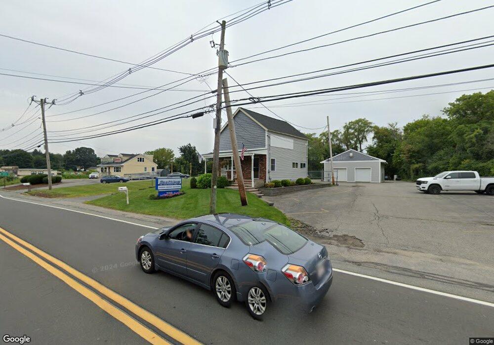
585 Boston Rd Billerica, MA 01821
Estimated Value: $892,678
--
Bed
1
Bath
2,702
Sq Ft
$330/Sq Ft
Est. Value
About This Home
This home is located at 585 Boston Rd, Billerica, MA 01821 and is currently estimated at $892,678, approximately $330 per square foot. 585 Boston Rd is a home located in Middlesex County with nearby schools including Billerica Memorial High School.
Ownership History
Date
Name
Owned For
Owner Type
Purchase Details
Closed on
Feb 5, 2004
Sold by
D N Mcnulty Inc
Bought by
Dave Ron Rt and Mcnulty David N
Current Estimated Value
Purchase Details
Closed on
Jan 31, 2001
Sold by
585 Boston Rd Rt and Dipietro Robert P
Bought by
Dn Mcnulty Inc
Home Financials for this Owner
Home Financials are based on the most recent Mortgage that was taken out on this home.
Original Mortgage
$215,920
Interest Rate
7.15%
Mortgage Type
Commercial
Create a Home Valuation Report for This Property
The Home Valuation Report is an in-depth analysis detailing your home's value as well as a comparison with similar homes in the area
Home Values in the Area
Average Home Value in this Area
Purchase History
| Date | Buyer | Sale Price | Title Company |
|---|---|---|---|
| Dave Ron Rt | -- | -- | |
| Dn Mcnulty Inc | $269,900 | -- |
Source: Public Records
Mortgage History
| Date | Status | Borrower | Loan Amount |
|---|---|---|---|
| Open | Dn Mcnulty Inc | $225,000 | |
| Previous Owner | Dn Mcnulty Inc | $215,920 |
Source: Public Records
Tax History Compared to Growth
Tax History
| Year | Tax Paid | Tax Assessment Tax Assessment Total Assessment is a certain percentage of the fair market value that is determined by local assessors to be the total taxable value of land and additions on the property. | Land | Improvement |
|---|---|---|---|---|
| 2025 | $17,103 | $676,800 | $359,600 | $317,200 |
| 2024 | $15,563 | $620,300 | $313,100 | $307,200 |
| 2023 | $11,191 | $423,100 | $313,100 | $110,000 |
| 2022 | $11,357 | $394,600 | $284,600 | $110,000 |
| 2021 | $11,795 | $394,600 | $284,600 | $110,000 |
| 2020 | $11,850 | $394,600 | $284,600 | $110,000 |
| 2019 | $11,364 | $361,800 | $270,500 | $91,300 |
| 2018 | $10,960 | $325,700 | $234,400 | $91,300 |
| 2017 | $10,453 | $312,600 | $221,300 | $91,300 |
| 2016 | $9,966 | $300,000 | $208,700 | $91,300 |
| 2015 | $9,481 | $290,200 | $198,900 | $91,300 |
| 2014 | $8,648 | $260,800 | $168,300 | $92,500 |
Source: Public Records
Map
Nearby Homes
- 30 Wyman Rd
- 86 Lexington Rd
- 88 Lexington Rd
- 10 Wentworth Dr
- 56 Glad Valley Dr
- 37 Porter St
- 17 Ravine Rd
- 110 Friendship St
- 14 Kenmar Dr Unit 111
- 22 Kenmar Dr Unit 194Y
- 10 Scroxton Dr
- 8 Water St
- 10 Pearl Rd
- 2 Karen Cir Unit 2
- 463 Middlesex Turnpike
- 5 Karen Cir Unit 16
- 32 Marshall St
- 454 Middlesex Turnpike
- 49 Baldwin Rd
- 120 Concord Rd
- 587 Boston Rd Unit R
- 587R rear Boston Rd
- 587R Boston Rd Unit R
- 630 Boston Rd Unit 203
- 630 Boston Rd Unit 2
- 630 Boston Rd Unit a
- 630 Boston Rd Unit b
- 630 Boston Rd Unit a&b
- 630 Boston Rd Unit warehouse
- 630 Boston Rd Unit 201
- 630 Boston Rd Unit 201 a
- 630 Boston Rd Unit m103
- 630 Boston Rd Unit 200b
- 630 Boston Rd Unit 200c
- 630 Boston Rd Unit m104
- 630 Boston Rd Unit 102
- 630 Boston Rd Unit 100 A
- 630 Boston Rd
- 630 Boston Rd Unit 202
- 622 Boston Rd