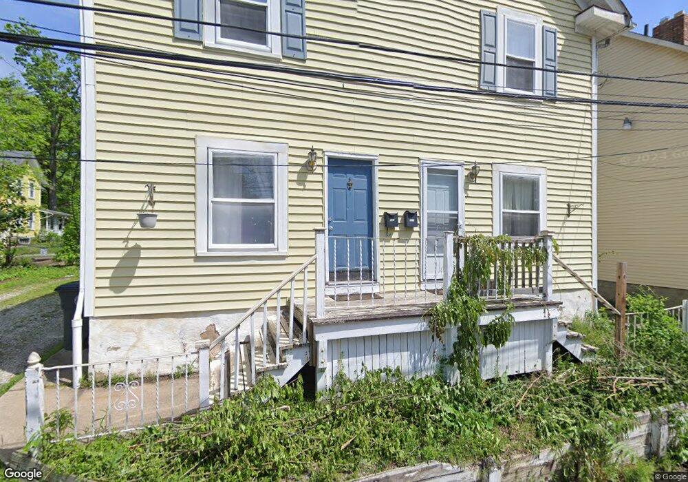
585 Colfax Place Unit 587 Akron, OH 44302
West Hill NeighborhoodEstimated Value: $102,000 - $132,000
3
Beds
1
Bath
2,448
Sq Ft
$48/Sq Ft
Est. Value
About This Home
This home is located at 585 Colfax Place Unit 587, Akron, OH 44302 and is currently estimated at $116,609, approximately $47 per square foot. 585 Colfax Place Unit 587 is a home located in Summit County with nearby schools including Towpath Trail High School, St. Vincent Elementary School, and Julie Billiart School Akron.
Ownership History
Date
Name
Owned For
Owner Type
Purchase Details
Closed on
Apr 27, 2012
Sold by
Felber Ruth L
Bought by
Embassy Builders Inc
Current Estimated Value
Purchase Details
Closed on
Apr 25, 2002
Sold by
Morrison Vaughn M
Bought by
Felber Matthew W and Felber Ruth L
Home Financials for this Owner
Home Financials are based on the most recent Mortgage that was taken out on this home.
Original Mortgage
$76,500
Interest Rate
7%
Mortgage Type
Purchase Money Mortgage
Purchase Details
Closed on
Apr 20, 2000
Sold by
Petroski James E and Plefka Petroski Teresa
Bought by
Morrison Vaughn M
Home Financials for this Owner
Home Financials are based on the most recent Mortgage that was taken out on this home.
Original Mortgage
$48,150
Interest Rate
8.21%
Mortgage Type
Purchase Money Mortgage
Create a Home Valuation Report for This Property
The Home Valuation Report is an in-depth analysis detailing your home's value as well as a comparison with similar homes in the area
Home Values in the Area
Average Home Value in this Area
Purchase History
| Date | Buyer | Sale Price | Title Company |
|---|---|---|---|
| Embassy Builders Inc | $30,000 | Attorney | |
| Felber Matthew W | $85,000 | Midland Commerce Group | |
| Morrison Vaughn M | $53,500 | -- |
Source: Public Records
Mortgage History
| Date | Status | Borrower | Loan Amount |
|---|---|---|---|
| Previous Owner | Felber Matthew W | $76,500 | |
| Previous Owner | Morrison Vaughn M | $48,150 |
Source: Public Records
Tax History
| Year | Tax Paid | Tax Assessment Tax Assessment Total Assessment is a certain percentage of the fair market value that is determined by local assessors to be the total taxable value of land and additions on the property. | Land | Improvement |
|---|---|---|---|---|
| 2024 | $1,882 | $33,751 | $5,310 | $28,441 |
| 2023 | $1,882 | $33,751 | $5,310 | $28,441 |
| 2022 | $1,435 | $19,852 | $3,122 | $16,730 |
| 2021 | $1,436 | $19,852 | $3,122 | $16,730 |
| 2020 | $1,416 | $19,850 | $3,120 | $16,730 |
| 2019 | $1,147 | $14,320 | $3,680 | $10,640 |
| 2018 | $1,133 | $14,320 | $3,680 | $10,640 |
| 2017 | $1,150 | $14,320 | $3,680 | $10,640 |
| 2016 | $1,151 | $14,320 | $3,680 | $10,640 |
| 2015 | $1,150 | $14,320 | $3,680 | $10,640 |
| 2014 | $1,141 | $14,320 | $3,680 | $10,640 |
| 2013 | $924 | $11,550 | $3,680 | $7,870 |
Source: Public Records
Map
Nearby Homes
- 105 Westwood Ave
- 525 Crosby St
- 699 W Exchange St
- 212 Gale St
- 262 S Portage Path
- 71 Dodge Ave
- 295 Grove St
- 127 Hollinger Ave
- 141 Grand Ave
- 325 Beechwood Dr
- 842 Stadelman Ave
- 87 Hawthorne Ave
- 434 Hillwood Dr
- 320 Wildwood Ave
- 414 Beechwood Dr
- 939 W Exchange St
- 892 Delia Ave
- 445 Beechwood Dr
- 370 Wildwood Ave
- 908 Stadelman Ave
Your Personal Tour Guide
Ask me questions while you tour the home.