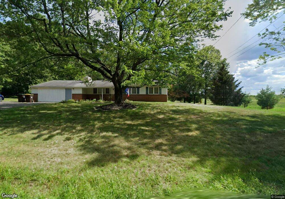
585 Derstine Rd Hatfield, PA 19440
Estimated Value: $769,000
4
Beds
3
Baths
3,922
Sq Ft
$196/Sq Ft
Est. Value
About This Home
This home is located at 585 Derstine Rd, Hatfield, PA 19440 and is currently estimated at $769,000, approximately $196 per square foot. 585 Derstine Rd is a home with nearby schools including Walton Farm El School, Pennfield Middle School, and North Penn Senior High School.
Ownership History
Date
Name
Owned For
Owner Type
Purchase Details
Closed on
Dec 5, 2012
Sold by
Citi Trustee Services Llc
Bought by
Brouse Frank D and Brouse Yvonne
Current Estimated Value
Purchase Details
Closed on
Feb 5, 2010
Sold by
Brouse Frank D and Brouse Yvonne D
Bought by
Citi Trustee Services Llc
Purchase Details
Closed on
Sep 14, 2004
Sold by
Derstine Vernon L and Derstine Miriam
Bought by
Brouse Frank D and Brouse Yvonne D
Purchase Details
Closed on
Jun 18, 2003
Sold by
Derstine Miriam and Derstine Vernon L
Bought by
Ppl Electric Util Corp
Create a Home Valuation Report for This Property
The Home Valuation Report is an in-depth analysis detailing your home's value as well as a comparison with similar homes in the area
Home Values in the Area
Average Home Value in this Area
Purchase History
| Date | Buyer | Sale Price | Title Company |
|---|---|---|---|
| Brouse Frank D | -- | None Available | |
| Citi Trustee Services Llc | -- | None Available | |
| Brouse Frank D | -- | -- | |
| Ppl Electric Util Corp | -- | -- |
Source: Public Records
Tax History Compared to Growth
Tax History
| Year | Tax Paid | Tax Assessment Tax Assessment Total Assessment is a certain percentage of the fair market value that is determined by local assessors to be the total taxable value of land and additions on the property. | Land | Improvement |
|---|---|---|---|---|
| 2025 | $12,491 | $311,970 | -- | -- |
| 2024 | $12,491 | $311,970 | -- | -- |
| 2023 | $11,955 | $311,970 | $0 | $0 |
| 2022 | $11,565 | $622,220 | $316,620 | $305,600 |
| 2021 | $11,236 | $622,220 | $316,620 | $305,600 |
| 2020 | $10,971 | $622,220 | $316,620 | $305,600 |
| 2019 | $10,788 | $622,220 | $316,620 | $305,600 |
| 2018 | $10,788 | $622,220 | $316,620 | $305,600 |
| 2017 | $10,376 | $622,220 | $316,620 | $305,600 |
| 2016 | $10,254 | $622,220 | $316,620 | $305,600 |
| 2015 | $10,077 | $622,220 | $316,620 | $305,600 |
| 2014 | $9,844 | $622,220 | $316,620 | $305,600 |
Source: Public Records
Map
Nearby Homes
- 3113 Arbour Green Ct
- 2805 N Ford Dr
- 2821 N Ford Dr
- 701 Quail Cir
- 829 Alexander Dr
- 2045 Pleasant Valley Dr
- 1520 Fairgrounds Rd
- 1095 Owen Ln
- 1165 Mason Rd
- 103 Allentown Rd
- 2801 Denbeigh Dr
- 635 Elroy Rd
- 302 W Broad St
- 2921 Cowpath Rd
- 113 Hickory Dr
- 109 Hickory Dr
- 2031 Oak Ave
- 24 S Wayne Ave
- 708 Finlay Dr
- 723 Finlay Dr
- 2912 Washington Ln
- 2916 Washington Ln
- 2908 Washington Ln
- 2920 Washington Ln
- 2904 Washington Ln
- 2924 Washington Ln
- 2900 Washington Ln
- 2896 Washington Ln
- 2928 Washington Ln
- 2892 Washington Ln
- 627 Derstine Rd
- 2888 Washington Ln
- 2932 Washington Ln
- 2905 Washington Ln
- 2909 Washington Ln
- 2913 Washington Ln
- 2884 Washington Ln
- 2901 Washington Ln
- 2897 Washington Ln
- 2893 Washington Ln