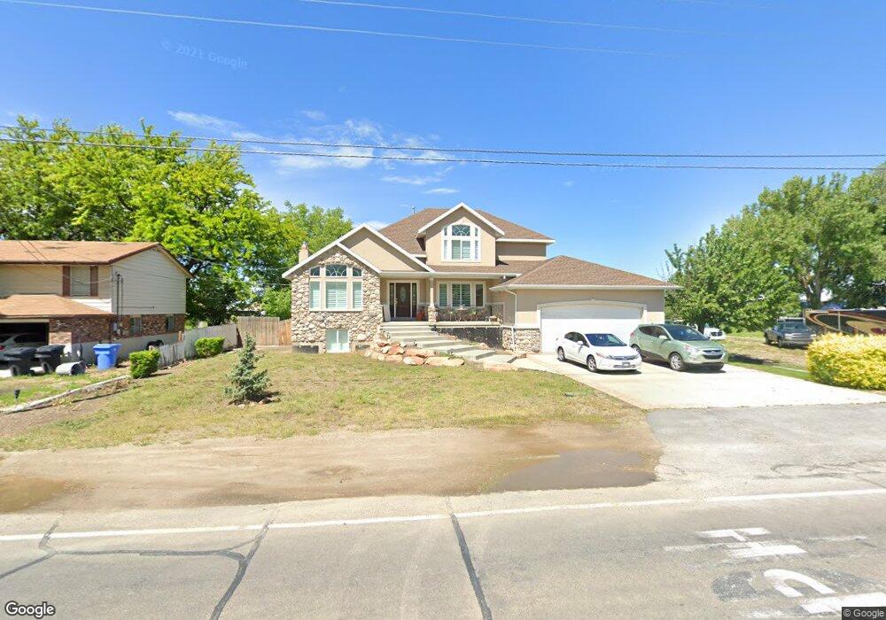
585 N 1100 W West Bountiful, UT 84087
Estimated Value: $834,658 - $1,213,000
4
Beds
3
Baths
2,670
Sq Ft
$357/Sq Ft
Est. Value
About This Home
This home is located at 585 N 1100 W, West Bountiful, UT 84087 and is currently estimated at $953,915, approximately $357 per square foot. 585 N 1100 W is a home located in Davis County with nearby schools including West Bountiful Elementary School, Bountiful Junior High School, and Viewmont High School.
Ownership History
Date
Name
Owned For
Owner Type
Purchase Details
Closed on
Mar 30, 2012
Sold by
Tanner Mark H
Bought by
Tanner Mark and Tanner Dee Hinckley
Current Estimated Value
Home Financials for this Owner
Home Financials are based on the most recent Mortgage that was taken out on this home.
Original Mortgage
$235,000
Outstanding Balance
$28,777
Interest Rate
3.14%
Mortgage Type
New Conventional
Estimated Equity
$925,138
Purchase Details
Closed on
Jan 13, 2012
Sold by
Tanner Mark H
Bought by
Tanner Mark and Tanner Dee Hinckley
Purchase Details
Closed on
Jul 28, 2004
Sold by
Hinckley Deanne and Moser Steorts Alice
Bought by
Tanner Mark H
Create a Home Valuation Report for This Property
The Home Valuation Report is an in-depth analysis detailing your home's value as well as a comparison with similar homes in the area
Home Values in the Area
Average Home Value in this Area
Purchase History
| Date | Buyer | Sale Price | Title Company |
|---|---|---|---|
| Tanner Mark | -- | Eagle Gate Title Ins | |
| Tanner Mark | -- | Eagle Gate Title Ins Agency | |
| Tanner Mark H | -- | Founders Title Co |
Source: Public Records
Mortgage History
| Date | Status | Borrower | Loan Amount |
|---|---|---|---|
| Open | Tanner Mark | $235,000 |
Source: Public Records
Tax History Compared to Growth
Tax History
| Year | Tax Paid | Tax Assessment Tax Assessment Total Assessment is a certain percentage of the fair market value that is determined by local assessors to be the total taxable value of land and additions on the property. | Land | Improvement |
|---|---|---|---|---|
| 2025 | $5,224 | $407,550 | $219,321 | $188,229 |
| 2024 | $4,952 | $405,351 | $183,145 | $222,206 |
| 2023 | $4,724 | $710,000 | $326,977 | $383,023 |
| 2022 | $4,727 | $402,050 | $172,587 | $229,463 |
| 2021 | $4,320 | $560,000 | $265,449 | $294,551 |
| 2020 | $3,920 | $494,000 | $220,408 | $273,592 |
| 2019 | $3,754 | $478,000 | $203,746 | $274,254 |
| 2018 | $3,581 | $456,000 | $178,284 | $277,716 |
| 2016 | $2,912 | $199,925 | $75,912 | $124,013 |
| 2015 | $2,906 | $191,290 | $75,912 | $115,378 |
| 2014 | $3,133 | $215,134 | $75,912 | $139,222 |
| 2013 | -- | $157,497 | $48,866 | $108,631 |
Source: Public Records
Map
Nearby Homes
- 280 N 1100 W
- Carson Plan at Amberly Place
- 2050 Farmhouse Plan at Amberly Place
- Pasadena Plan at Amberly Place
- Portland Plan at Amberly Place
- 767 W 220 N
- 825 W 1320 N
- 1084 W Audrey Ln Unit 20
- 1084 W Audrey Ln
- 680 W 500 S Unit 22
- 680 W 500 S Unit 17
- 1075 W Audrey Ln Unit 6
- 1067 W Audrey Ln Unit 8
- Swiss 2 - Urban Plan at The Audrey - theAUDREY
- Swiss 3 - Urban Plan at The Audrey - theAUDREY
- Swiss 1 - Cottage Plan at The Audrey - theAUDREY
- Swiss 4 - Cottage Plan at The Audrey - theAUDREY
- Swiss 2 - Cottage Plan at The Audrey - theAUDREY
- Swiss 3 - Cottage Plan at The Audrey - theAUDREY
- Swiss 4 - Urban Plan at The Audrey - theAUDREY