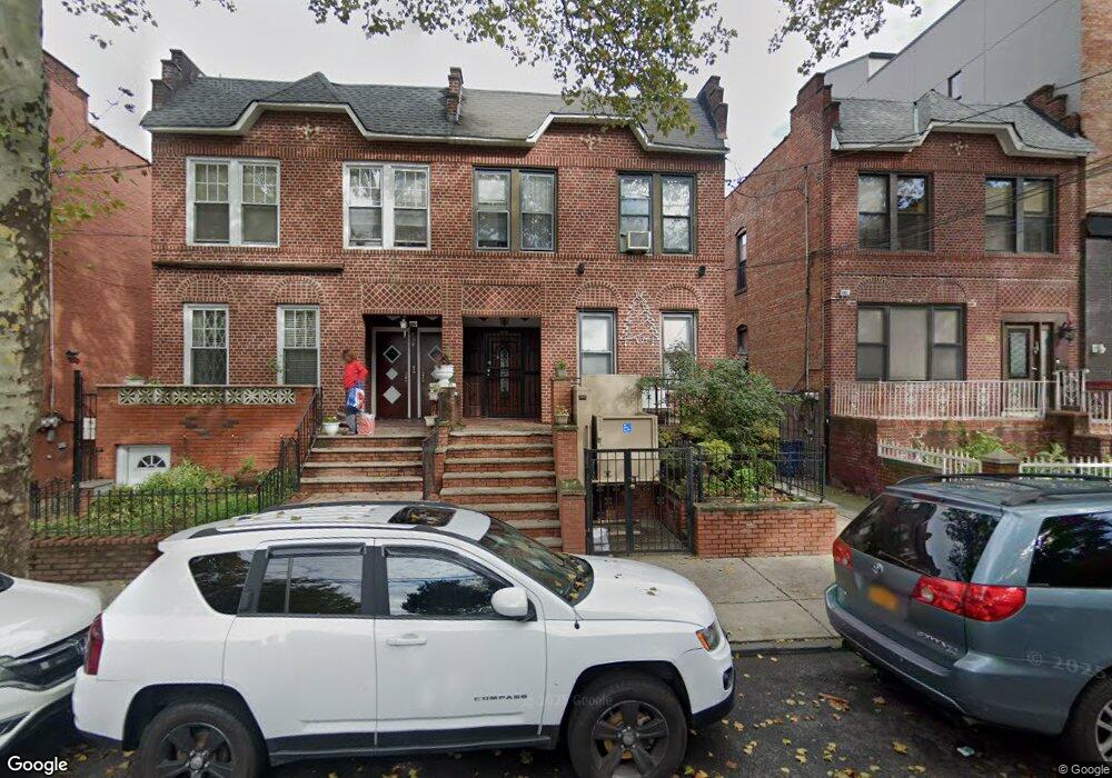
585 Rutland Rd Brooklyn, NY 11203
East Flatbush NeighborhoodEstimated Value: $1,067,000 - $1,309,000
--
Bed
--
Bath
2,320
Sq Ft
$495/Sq Ft
Est. Value
About This Home
This home is located at 585 Rutland Rd, Brooklyn, NY 11203 and is currently estimated at $1,148,919, approximately $495 per square foot. 585 Rutland Rd is a home located in Kings County with nearby schools including P.S. 91 The Albany Avenue School, New Heights Middle School, and Beth Rivkah Elementary School.
Ownership History
Date
Name
Owned For
Owner Type
Purchase Details
Closed on
Mar 27, 2025
Sold by
Stout Renee E and Stout William P
Bought by
Renee E Stout As Trustee and The Revocable Living Trust Of Renee E S
Current Estimated Value
Purchase Details
Closed on
Jun 1, 2008
Sold by
Stout William P
Bought by
Stout Renee E and Stout William P
Create a Home Valuation Report for This Property
The Home Valuation Report is an in-depth analysis detailing your home's value as well as a comparison with similar homes in the area
Home Values in the Area
Average Home Value in this Area
Purchase History
| Date | Buyer | Sale Price | Title Company |
|---|---|---|---|
| Renee E Stout As Trustee | -- | -- | |
| Stout Renee E | -- | -- | |
| Stout Renee E | -- | -- |
Source: Public Records
Tax History Compared to Growth
Tax History
| Year | Tax Paid | Tax Assessment Tax Assessment Total Assessment is a certain percentage of the fair market value that is determined by local assessors to be the total taxable value of land and additions on the property. | Land | Improvement |
|---|---|---|---|---|
| 2025 | $7,197 | $71,220 | $22,320 | $48,900 |
| 2024 | $7,197 | $78,540 | $22,320 | $56,220 |
| 2023 | $7,277 | $75,420 | $22,320 | $53,100 |
| 2022 | $7,098 | $68,100 | $22,320 | $45,780 |
| 2021 | $7,060 | $61,200 | $22,320 | $38,880 |
| 2020 | $3,311 | $65,640 | $22,320 | $43,320 |
| 2019 | $6,246 | $64,260 | $22,320 | $41,940 |
| 2018 | $6,087 | $29,859 | $12,397 | $17,462 |
| 2017 | $6,040 | $29,631 | $14,278 | $15,353 |
| 2016 | $5,588 | $27,955 | $17,419 | $10,536 |
| 2015 | $3,152 | $26,374 | $16,720 | $9,654 |
| 2014 | $3,152 | $24,883 | $15,397 | $9,486 |
Source: Public Records
Map
Nearby Homes
- 602 Maple St
- 487 Midwood St
- 556 E New York Ave
- 691 Winthrop St
- 704 Lefferts Ave
- 112 E 45th St
- 446 Kingston Ave Unit D9
- 122 E 46th St
- 20 Lamont Ct
- 755 Albany Ave
- 406 Midwood St Unit PHA
- 406 Midwood St Unit 2 B
- 406 Midwood St Unit 1 B
- 406 Midwood St Unit 2 A
- 406 Midwood St Unit PH
- 406 Midwood St Unit 1-BB
- 406 Midwood St Unit 1 A
- 10 E 43rd St Unit 4K
- 10 E 43rd St Unit 5e
- 10 E 43rd St Unit 4J
- 587 Rutland Rd
- 583 Rutland Rd
- 591 Rutland Rd
- 591 Rutland Rd Unit 1R
- 579 Rutland Rd
- 575 Rutland Rd
- 593 Rutland Rd
- 593 Rutland Rd Unit 1R
- 593 Rutland Rd Unit 4F
- 595 Rutland Rd
- 571 Rutland Rd
- 580 Midwood St
- 578 Midwood St
- 586 Midwood St
- 576 Midwood St
- 597 Rutland Rd
- 588 Midwood St
- 569 Rutland Rd
- 574 Midwood St
- 592 Midwood St