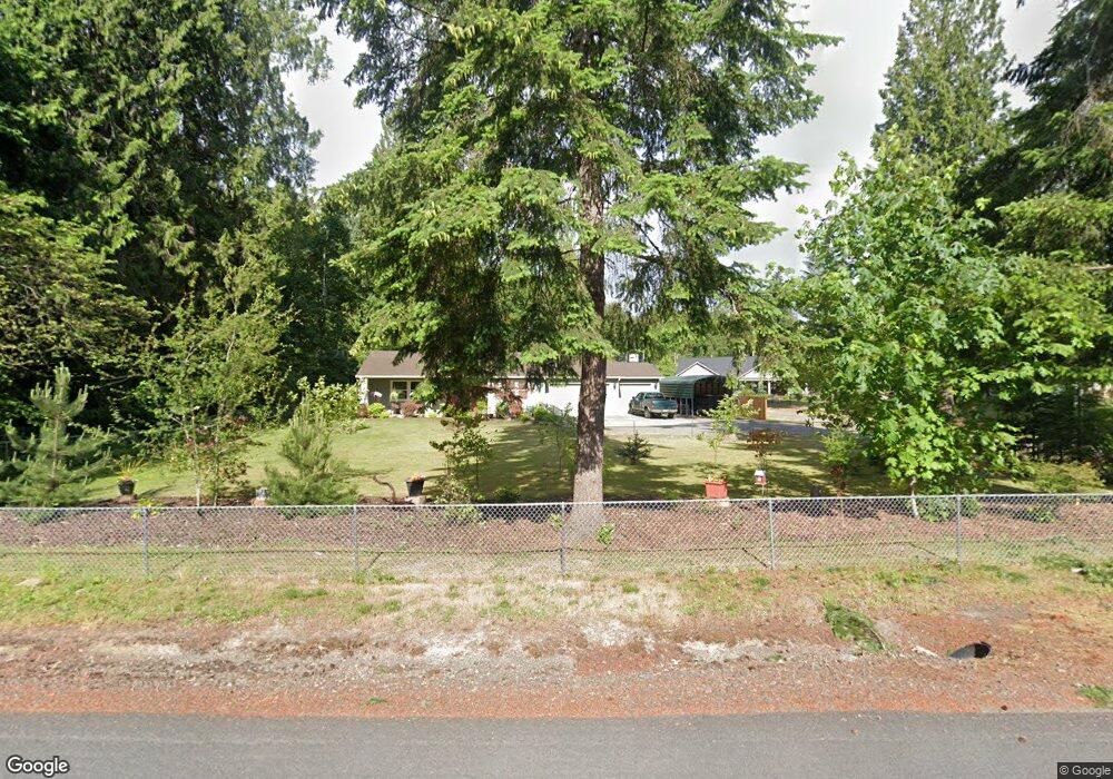
585 Umiker Rd Castle Rock, WA 98611
Estimated Value: $523,840 - $611,000
3
Beds
2
Baths
1,690
Sq Ft
$339/Sq Ft
Est. Value
About This Home
This home is located at 585 Umiker Rd, Castle Rock, WA 98611 and is currently estimated at $572,960, approximately $339 per square foot. 585 Umiker Rd is a home located in Cowlitz County with nearby schools including Castle Rock Elementary School, Castle Rock Middle School, and Castle Rock High School.
Ownership History
Date
Name
Owned For
Owner Type
Purchase Details
Closed on
Nov 24, 2015
Sold by
Angelo Joseph and Angelo Albert
Bought by
Carlson G Alvin and Carlson Patricia A
Current Estimated Value
Home Financials for this Owner
Home Financials are based on the most recent Mortgage that was taken out on this home.
Original Mortgage
$211,493
Interest Rate
3.76%
Mortgage Type
Construction
Purchase Details
Closed on
May 14, 2009
Sold by
Bannan Jeffrey and Angelo Theodore
Bought by
Smith Christopher and Smith Julie
Purchase Details
Closed on
May 11, 2009
Sold by
Angelo Maryjane
Bought by
Angelo Theodore
Purchase Details
Closed on
Aug 3, 2006
Sold by
Angelo Mary Jane
Bought by
Angelo Theodore
Purchase Details
Closed on
Jun 1, 2006
Sold by
Kordonowy David S and Estate Of Samuel & Katherine K
Bought by
Angelo Theodore
Create a Home Valuation Report for This Property
The Home Valuation Report is an in-depth analysis detailing your home's value as well as a comparison with similar homes in the area
Purchase History
| Date | Buyer | Sale Price | Title Company |
|---|---|---|---|
| Carlson G Alvin | $45,000 | Stewart Title Cowlitz County | |
| Smith Christopher | -- | Stewart Title Company | |
| Angelo Theodore | -- | Stewart Title | |
| Angelo Theodore | -- | Stewart Title Of Wes | |
| Bannan Jeffrey | -- | Stewart Title Of Wes | |
| Angelo Theodore | $147,500 | Stewart Title |
Source: Public Records
Mortgage History
| Date | Status | Borrower | Loan Amount |
|---|---|---|---|
| Closed | Carlson G Alvin | $211,493 |
Source: Public Records
Tax History
| Year | Tax Paid | Tax Assessment Tax Assessment Total Assessment is a certain percentage of the fair market value that is determined by local assessors to be the total taxable value of land and additions on the property. | Land | Improvement |
|---|---|---|---|---|
| 2024 | $4,108 | $491,270 | $56,260 | $435,010 |
| 2023 | $3,715 | $524,020 | $56,260 | $467,760 |
| 2022 | $2,730 | $459,850 | $56,260 | $403,590 |
| 2021 | $2,463 | $304,650 | $56,260 | $248,390 |
| 2020 | $2,567 | $266,880 | $48,920 | $217,960 |
| 2019 | $2,187 | $288,627 | $48,018 | $240,609 |
| 2018 | $2,382 | $242,060 | $48,020 | $194,040 |
| 2017 | $2,337 | $228,180 | $45,730 | $182,450 |
| 2016 | $436 | $226,000 | $43,550 | $182,450 |
| 2015 | $426 | $43,550 | $43,550 | $0 |
| 2013 | -- | $41,300 | $41,300 | $0 |
Source: Public Records
Map
Nearby Homes
- 121 Gassman Rd
- 143 Gassman Rd
- 143 Annabelle St
- 118 Annabelle St
- 124 Annabelle St
- 155 Gassman Rd
- 170 Annabelle St
- 119 Key Rd
- 114 Cherry St NW
- 7629 Old Pacific Hwy N
- 8023 Old Pacific Hwy Unit 4
- 65 Shintaffer St NW
- 136 3rd Ave SW
- 441 4th Ave SW
- 715 NE Pioneer Ave NE
- 611 Pioneer Ave NE
- 546 4th Ave SW
- 0 Pioneer Ave NE
- 730 Little Ave NE
- 438 Front Ave SW
Your Personal Tour Guide
Ask me questions while you tour the home.