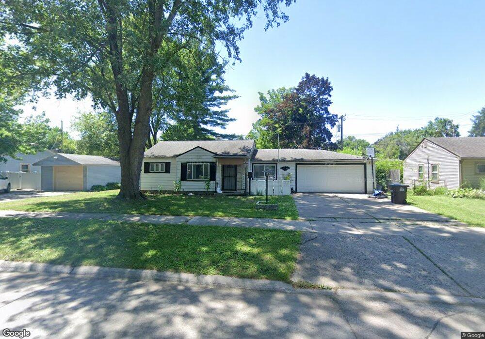
5850 Daniels St Taylor, MI 48180
Estimated Value: $143,000 - $173,000
3
Beds
2
Baths
1,387
Sq Ft
$116/Sq Ft
Est. Value
About This Home
This home is located at 5850 Daniels St, Taylor, MI 48180 and is currently estimated at $160,637, approximately $115 per square foot. 5850 Daniels St is a home located in Wayne County with nearby schools including Holland Elementary School, Hoover Middle School, and Taylor High School.
Ownership History
Date
Name
Owned For
Owner Type
Purchase Details
Closed on
May 13, 2008
Sold by
Scales Cindy and Stewart Darrell Clyde
Bought by
Stewart Jerry
Current Estimated Value
Home Financials for this Owner
Home Financials are based on the most recent Mortgage that was taken out on this home.
Original Mortgage
$50,500
Outstanding Balance
$31,965
Interest Rate
5.87%
Mortgage Type
Purchase Money Mortgage
Estimated Equity
$128,672
Purchase Details
Closed on
Apr 1, 2008
Sold by
Scales Cindy and Estate Of James F Stewart
Bought by
Stewart Jerry
Home Financials for this Owner
Home Financials are based on the most recent Mortgage that was taken out on this home.
Original Mortgage
$50,500
Outstanding Balance
$31,965
Interest Rate
5.87%
Mortgage Type
Purchase Money Mortgage
Estimated Equity
$128,672
Create a Home Valuation Report for This Property
The Home Valuation Report is an in-depth analysis detailing your home's value as well as a comparison with similar homes in the area
Home Values in the Area
Average Home Value in this Area
Purchase History
| Date | Buyer | Sale Price | Title Company |
|---|---|---|---|
| Stewart Jerry | -- | Michigan Title Insurance Age | |
| Stewart Jerry | $46,000 | Michigan Title Insurance Age |
Source: Public Records
Mortgage History
| Date | Status | Borrower | Loan Amount |
|---|---|---|---|
| Open | Stewart Jerry | $50,500 | |
| Previous Owner | Stewart Jerry | $50,500 |
Source: Public Records
Tax History
| Year | Tax Paid | Tax Assessment Tax Assessment Total Assessment is a certain percentage of the fair market value that is determined by local assessors to be the total taxable value of land and additions on the property. | Land | Improvement |
|---|---|---|---|---|
| 2025 | $1,506 | $81,800 | $0 | $0 |
| 2024 | $1,458 | $74,600 | $0 | $0 |
| 2023 | $2,336 | $63,500 | $0 | $0 |
| 2022 | $1,392 | $59,800 | $0 | $0 |
| 2021 | $2,294 | $50,600 | $0 | $0 |
| 2020 | $1,539 | $43,300 | $0 | $0 |
| 2019 | $153,077 | $37,500 | $0 | $0 |
| 2018 | $1,195 | $28,600 | $0 | $0 |
| 2017 | $683 | $28,600 | $0 | $0 |
| 2016 | $2,390 | $27,800 | $0 | $0 |
| 2015 | $2,700 | $27,000 | $0 | $0 |
| 2013 | $3,010 | $31,200 | $0 | $0 |
| 2012 | $1,339 | $30,500 | $10,900 | $19,600 |
Source: Public Records
Map
Nearby Homes
- 5940 Daniels St
- 27059 Jeannette Ct
- 27032 Joan St
- 6144 Princess St
- 6198 Princess St
- 5970 John Daly St
- 27029 Michelle Ct
- 5132 S Inkster Rd
- 6367 Glenis St
- 26532 Powers Ave
- 4863 Glenis St
- 26424 Beverly Rd
- 6310 Duncan St
- 26735 Annapolis St
- 26131 Amherst St
- 27658 Eton St
- 27272 Hopkins St
- 6161 Fellrath St
- 6179 Fellrath St
- 26225 McDonald St
- 5850 Daniels St Unit Bldg-Unit
- 5834 Daniels St
- 5866 Daniels St
- 5882 Daniels St
- 5855 Daniels St
- 5843 Daniels St
- 27119 van Born Rd
- 27127 van Born Rd
- 5867 Daniels St
- 5831 Daniels St
- 27173 van Born Rd
- 5879 Daniels St Unit Bldg-Unit
- 5879 Daniels St
- 27063 van Born Rd
- 5902 Daniels St
- 5891 Daniels St
- 27045 van Born Rd
- 27161 van Born Rd
- 5903 Daniels St
- 5852 Sylvia St