Estimated Value: $280,000 - $357,000
3
Beds
2
Baths
988
Sq Ft
$315/Sq Ft
Est. Value
About This Home
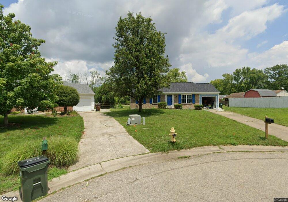
This home is located at 5856 Addison Dr, Mason, OH 45040 and is currently estimated at $310,991, approximately $314 per square foot. 5856 Addison Dr is a home located in Warren County with nearby schools including Mason Intermediate Elementary School, Mason Middle School, and William Mason High School.
Ownership History
Date
Name
Owned For
Owner Type
Purchase Details
Closed on
Jan 29, 2025
Sold by
Taylor Robin R
Bought by
Taylor Baby Rose Marie G and Taylor Lukus A
Current Estimated Value
Purchase Details
Closed on
Jun 8, 2001
Sold by
Hoying Bryan
Bought by
Taylor Donald S and Taylor Robin
Home Financials for this Owner
Home Financials are based on the most recent Mortgage that was taken out on this home.
Original Mortgage
$131,200
Interest Rate
7.18%
Mortgage Type
FHA
Purchase Details
Closed on
Sep 5, 1995
Sold by
Wilder Steven J
Bought by
Michelle Bryan G and Michelle Hoying
Home Financials for this Owner
Home Financials are based on the most recent Mortgage that was taken out on this home.
Original Mortgage
$107,100
Interest Rate
7.55%
Mortgage Type
VA
Purchase Details
Closed on
Jun 11, 1992
Sold by
American Heritage Constru
Bought by
Wilder Wilder and Wilder Steven J
Purchase Details
Closed on
Dec 18, 1991
Sold by
American Heritage Constru
Bought by
American Heritage Constru
Create a Home Valuation Report for This Property
The Home Valuation Report is an in-depth analysis detailing your home's value as well as a comparison with similar homes in the area
Home Values in the Area
Average Home Value in this Area
Purchase History
| Date | Buyer | Sale Price | Title Company |
|---|---|---|---|
| Taylor Baby Rose Marie G | $80,000 | None Listed On Document | |
| Taylor Donald S | $133,300 | -- | |
| Michelle Bryan G | $105,000 | -- | |
| Wilder Wilder | $82,800 | -- | |
| American Heritage Constru | -- | -- |
Source: Public Records
Mortgage History
| Date | Status | Borrower | Loan Amount |
|---|---|---|---|
| Previous Owner | Taylor Donald S | $131,200 | |
| Previous Owner | Michelle Bryan G | $107,100 |
Source: Public Records
Tax History Compared to Growth
Tax History
| Year | Tax Paid | Tax Assessment Tax Assessment Total Assessment is a certain percentage of the fair market value that is determined by local assessors to be the total taxable value of land and additions on the property. | Land | Improvement |
|---|---|---|---|---|
| 2024 | $2,604 | $73,970 | $24,500 | $49,470 |
| 2023 | $2,412 | $58,954 | $15,067 | $43,886 |
| 2022 | $2,381 | $58,954 | $15,068 | $43,887 |
| 2021 | $2,256 | $58,954 | $15,068 | $43,887 |
| 2020 | $2,053 | $47,929 | $12,250 | $35,679 |
| 2019 | $1,887 | $47,929 | $12,250 | $35,679 |
| 2018 | $1,893 | $47,929 | $12,250 | $35,679 |
| 2017 | $1,738 | $42,319 | $8,750 | $33,569 |
| 2016 | $1,790 | $42,319 | $8,750 | $33,569 |
| 2015 | $1,794 | $42,319 | $8,750 | $33,569 |
| 2014 | $1,663 | $37,780 | $7,810 | $29,970 |
| 2013 | $1,667 | $42,310 | $8,750 | $33,560 |
Source: Public Records
Map
Nearby Homes
- 5944 Snider Cove Way
- 570 Cocinda Ln
- 790 Indianwood Dr
- 3011 Ash Ct
- 5641 Melbury Ct
- 670 Davis Ln
- 1064 Winding Creek Ln
- 1074 Willow Ln
- 1218 Anthony Ln
- 6715 Willow Ln
- 6860 Lexington Park Blvd
- 5255 Chapel Ln
- 6138 Nicholas Way
- 6387 Coverage Ct
- 6403 Coverage Ct
- 6357 Coverage Ct
- 6383 Coverage Ct
- 6407 Coverage Ct
- 6375 Coverage Ct
- 6365 Coverage Ct
- 5866 Addison Dr
- 991 Brookcrest Dr
- 1003 Brookcrest Dr
- 981 Brookcrest Dr
- 5876 Addison Dr
- 973 Brookcrest Dr
- 5873 Addison Dr
- 1009 Brookcrest Dr
- 965 Brookcrest Dr
- 5859 Addison Dr
- 5867 Addison Dr
- 957 Brookcrest Dr
- 1015 Brookcrest Dr
- 988 Brookcrest Dr
- 980 Brookcrest Dr
- 996 Brookcrest Dr
- 974 Brookcrest Dr
- 1004 Brookcrest Dr
- 966 Brookcrest Dr
- 951 Brookcrest Dr