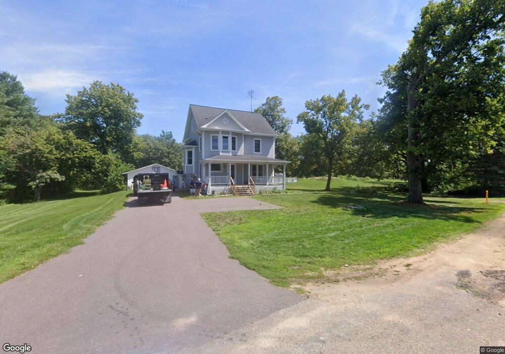
5858 Voss Rd Mazomanie, WI 53560
Estimated Value: $379,000 - $485,000
5
Beds
2
Baths
2,500
Sq Ft
$173/Sq Ft
Est. Value
About This Home
This home is located at 5858 Voss Rd, Mazomanie, WI 53560 and is currently estimated at $433,304, approximately $173 per square foot. 5858 Voss Rd is a home located in Dane County with nearby schools including Wisconsin Heights Elementary School, Mazomanie Elementary School, and Wisconsin Heights Middle School.
Ownership History
Date
Name
Owned For
Owner Type
Purchase Details
Closed on
Jul 7, 2015
Sold by
Carter Hudson Llc
Bought by
Bird Julie and Bird Steven
Current Estimated Value
Home Financials for this Owner
Home Financials are based on the most recent Mortgage that was taken out on this home.
Original Mortgage
$162,000
Outstanding Balance
$122,962
Interest Rate
3.12%
Mortgage Type
Adjustable Rate Mortgage/ARM
Estimated Equity
$310,342
Create a Home Valuation Report for This Property
The Home Valuation Report is an in-depth analysis detailing your home's value as well as a comparison with similar homes in the area
Home Values in the Area
Average Home Value in this Area
Purchase History
| Date | Buyer | Sale Price | Title Company |
|---|---|---|---|
| Bird Julie | $180,000 | Attorney | |
| Bird Julie | $180,000 | Attorney |
Source: Public Records
Mortgage History
| Date | Status | Borrower | Loan Amount |
|---|---|---|---|
| Open | Bird Julie | $162,000 | |
| Closed | Bird Julie | $162,000 |
Source: Public Records
Tax History Compared to Growth
Tax History
| Year | Tax Paid | Tax Assessment Tax Assessment Total Assessment is a certain percentage of the fair market value that is determined by local assessors to be the total taxable value of land and additions on the property. | Land | Improvement |
|---|---|---|---|---|
| 2024 | $5,169 | $280,800 | $66,000 | $214,800 |
| 2023 | $5,231 | $281,700 | $66,000 | $215,700 |
| 2021 | $4,417 | $183,500 | $53,100 | $130,400 |
| 2020 | $4,097 | $183,500 | $53,100 | $130,400 |
| 2019 | $3,971 | $183,500 | $53,100 | $130,400 |
| 2018 | $3,830 | $183,500 | $53,100 | $130,400 |
| 2017 | $3,791 | $183,500 | $53,100 | $130,400 |
| 2016 | $3,904 | $183,500 | $53,100 | $130,400 |
| 2015 | $4,679 | $221,000 | $53,100 | $167,900 |
| 2014 | $4,523 | $221,000 | $53,100 | $167,900 |
| 2013 | $4,283 | $221,000 | $53,100 | $167,900 |
Source: Public Records
Map
Nearby Homes
- 9.9 acres Hwy 14 & Hwy 78 19
- 0 Scara Brea Ln Unit 2008245
- 410 University Ln
- 107-109 E North St
- Lot 18 Ridge Run
- 450 Bridge St
- 409 Bridge St
- 325 W Division St
- 706 Reeve Rd
- 708 Reeve Rd
- 14 N John St
- Lot 2 Csm 12049 Highway 14
- 710 Reeve Rd
- 714 Reeve Rd
- 429 Emily Rd
- 603 Prairie Ln
- 501 Emily Rd
- 709 Prairie Ln
- 505 Emily Rd
- 508 Prairie Ln
- 5861 Voss Rd
- 5881 Derby Rd
- 5900 Derby Rd
- 10348 Hudson Rd
- 10331 Curtis Rd
- 10363 Hudson Rd
- 16.22 ac Hwy 14
- 10322 Curtis Rd
- 10340 Curtis Rd
- 10345 Curtis Rd
- 10360 Us Highway 14
- 10367 Hudson Rd
- 10348 Curtis Rd
- 10370 Hudson Rd
- 10359 Curtis Rd
- 10326 Curtis Rd
- 10331 Us Highway 14
- 10371 Hudson Rd
- 10354 Curtis Rd
- 10332 Curtis Rd