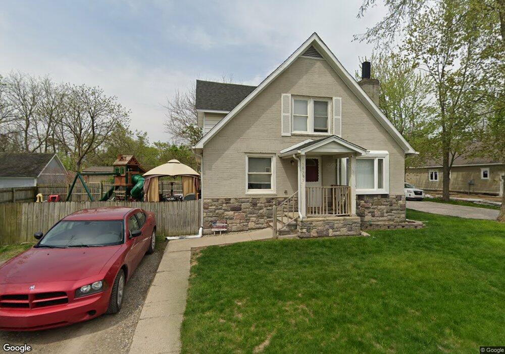
58585 Lind Rd Washington, MI 48094
Estimated Value: $198,000 - $278,000
--
Bed
1
Bath
1,428
Sq Ft
$166/Sq Ft
Est. Value
About This Home
This home is located at 58585 Lind Rd, Washington, MI 48094 and is currently estimated at $237,152, approximately $166 per square foot. 58585 Lind Rd is a home located in Macomb County with nearby schools including Cross Of Glory Lutheran School.
Ownership History
Date
Name
Owned For
Owner Type
Purchase Details
Closed on
Mar 10, 2006
Sold by
Walsh William P and Walsh Deborah
Bought by
Jpmorgan Chase Bank and Abfs Mortgage Loan Trust 2003-1
Current Estimated Value
Purchase Details
Closed on
Mar 8, 2006
Sold by
Walsh William P
Bought by
Miller Kristi and 58585 Lind Residential Land Tr
Purchase Details
Closed on
Dec 16, 2003
Sold by
Walsh Deborah Ann
Bought by
Walsh William Patrick
Purchase Details
Closed on
Dec 20, 2000
Sold by
Brick Design Properties
Bought by
Walsh William P
Home Financials for this Owner
Home Financials are based on the most recent Mortgage that was taken out on this home.
Original Mortgage
$138,700
Interest Rate
7.06%
Purchase Details
Closed on
May 17, 2000
Sold by
Timmermans Raymond C
Bought by
Brick Designproperties Inc
Create a Home Valuation Report for This Property
The Home Valuation Report is an in-depth analysis detailing your home's value as well as a comparison with similar homes in the area
Home Values in the Area
Average Home Value in this Area
Purchase History
| Date | Buyer | Sale Price | Title Company |
|---|---|---|---|
| Jpmorgan Chase Bank | $131,750 | None Available | |
| Miller Kristi | -- | None Available | |
| Walsh William Patrick | -- | -- | |
| Walsh William P | $146,000 | -- | |
| Brick Designproperties Inc | $123,000 | -- |
Source: Public Records
Mortgage History
| Date | Status | Borrower | Loan Amount |
|---|---|---|---|
| Previous Owner | Walsh William P | $138,700 |
Source: Public Records
Tax History Compared to Growth
Tax History
| Year | Tax Paid | Tax Assessment Tax Assessment Total Assessment is a certain percentage of the fair market value that is determined by local assessors to be the total taxable value of land and additions on the property. | Land | Improvement |
|---|---|---|---|---|
| 2025 | $2,569 | $93,500 | $0 | $0 |
| 2024 | $2,039 | $87,600 | $0 | $0 |
| 2023 | $1,955 | $83,100 | $0 | $0 |
| 2022 | $2,372 | $75,900 | $0 | $0 |
| 2021 | $2,453 | $70,400 | $0 | $0 |
| 2020 | $1,795 | $66,900 | $0 | $0 |
| 2019 | $2,165 | $58,400 | $0 | $0 |
| 2018 | $2,284 | $58,300 | $0 | $0 |
| 2017 | $2,221 | $56,100 | $23,100 | $33,000 |
| 2016 | $2,084 | $56,100 | $0 | $0 |
| 2015 | -- | $44,700 | $0 | $0 |
| 2013 | $1,298 | $41,300 | $14,000 | $27,300 |
| 2012 | $1,298 | $39,600 | $0 | $0 |
Source: Public Records
Map
Nearby Homes
- 6933 Boulder Pointe Dr Unit 59
- 7427 Emerson
- 58152 Carbine
- 58019 Van Dyke Rd
- 6797 Boulder Pointe Dr Unit 25
- 8400 27 Mile Rd Unit Lot 2
- 8400 27 Mile Rd Unit Lot 1
- 6725 Boulder Pointe Dr Unit 7
- 7070 Venturi Dr
- 58144 Pheasant Ridge
- 0 Cathey Unit Lot 4
- 0 Cathey Unit Lot 5
- 7250 Lindrath
- 59601 Van Dyke Rd
- 8699 Pioneer St
- 57136 Megan Dr
- 57016 Megan Dr
- 57911 Lancaster Rd
- 00 Oakridge Dr
- 7966 Firestone Ln Unit 44