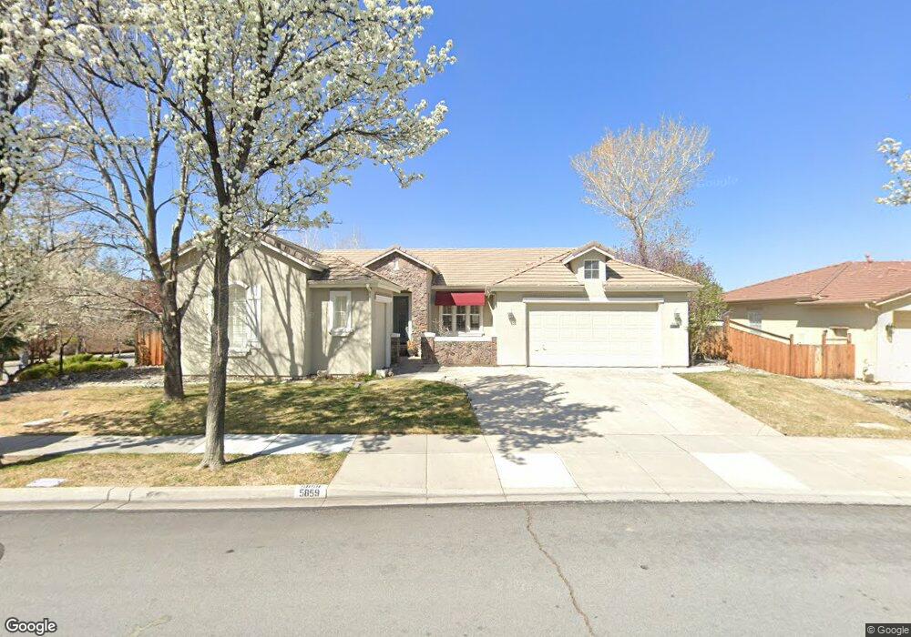
5859 Solstice Dr Sparks, NV 89436
Wingfield Springs NeighborhoodEstimated Value: $670,000 - $806,000
3
Beds
3
Baths
2,004
Sq Ft
$363/Sq Ft
Est. Value
About This Home
This home is located at 5859 Solstice Dr, Sparks, NV 89436 and is currently estimated at $727,488, approximately $363 per square foot. 5859 Solstice Dr is a home located in Washoe County with nearby schools including Van Gorder Elementary School, Sky Ranch Middle School, and Spanish Springs High School.
Ownership History
Date
Name
Owned For
Owner Type
Purchase Details
Closed on
Sep 7, 2021
Sold by
Heitzenrader Kenneth Dewayne and The Heitzenrader Family Trust
Bought by
Heitzenrader Scott A and Heitzenrader Christina K
Current Estimated Value
Purchase Details
Closed on
Jul 15, 2005
Sold by
Reynen & Bardis Wingfield Springs Llc
Bought by
Heitzenrader Kenneth Dewayne and Heitzenrader Judith Anne Scott
Create a Home Valuation Report for This Property
The Home Valuation Report is an in-depth analysis detailing your home's value as well as a comparison with similar homes in the area
Home Values in the Area
Average Home Value in this Area
Purchase History
| Date | Buyer | Sale Price | Title Company |
|---|---|---|---|
| Heitzenrader Scott A | $650,000 | First Centennial Reno | |
| Heitzenrader Kenneth Dewayne | $659,000 | First American Title |
Source: Public Records
Tax History
| Year | Tax Paid | Tax Assessment Tax Assessment Total Assessment is a certain percentage of the fair market value that is determined by local assessors to be the total taxable value of land and additions on the property. | Land | Improvement |
|---|---|---|---|---|
| 2026 | $4,080 | $210,949 | $60,288 | $150,661 |
| 2025 | $5,044 | $212,999 | $60,288 | $152,712 |
| 2024 | $5,044 | $203,822 | $49,777 | $154,045 |
| 2023 | $4,672 | $197,572 | $50,505 | $147,067 |
| 2022 | $4,327 | $162,424 | $41,678 | $120,746 |
| 2021 | $4,007 | $156,646 | $36,855 | $119,791 |
| 2020 | $3,888 | $158,083 | $36,838 | $121,245 |
| 2019 | $3,774 | $150,761 | $34,519 | $116,242 |
| 2018 | $3,667 | $146,618 | $32,744 | $113,874 |
| 2017 | $3,560 | $144,309 | $30,781 | $113,528 |
| 2016 | $3,470 | $141,582 | $29,164 | $112,418 |
| 2015 | $1,734 | $127,484 | $25,410 | $102,074 |
| 2014 | $3,366 | $107,231 | $17,154 | $90,077 |
| 2013 | -- | $87,284 | $13,923 | $73,361 |
Source: Public Records
Map
Nearby Homes
- 2910 Albazano Ct
- 5958 Solstice Dr
- 5989 Solstice Dr
- 2730 Albazano Dr Unit 21A
- 2825 Grosmont Dr Unit 21A
- 5700 Falcon Ridge Ct
- 6180 Ingleston Dr Unit 316
- 6151 Ingleston Dr
- 6177 Black Gypsum Ct
- 5926 Ingleston Dr
- 5465 Spirit Ct
- 6272 Black Cinder Ct Unit 2428
- 5865 Ingleston Dr
- 3239 Banestone Rd Unit 19B
- 3194 10 Mile Dr
- 5530 Spandrell Cir
- 6302 Cokenee Ct
- 6375 N Ginger Quill Ct
- 5345 Energystone Dr
- 6313 Bonita Ct
- 5869 Solstice Dr
- 5889 Solstice Dr Unit 20
- 2850 Albazano Dr
- 2850 Albazano Dr Unit 1
- 5862 Solstice Dr
- 2860 Albazano Dr
- 2840 Albazano Dr Unit 21A
- 5872 Solstice Dr
- 2830 Albazano Dr Unit 21A
- 5909 Solstice Dr
- 2880 Albazano Ct
- 2820 Albazano Dr
- 5890 Solstice Dr
- 2890 Albazano Ct
- 2810 Albazano Dr
- 2790 Albazano Dr
- 2900 Albazano Ct Unit 21B
- 5929 Solstice Dr
- 5924 Axis Dr
- 2864 Grosmont Dr Unit 21A
Your Personal Tour Guide
Ask me questions while you tour the home.