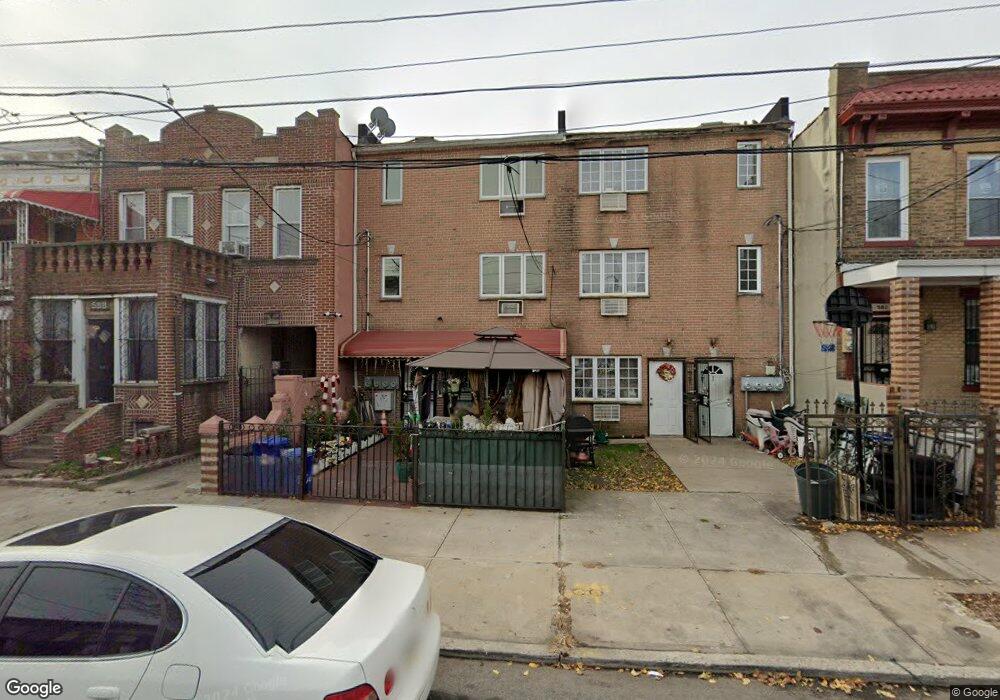
586 Hinsdale St Brooklyn, NY 11207
Brownsville NeighborhoodEstimated Value: $836,000 - $1,172,000
7
Beds
6
Baths
3,240
Sq Ft
$316/Sq Ft
Est. Value
About This Home
This home is located at 586 Hinsdale St, Brooklyn, NY 11207 and is currently estimated at $1,023,876, approximately $316 per square foot. 586 Hinsdale St is a home located in Kings County with nearby schools including P.S. 190 - Sheffield and Achievement First - East New York School.
Ownership History
Date
Name
Owned For
Owner Type
Purchase Details
Closed on
Feb 2, 2018
Sold by
433 Rh Group Inc
Bought by
Sandy Clarissa and Sandy Keena
Current Estimated Value
Home Financials for this Owner
Home Financials are based on the most recent Mortgage that was taken out on this home.
Original Mortgage
$834,604
Outstanding Balance
$703,570
Interest Rate
3.99%
Mortgage Type
Purchase Money Mortgage
Estimated Equity
$320,306
Purchase Details
Closed on
Feb 27, 2017
Sold by
Green Phillippa and Tracey Claudia
Bought by
433 Rh Group Inc
Purchase Details
Closed on
Dec 13, 2006
Sold by
T D Equities Inc
Bought by
Green Phillippa and Tracey Claudia
Create a Home Valuation Report for This Property
The Home Valuation Report is an in-depth analysis detailing your home's value as well as a comparison with similar homes in the area
Home Values in the Area
Average Home Value in this Area
Purchase History
| Date | Buyer | Sale Price | Title Company |
|---|---|---|---|
| Sandy Clarissa | $850,000 | -- | |
| 433 Rh Group Inc | $280,000 | -- | |
| Green Phillippa | -- | -- | |
| Green Phillippa | -- | -- |
Source: Public Records
Mortgage History
| Date | Status | Borrower | Loan Amount |
|---|---|---|---|
| Open | Sandy Clarissa | $834,604 | |
| Closed | Green Phillippa | $0 |
Source: Public Records
Tax History Compared to Growth
Tax History
| Year | Tax Paid | Tax Assessment Tax Assessment Total Assessment is a certain percentage of the fair market value that is determined by local assessors to be the total taxable value of land and additions on the property. | Land | Improvement |
|---|---|---|---|---|
| 2025 | $7,098 | $56,760 | $20,040 | $36,720 |
| 2024 | $7,098 | $56,400 | $20,040 | $36,360 |
| 2023 | $7,177 | $58,620 | $20,040 | $38,580 |
| 2022 | $7,001 | $54,840 | $20,040 | $34,800 |
| 2021 | $6,963 | $42,420 | $20,040 | $22,380 |
| 2020 | $3,265 | $39,180 | $20,040 | $19,140 |
| 2019 | $6,160 | $39,180 | $20,040 | $19,140 |
| 2017 | $5,958 | $29,226 | $15,397 | $13,829 |
| 2016 | $5,512 | $27,572 | $14,998 | $12,574 |
| 2015 | $3,850 | $26,012 | $16,593 | $9,419 |
| 2014 | $3,850 | $24,540 | $18,180 | $6,360 |
Source: Public Records
Map
Nearby Homes
- 442 Newport St
- 584 Hinsdale St
- 589 Hinsdale St
- 541 Hinsdale St
- 582 Williams Ave
- 578 Williams Ave
- 533 Snediker Ave
- 576 Williams Ave
- 650 Williams Ave
- 660 Williams Ave Unit 142
- 610 Alabama Ave
- 606 Alabama Ave
- 563 Powell St
- 1753 Linden Blvd
- 1755 Linden Blvd
- 546 Powell St
- 699 Sackman St
- 1825 Linden Blvd
- 679 Georgia Ave
- 555 Christopher Ave
- 588 Hinsdale St
- 590 Hinsdale St
- 582 Hinsdale St
- 592 Hinsdale St
- 580 Hinsdale St
- 594 Hinsdale St
- 596 Hinsdale St
- 591 Snediker Ave
- 589 Snediker Ave
- 593 Snediker Ave
- 585 Snediker Ave
- 597 Snediker Ave
- 598 Hinsdale St
- 583 Snediker Ave
- 448 Newport St
- 448 Newport St Unit 2
- 450 Newport St
- 446 Newport St
- 599 Snediker Ave
- 454 Newport St