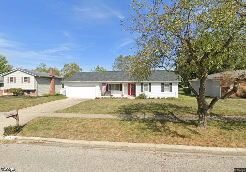
586 Michael Ave Westerville, OH 43081
Estimated Value: $371,000 - $389,000
3
Beds
2
Baths
1,500
Sq Ft
$252/Sq Ft
Est. Value
About This Home
This home is located at 586 Michael Ave, Westerville, OH 43081 and is currently estimated at $377,897, approximately $251 per square foot. 586 Michael Ave is a home located in Franklin County with nearby schools including Robert Frost Elementary School, Heritage Middle School, and Westerville-North High School.
Ownership History
Date
Name
Owned For
Owner Type
Purchase Details
Closed on
Jan 27, 2014
Sold by
Warner Donald L
Bought by
Warner Donald L and Donald L Warner Trust
Current Estimated Value
Purchase Details
Closed on
Nov 4, 1992
Bought by
Warner Donald L
Purchase Details
Closed on
Dec 1, 1985
Create a Home Valuation Report for This Property
The Home Valuation Report is an in-depth analysis detailing your home's value as well as a comparison with similar homes in the area
Home Values in the Area
Average Home Value in this Area
Purchase History
| Date | Buyer | Sale Price | Title Company |
|---|---|---|---|
| Warner Donald L | -- | None Available | |
| Warner Donald L | $99,500 | -- | |
| -- | $77,900 | -- |
Source: Public Records
Tax History Compared to Growth
Tax History
| Year | Tax Paid | Tax Assessment Tax Assessment Total Assessment is a certain percentage of the fair market value that is determined by local assessors to be the total taxable value of land and additions on the property. | Land | Improvement |
|---|---|---|---|---|
| 2024 | $5,691 | $109,940 | $29,750 | $80,190 |
| 2023 | $5,605 | $109,935 | $29,750 | $80,185 |
| 2022 | $4,603 | $71,930 | $17,150 | $54,780 |
| 2021 | $4,642 | $71,930 | $17,150 | $54,780 |
| 2020 | $4,628 | $71,930 | $17,150 | $54,780 |
| 2019 | $3,768 | $57,300 | $17,150 | $40,150 |
| 2018 | $3,647 | $57,300 | $17,150 | $40,150 |
| 2017 | $3,712 | $57,300 | $17,150 | $40,150 |
| 2016 | $3,718 | $53,100 | $17,710 | $35,390 |
| 2015 | $3,601 | $53,100 | $17,710 | $35,390 |
| 2014 | $3,604 | $53,100 | $17,710 | $35,390 |
| 2013 | $1,697 | $50,575 | $16,870 | $33,705 |
Source: Public Records
Map
Nearby Homes
- 547 County Line Rd
- 200 Matthew Ave
- 150 Matthew Ave
- 718 Sugar Ct
- 589 E College Ave
- 368 E College Ave
- 364 E College Ave
- 768 Collingwood Dr
- 912 Lakeway Ct E
- 267 Windemere Place
- 192 Buckeye Ct
- 417 E Park St
- 974 Lakeland Dr
- 182 Hillcrest Dr
- 656 Olde Mill Dr
- 348 Buck Run Trail
- 199 E College Ave
- 223 Dogwood Ln
- 754 Kingsmead Rd Unit 18754
- 137 Abbeycross Ln
- 578 Michael Ave
- 594 Michael Ave
- 570 Michael Ave
- 602 Michael Ave
- 583 Michael Ave
- 577 County Line Rd
- 585 County Line Rd
- 601 Michael Ave
- 567 Michael Ave
- 303 Matthew Ave
- 564 Michael Ave
- 304 Matthew Ave
- 536 Michael Ave
- 215 Murnane St
- 295 Matthew Ave
- 612 Michael Ave
- 605 County Line Rd
- 556 Michael Ave
- 528 Michael Ave
- 296 Matthew Ave