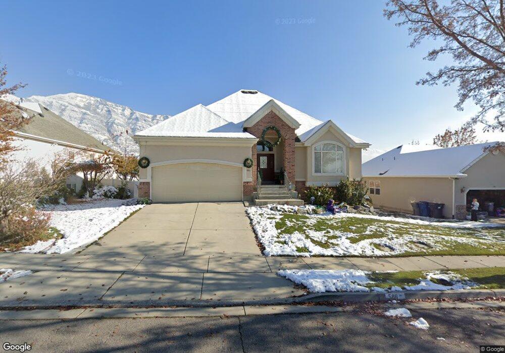
586 N 1280 E American Fork, UT 84003
Estimated Value: $668,000 - $733,770
5
Beds
4
Baths
3,714
Sq Ft
$187/Sq Ft
Est. Value
About This Home
This home is located at 586 N 1280 E, American Fork, UT 84003 and is currently estimated at $693,257, approximately $186 per square foot. 586 N 1280 E is a home located in Utah County with nearby schools including Barratt Elementary School, American Fork Junior High School, and American Fork High School.
Ownership History
Date
Name
Owned For
Owner Type
Purchase Details
Closed on
Jan 26, 2024
Sold by
Angus Denise
Bought by
Angus Family Trust and Angus
Current Estimated Value
Purchase Details
Closed on
Oct 9, 2020
Sold by
Angus Doug and Angus Denise
Bought by
Angus Denise
Home Financials for this Owner
Home Financials are based on the most recent Mortgage that was taken out on this home.
Original Mortgage
$308,000
Interest Rate
2.9%
Mortgage Type
New Conventional
Purchase Details
Closed on
Apr 30, 2010
Sold by
Mackay Thomas W
Bought by
Angus Douglas M and Angus Denise B
Home Financials for this Owner
Home Financials are based on the most recent Mortgage that was taken out on this home.
Original Mortgage
$317,149
Interest Rate
5.5%
Mortgage Type
FHA
Purchase Details
Closed on
Oct 17, 2000
Sold by
Boyce Worthington Homes Llc & Layne Hena
Bought by
Mackay Thomas W and Mackay Rosemary T
Home Financials for this Owner
Home Financials are based on the most recent Mortgage that was taken out on this home.
Original Mortgage
$212,650
Interest Rate
7.96%
Create a Home Valuation Report for This Property
The Home Valuation Report is an in-depth analysis detailing your home's value as well as a comparison with similar homes in the area
Home Values in the Area
Average Home Value in this Area
Purchase History
| Date | Buyer | Sale Price | Title Company |
|---|---|---|---|
| Angus Family Trust | -- | None Listed On Document | |
| Angus Denise | -- | Bartlett Title Ins Agcy | |
| Angus Doug | -- | Bartlett Title Ins Agcy Inc | |
| Angus Douglas M | -- | Empire Land Title Inc | |
| Mackay Thomas W | -- | First American Title Co |
Source: Public Records
Mortgage History
| Date | Status | Borrower | Loan Amount |
|---|---|---|---|
| Previous Owner | Angus Doug | $308,000 | |
| Previous Owner | Angus Douglas M | $317,149 | |
| Previous Owner | Mackay Thomas W | $212,650 |
Source: Public Records
Tax History
| Year | Tax Paid | Tax Assessment Tax Assessment Total Assessment is a certain percentage of the fair market value that is determined by local assessors to be the total taxable value of land and additions on the property. | Land | Improvement |
|---|---|---|---|---|
| 2025 | $3,180 | $368,995 | -- | -- |
| 2024 | $3,180 | $353,320 | $0 | $0 |
| 2023 | $2,994 | $352,715 | $0 | $0 |
| 2022 | $3,084 | $358,490 | $0 | $0 |
| 2021 | $2,707 | $491,600 | $173,400 | $318,200 |
| 2020 | $2,632 | $463,600 | $160,600 | $303,000 |
| 2019 | $2,507 | $456,700 | $153,700 | $303,000 |
| 2018 | $2,544 | $443,100 | $140,100 | $303,000 |
| 2017 | $2,552 | $239,910 | $0 | $0 |
| 2016 | $2,362 | $206,250 | $0 | $0 |
| 2015 | $2,416 | $200,200 | $0 | $0 |
| 2014 | $2,115 | $172,920 | $0 | $0 |
Source: Public Records
Map
Nearby Homes
- 1121 E 580 N
- 462 N 950 E Unit 5
- 912 E Ellens St Unit 1
- 1125 N 1270 E
- 1045 N 930 E Unit 58
- 1289 W 1670 N
- 837 E 475 N
- 322 N 900 E
- 1897 N 900 W
- 1058 N 930 E Unit 64
- 980 W 1800 N
- 681 W 2760 N
- 1077 N 950 E
- 1089 N 950 E
- 1609 N 900 W
- 1427 Narra Place
- 472 W 2760 N
- 674 W 1590 N Unit 11
- 1365 N 990 W
- 1578 N 750 W Unit 15
- 574 N 1280 E
- 560 N 1280 E
- 562 N 1280 E
- 612 N 1280 E
- 545 N 1280 E
- 1278 E 600 North Cir
- 1278 E 600 Cir N
- 1276 E 600 North Cir
- 1276 Temple Meadow Cir
- 1276 E 600 Cir N
- 565 N 1280 E
- 1274 E 600 North Cir
- 1274 E 600 Cir N
- 624 N 1280 E
- 624 N 1280 E Unit 4
- 548 N 1280 E
- 548 N 1280 E Unit 10
- 1277 E 530 N
- 1272 E 600 North Cir
- 1272 E 600 Cir N
Your Personal Tour Guide
Ask me questions while you tour the home.