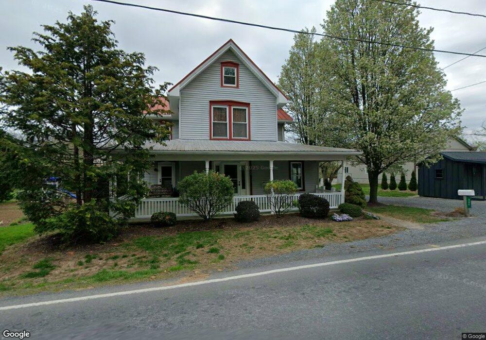
586 Red Run Rd East Earl, PA 17519
Estimated Value: $420,000 - $490,000
3
Beds
1
Bath
2,386
Sq Ft
$188/Sq Ft
Est. Value
About This Home
This home is located at 586 Red Run Rd, East Earl, PA 17519 and is currently estimated at $449,743, approximately $188 per square foot. 586 Red Run Rd is a home located in Lancaster County with nearby schools including Garden Spot Middle School, Garden Spot Senior High School, and Muddy Creek Christian School.
Ownership History
Date
Name
Owned For
Owner Type
Purchase Details
Closed on
Jun 8, 2016
Sold by
Reiff Kenneth M and Reiff Katie R
Bought by
Martin Edwin S and Martin Arlene M
Current Estimated Value
Home Financials for this Owner
Home Financials are based on the most recent Mortgage that was taken out on this home.
Original Mortgage
$212,560
Outstanding Balance
$169,449
Interest Rate
3.62%
Mortgage Type
Adjustable Rate Mortgage/ARM
Estimated Equity
$280,294
Purchase Details
Closed on
May 2, 2011
Sold by
Reiff Kenneth M and Reiff Christian M
Bought by
Reiff Kenneth M and Reiff Katie R
Purchase Details
Closed on
Sep 6, 2005
Sold by
Martin Thomas H and Martin Miriam H
Bought by
Martin Thomas H and Martin Miriam H
Create a Home Valuation Report for This Property
The Home Valuation Report is an in-depth analysis detailing your home's value as well as a comparison with similar homes in the area
Home Values in the Area
Average Home Value in this Area
Purchase History
| Date | Buyer | Sale Price | Title Company |
|---|---|---|---|
| Martin Edwin S | $275,000 | None Available | |
| Reiff Kenneth M | -- | None Available | |
| Martin Thomas H | -- | -- |
Source: Public Records
Mortgage History
| Date | Status | Borrower | Loan Amount |
|---|---|---|---|
| Open | Martin Edwin S | $212,560 |
Source: Public Records
Tax History Compared to Growth
Tax History
| Year | Tax Paid | Tax Assessment Tax Assessment Total Assessment is a certain percentage of the fair market value that is determined by local assessors to be the total taxable value of land and additions on the property. | Land | Improvement |
|---|---|---|---|---|
| 2025 | $4,019 | $224,400 | $82,700 | $141,700 |
| 2024 | $4,019 | $224,400 | $82,700 | $141,700 |
| 2023 | $3,523 | $199,600 | $82,700 | $116,900 |
| 2022 | $3,485 | $199,600 | $82,700 | $116,900 |
| 2021 | $3,430 | $199,600 | $82,700 | $116,900 |
| 2020 | $3,430 | $199,600 | $82,700 | $116,900 |
| 2019 | $3,392 | $199,600 | $82,700 | $116,900 |
| 2018 | $3,991 | $199,600 | $82,700 | $116,900 |
| 2017 | $3,513 | $168,700 | $52,200 | $116,500 |
| 2016 | $3,513 | $168,700 | $52,200 | $116,500 |
| 2015 | $976 | $168,700 | $52,200 | $116,500 |
| 2014 | $2,367 | $168,700 | $52,200 | $116,500 |
Source: Public Records
Map
Nearby Homes
- 105 Carriage Way Unit 2 LOT
- 303 W Main St
- 208 New St
- 420 Linden St
- 412 Linden St
- 133 Millstone Dr
- 103 Lynwood Dr
- 111 Oatfield Dr
- 302 E Main St
- 1328 Union Grove Rd
- 602 Greenview Dr
- 534 High Point Dr
- 1487 Ironstone Dr
- 114 Hawk Valley Ln Unit 104
- 117 Hawk Valley Ln Unit 105
- 101 Hawk Valley Ln
- Bridgemont Plan at Hawk Valley Estates
- Sullivan Plan at Hawk Valley Estates
- Silverbrooke Plan at Hawk Valley Estates
- Wesley Plan at Hawk Valley Estates
- 592 Red Run Rd
- 583 Red Run Rd
- 576 Red Run Rd
- 593 Red Run Rd
- 596 Red Run Rd
- 574 Red Run Rd
- 574 Red Run Rd Unit 1
- 287 Wildflower Dr
- 285 Wildflower Dr
- 281 Wildflower Dr
- 279 Wildflower Dr
- 0 Red Run Rd Unit 12 1004703915
- 0 Red Run Rd Unit 12 1004703887
- 0 Red Run Rd Unit 12 1004703459
- 0 Red Run Rd Unit 4 1004576781
- 0 Red Run Rd Unit 11 1004541159
- 0 Red Run Rd Unit 12 1004511687
- 0 Red Run Rd Unit 149646
- 0 Red Run Rd Unit 141674
- 0 Red Run Rd Unit 142053