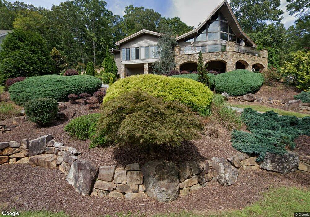
586 Shore Dr Dahlonega, GA 30533
Estimated Value: $628,000 - $1,132,000
--
Bed
3
Baths
4,931
Sq Ft
$172/Sq Ft
Est. Value
About This Home
This home is located at 586 Shore Dr, Dahlonega, GA 30533 and is currently estimated at $848,039, approximately $171 per square foot. 586 Shore Dr is a home located in Lumpkin County with nearby schools including Lumpkin County High School.
Ownership History
Date
Name
Owned For
Owner Type
Purchase Details
Closed on
Sep 20, 2006
Sold by
Not Provided
Bought by
Cain James Carlton and Lydia Angela Cain
Current Estimated Value
Home Financials for this Owner
Home Financials are based on the most recent Mortgage that was taken out on this home.
Original Mortgage
$650,000
Outstanding Balance
$404,933
Interest Rate
6.46%
Mortgage Type
New Conventional
Estimated Equity
$443,106
Purchase Details
Closed on
Jan 20, 2006
Sold by
Not Provided
Bought by
Cain James Carlton and Lydia Angela Cain
Purchase Details
Closed on
Nov 21, 2000
Bought by
Rohrobough Beverly
Purchase Details
Closed on
Apr 27, 1998
Sold by
Rohrobough Beverly
Bought by
Reese Clay W
Create a Home Valuation Report for This Property
The Home Valuation Report is an in-depth analysis detailing your home's value as well as a comparison with similar homes in the area
Home Values in the Area
Average Home Value in this Area
Purchase History
| Date | Buyer | Sale Price | Title Company |
|---|---|---|---|
| Cain James Carlton | -- | -- | |
| Cain James Carlton | $137,500 | -- | |
| Rohrobough Beverly | -- | -- | |
| Reese Clay W | $30,000 | -- |
Source: Public Records
Mortgage History
| Date | Status | Borrower | Loan Amount |
|---|---|---|---|
| Open | Cain James Carlton | $650,000 |
Source: Public Records
Tax History Compared to Growth
Tax History
| Year | Tax Paid | Tax Assessment Tax Assessment Total Assessment is a certain percentage of the fair market value that is determined by local assessors to be the total taxable value of land and additions on the property. | Land | Improvement |
|---|---|---|---|---|
| 2024 | $5,206 | $326,839 | $49,800 | $277,039 |
| 2023 | $4,458 | $312,597 | $49,800 | $262,797 |
| 2022 | $4,848 | $299,479 | $49,800 | $249,679 |
| 2021 | $4,027 | $261,787 | $49,800 | $211,987 |
| 2020 | $4,030 | $257,564 | $49,800 | $207,764 |
| 2019 | $4,080 | $257,564 | $49,800 | $207,764 |
| 2018 | $3,629 | $231,484 | $49,800 | $181,684 |
| 2017 | $6,468 | $225,576 | $49,800 | $175,776 |
| 2016 | $6,367 | $214,916 | $49,800 | $165,116 |
| 2015 | $5,660 | $214,916 | $49,800 | $165,116 |
| 2014 | $5,660 | $216,684 | $49,800 | $166,884 |
| 2013 | -- | $218,451 | $49,800 | $168,651 |
Source: Public Records
Map
Nearby Homes
- 7836 Beachwood Dr
- 7828 Beachwood Dr
- 5441 Oak Manor Way
- 5425 Oak Manor Way
- 5421 Oak Manor Way
- 5440 Oak Manor Way
- 5409 Oak Manor Way
- 5405 Oak Manor Way
- 5441 Oak Manor Way Unit LOT 13
- 5405 Oak Manor Way Unit LOT 22
- 5409 Oak Manor Way Unit LOT 21
- 5440 Oak Manor Way Unit LOT 10
- 5421 Oak Manor Way Unit LOT 18
- 5425 Oak Manor Way Unit LOT 17
- 7804 Poplar Place
- 505 Mill Cove Dr
- 60 Dogwood Ln
- 407 Mill Cove Dr
- 7606 Pine Place
- 7457 Dogwood Trail