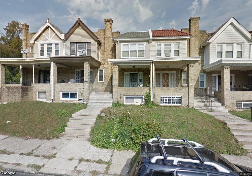
5861 Stockton Rd Philadelphia, PA 19138
East Germantown NeighborhoodEstimated Value: $151,000 - $200,000
3
Beds
1
Bath
1,210
Sq Ft
$148/Sq Ft
Est. Value
About This Home
This home is located at 5861 Stockton Rd, Philadelphia, PA 19138 and is currently estimated at $179,678, approximately $148 per square foot. 5861 Stockton Rd is a home located in Philadelphia County with nearby schools including Martin Luther King High School, Mastery Charter School - Francis D. Pastorius Elemen, and West Oak Lane Charter School.
Ownership History
Date
Name
Owned For
Owner Type
Purchase Details
Closed on
Oct 6, 1999
Sold by
Perry Joice C
Bought by
Landon Judy
Current Estimated Value
Home Financials for this Owner
Home Financials are based on the most recent Mortgage that was taken out on this home.
Original Mortgage
$40,000
Interest Rate
8.21%
Create a Home Valuation Report for This Property
The Home Valuation Report is an in-depth analysis detailing your home's value as well as a comparison with similar homes in the area
Home Values in the Area
Average Home Value in this Area
Purchase History
| Date | Buyer | Sale Price | Title Company |
|---|---|---|---|
| Landon Judy | $51,000 | -- |
Source: Public Records
Mortgage History
| Date | Status | Borrower | Loan Amount |
|---|---|---|---|
| Previous Owner | Landon Judy | $40,000 |
Source: Public Records
Tax History Compared to Growth
Tax History
| Year | Tax Paid | Tax Assessment Tax Assessment Total Assessment is a certain percentage of the fair market value that is determined by local assessors to be the total taxable value of land and additions on the property. | Land | Improvement |
|---|---|---|---|---|
| 2025 | $1,813 | $172,100 | $34,420 | $137,680 |
| 2024 | $1,813 | $172,100 | $34,420 | $137,680 |
| 2023 | $1,813 | $129,500 | $25,900 | $103,600 |
| 2022 | $1,183 | $84,500 | $25,900 | $58,600 |
| 2021 | $1,347 | $0 | $0 | $0 |
| 2020 | $1,347 | $0 | $0 | $0 |
| 2019 | $1,405 | $0 | $0 | $0 |
| 2018 | $1,405 | $0 | $0 | $0 |
| 2017 | $1,390 | $0 | $0 | $0 |
| 2016 | -- | $0 | $0 | $0 |
| 2015 | -- | $0 | $0 | $0 |
| 2014 | -- | $99,300 | $8,704 | $90,596 |
| 2012 | -- | $10,240 | $1,858 | $8,382 |
Source: Public Records
Map
Nearby Homes
- 5852 Crittenden St
- 5843 Crittenden St
- 5839 Crittenden St
- 5831 Crittenden St
- 1147 E Price St
- 5829 Crittenden St
- 5827 Crittenden St
- 5725 Crittenden St
- 1344 Narragansett St
- 1226 E Chelten Ave
- 1108 E Stafford St
- 1043 E Chelten Ave
- 2152 Stenton Ave
- 1039 E Chelten Ave
- 6531 N Beechwood St
- 5530 Matthews St
- 6620 Cornelius St
- 6329 N Beechwood St
- 5656 Ardleigh St
- 2125 Stenton Ave
- 5859 Stockton Rd
- 5863 Stockton Rd
- 5857 Stockton Rd
- 5855 Stockton Rd
- 5853 Stockton Rd
- 5851 Stockton Rd
- 5858 Brush Rd
- 5860 Brush Rd
- 5856 Brush Rd
- 5862 Brush Rd
- 5849 Stockton Rd
- 5854 Brush Rd
- 5852 Brush Rd
- 5847 Stockton Rd
- 5850 Brush Rd
- 5845 Stockton Rd
- 5848 Brush Rd
- 5860 Stockton Rd
- 5858 Stockton Rd
- 5862 Stockton Rd