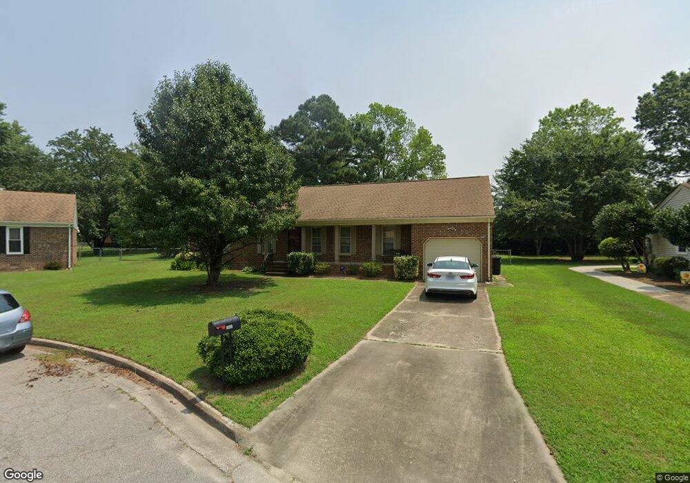
5862 Woodside Cir Portsmouth, VA 23703
Churchland NeighborhoodEstimated Value: $315,209 - $354,000
--
Bed
2
Baths
1,525
Sq Ft
$218/Sq Ft
Est. Value
About This Home
This home is located at 5862 Woodside Cir, Portsmouth, VA 23703 and is currently estimated at $332,552, approximately $218 per square foot. 5862 Woodside Cir is a home located in Portsmouth City with nearby schools including Churchland Primary/Intermediate School, Churchland Middle School, and Churchland High School.
Ownership History
Date
Name
Owned For
Owner Type
Purchase Details
Closed on
Oct 11, 2005
Sold by
Cherry Patricia G
Bought by
Oloughlin Steven F
Current Estimated Value
Home Financials for this Owner
Home Financials are based on the most recent Mortgage that was taken out on this home.
Original Mortgage
$174,900
Outstanding Balance
$93,160
Interest Rate
5.78%
Mortgage Type
VA
Estimated Equity
$239,392
Create a Home Valuation Report for This Property
The Home Valuation Report is an in-depth analysis detailing your home's value as well as a comparison with similar homes in the area
Home Values in the Area
Average Home Value in this Area
Purchase History
| Date | Buyer | Sale Price | Title Company |
|---|---|---|---|
| Oloughlin Steven F | $199,900 | -- |
Source: Public Records
Mortgage History
| Date | Status | Borrower | Loan Amount |
|---|---|---|---|
| Open | Oloughlin Steven F | $174,900 |
Source: Public Records
Tax History Compared to Growth
Tax History
| Year | Tax Paid | Tax Assessment Tax Assessment Total Assessment is a certain percentage of the fair market value that is determined by local assessors to be the total taxable value of land and additions on the property. | Land | Improvement |
|---|---|---|---|---|
| 2025 | $4,079 | $322,910 | $91,800 | $231,110 |
| 2024 | $4,079 | $317,740 | $91,800 | $225,940 |
| 2023 | $3,648 | $291,870 | $91,800 | $200,070 |
| 2022 | $3,349 | $257,590 | $76,500 | $181,090 |
| 2021 | $3,021 | $232,410 | $51,320 | $181,090 |
| 2020 | $2,989 | $229,960 | $48,870 | $181,090 |
| 2019 | $2,877 | $221,340 | $48,870 | $172,470 |
| 2018 | $2,877 | $221,340 | $48,870 | $172,470 |
| 2017 | $2,877 | $221,340 | $48,870 | $172,470 |
| 2016 | $2,877 | $221,340 | $48,870 | $172,470 |
| 2015 | $2,765 | $212,720 | $48,870 | $163,850 |
| 2014 | $2,702 | $212,720 | $48,870 | $163,850 |
Source: Public Records
Map
Nearby Homes
- 4619 River Shore Rd
- 4444 Southampton Arch
- 21 Windy Pines Crescent
- 4726 River Shore Rd
- 5833 Hawthorne Ln
- 5728 Hawthorne Ln
- 4224 Burnham Dr
- 5693 Rivermill Cir
- 6750 Burbage Landing Cir
- 4232 Summerset Dr
- 8 Compass Ct
- 6602 James Point Ct
- 4200 Quince Rd
- 5606 Gregory Ct
- 4071 Long Point Blvd
- 17 Shoal Ct
- 5028 Bay Cir
- 4100 Mayfair Way
- 6832 Ivanhoe Ct
- 4028 Swannanoa Dr
- 5858 Woodside Cir
- 5866 Woodside Cir
- 4504 Raintree Ln
- 4506 Raintree Ln
- 5854 Woodside Cir
- 4502 Raintree Ln
- 5878 Woodside Cir
- 4622 Southampton Arch
- 5870 Woodside Cir
- 4620 Southampton Arch
- 5874 Woodside Cir
- 5874 Woodside Cir
- 4624 Southampton Arch
- 5882 Woodside Cir
- 5846 Woodside Ln
- 5850 Woodside Ln
- 4626 Southampton Arch
- 4507 Raintree Ln
- 4500 Raintree Ln
- 4503 Raintree Ln