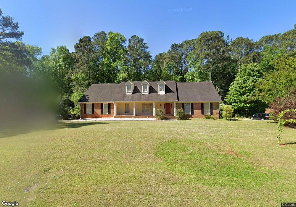
5865 Ashridge Ct Unit 5 Stone Mountain, GA 30087
Estimated Value: $523,405 - $583,000
5
Beds
4
Baths
3,725
Sq Ft
$149/Sq Ft
Est. Value
About This Home
This home is located at 5865 Ashridge Ct Unit 5, Stone Mountain, GA 30087 and is currently estimated at $555,101, approximately $149 per square foot. 5865 Ashridge Ct Unit 5 is a home located in DeKalb County with nearby schools including Smoke Rise Elementary School, Tucker Middle School, and Tucker High School.
Ownership History
Date
Name
Owned For
Owner Type
Purchase Details
Closed on
Jul 27, 2021
Sold by
Wilbanks Rodney
Bought by
Matrundola Marco Cesare and Matrundola Cesare
Current Estimated Value
Purchase Details
Closed on
Apr 27, 2021
Sold by
Pierce L Wayne
Bought by
Wilbanks Rodney
Home Financials for this Owner
Home Financials are based on the most recent Mortgage that was taken out on this home.
Original Mortgage
$200,000
Interest Rate
3.1%
Mortgage Type
New Conventional
Purchase Details
Closed on
Apr 28, 2015
Sold by
Wheeler Sara Jane Padgett
Bought by
Pierce L Wayne
Purchase Details
Closed on
Aug 5, 2012
Sold by
Wheeler Joe Lee
Bought by
Wheeler Sara Jane Padgett
Create a Home Valuation Report for This Property
The Home Valuation Report is an in-depth analysis detailing your home's value as well as a comparison with similar homes in the area
Home Values in the Area
Average Home Value in this Area
Purchase History
| Date | Buyer | Sale Price | Title Company |
|---|---|---|---|
| Matrundola Marco Cesare | $435,000 | -- | |
| Matrundola Marco Cesare | $435,000 | -- | |
| Wilbanks Rodney | $300,000 | -- | |
| Wilbanks Rodney | $300,000 | -- | |
| Pierce L Wayne | $251,286 | -- | |
| Pierce L Wayne | $251,286 | -- | |
| Wheeler Sara Jane Padgett | -- | -- | |
| Wheeler Sara Jane Padgett | -- | -- |
Source: Public Records
Mortgage History
| Date | Status | Borrower | Loan Amount |
|---|---|---|---|
| Previous Owner | Wilbanks Rodney | $200,000 |
Source: Public Records
Tax History Compared to Growth
Tax History
| Year | Tax Paid | Tax Assessment Tax Assessment Total Assessment is a certain percentage of the fair market value that is determined by local assessors to be the total taxable value of land and additions on the property. | Land | Improvement |
|---|---|---|---|---|
| 2025 | $6,404 | $188,160 | $34,000 | $154,160 |
| 2024 | $7,103 | $202,440 | $34,000 | $168,440 |
| 2023 | $7,103 | $202,440 | $34,000 | $168,440 |
| 2022 | $7,763 | $169,240 | $22,400 | $146,840 |
| 2021 | $6,108 | $129,280 | $22,400 | $106,880 |
| 2020 | $5,725 | $122,120 | $20,000 | $102,120 |
| 2019 | $5,118 | $108,320 | $20,000 | $88,320 |
| 2018 | $4,113 | $114,680 | $20,000 | $94,680 |
| 2017 | $4,530 | $93,800 | $10,240 | $83,560 |
| 2016 | $4,465 | $92,120 | $10,240 | $81,880 |
| 2014 | $2,172 | $63,680 | $10,240 | $53,440 |
Source: Public Records
Map
Nearby Homes
- 5936 Millstone Ln
- 5798 Musket Ln
- 1019 Crestwood Ln
- 923 Tall Pine Ct SW
- 5774 Vantage Ct
- 5919 Heritage Ln
- 5888 Old Stone Mountain Rd
- 1777 E Gate Trail
- 771 Mountainbrooke Cir SW
- 5632 Stillwater Ct
- 6268 Old Stone Mountain Rd
- 851 Rockbridge Rd SW
- 5523 Bahia Mar Cir
- 1809 Silver Ridge Ct
- 881 Rockbridge Rd SW
- 5951 Hugh Howell Rd
- 5865 Ashridge Ct
- 5853 Ashridge Ct
- 5877 Ashridge Ct
- 5858 Ashridge Ct
- 5868 Ashridge Ct
- 5885 Ashridge Ct
- 5841 Ashridge Ct
- 5878 Ashridge Ct
- 5846 Ashridge Ct
- 5888 Ashridge Ct
- 0 Ashridge Ct Unit 8435516
- 0 Ashridge Ct Unit 8979946
- 0 Ashridge Ct Unit 8546602
- 5834 Ashridge Ct
- 5825 Ashridge Ct
- 5882 Millstone Ln Unit 8
- 5882 Millstone Ln
- 0 Millstone Ln Unit 7484865
- 0 Millstone Ln Unit 8691713
- 0 Millstone Ln Unit 8662495