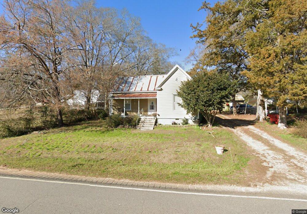
5869 Highway 72 E Carlton, GA 30627
Estimated Value: $106,000 - $211,000
--
Bed
1
Bath
1,259
Sq Ft
$141/Sq Ft
Est. Value
About This Home
This home is located at 5869 Highway 72 E, Carlton, GA 30627 and is currently estimated at $177,206, approximately $140 per square foot. 5869 Highway 72 E is a home located in Madison County with nearby schools including Madison County High School.
Ownership History
Date
Name
Owned For
Owner Type
Purchase Details
Closed on
Mar 3, 2017
Sold by
Staniszewski David C
Bought by
Miller Nancy
Current Estimated Value
Purchase Details
Closed on
Aug 4, 2006
Sold by
Gunter Sheila A
Bought by
Staniszewski David C
Home Financials for this Owner
Home Financials are based on the most recent Mortgage that was taken out on this home.
Original Mortgage
$52,700
Interest Rate
6.71%
Mortgage Type
New Conventional
Purchase Details
Closed on
Feb 26, 1996
Bought by
Gunter Shelia A
Create a Home Valuation Report for This Property
The Home Valuation Report is an in-depth analysis detailing your home's value as well as a comparison with similar homes in the area
Home Values in the Area
Average Home Value in this Area
Purchase History
| Date | Buyer | Sale Price | Title Company |
|---|---|---|---|
| Miller Nancy | $65,000 | -- | |
| Staniszewski David C | $52,700 | -- | |
| Gunter Shelia A | -- | -- |
Source: Public Records
Mortgage History
| Date | Status | Borrower | Loan Amount |
|---|---|---|---|
| Previous Owner | Staniszewski David C | $52,700 |
Source: Public Records
Tax History Compared to Growth
Tax History
| Year | Tax Paid | Tax Assessment Tax Assessment Total Assessment is a certain percentage of the fair market value that is determined by local assessors to be the total taxable value of land and additions on the property. | Land | Improvement |
|---|---|---|---|---|
| 2025 | $763 | $44,684 | $9,158 | $35,526 |
| 2024 | $750 | $43,457 | $9,158 | $34,299 |
| 2023 | $1,299 | $38,093 | $7,632 | $30,461 |
| 2022 | $443 | $32,049 | $5,247 | $26,802 |
| 2021 | $436 | $22,189 | $5,247 | $16,942 |
| 2020 | $411 | $21,426 | $4,484 | $16,942 |
| 2019 | $800 | $23,095 | $4,932 | $18,163 |
| 2018 | $756 | $21,749 | $4,513 | $17,236 |
| 2017 | $472 | $14,666 | $3,816 | $10,850 |
| 2016 | $396 | $12,233 | $3,469 | $8,764 |
| 2015 | $367 | $12,233 | $3,469 | $8,764 |
| 2014 | $360 | $11,982 | $3,162 | $8,820 |
| 2013 | -- | $11,982 | $3,162 | $8,820 |
Source: Public Records
Map
Nearby Homes
- 6367 Highway 72 E
- 6476 Georgia 72
- 670 S Railroad Ave
- 667 Paoli Rd
- 724 Bertha Willis Rd
- 88 S Railroad Ave
- 376 Paoli Rd
- 0 Broad River Rd Unit 10650042
- 3614 Georgia 72
- 0 Berkley Rd Unit 10545423
- 00 River Rd
- 600 Piney Grove Rd
- 0 River Rd Unit 10639917
- 730 Osley Mill Rd
- 1163 Nickville Rd
- 474 Watson Mill
- 490 Watson Mill
- 5 Watson Mill
- 4 Watson Mill
- 6 Watson Mill
- 5869 Hwy 72e
- 5895 Hwy 72e
- 5895 Highway 72 E
- 5895 Georgia 72
- 5927 Highway 72 E
- 1404 S Railroad Ave
- 1376 S Railroad Ave
- 1388 S Railroad Ave
- 25 Ninth St
- 115 N Fifth Ave
- 5769 Hwy 72e
- 00 Ninth St
- 176 Ninth St
- 5927 Hwy 72e
- 0 N Fifth St Unit 3128594
- 0 N Fifth St Unit CM924193
- 1474 S Railroad Ave
- 62 Ninth St
- 104 N Fifth Ave
- 1520 S Railroad Ave