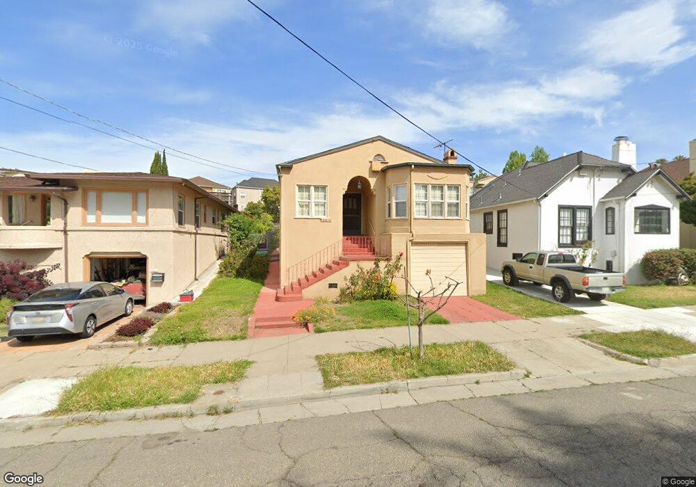
587 Athol Ave Oakland, CA 94606
Cleveland Heights NeighborhoodEstimated Value: $1,044,000 - $1,474,000
3
Beds
1
Bath
1,876
Sq Ft
$641/Sq Ft
Est. Value
About This Home
This home is located at 587 Athol Ave, Oakland, CA 94606 and is currently estimated at $1,202,480, approximately $640 per square foot. 587 Athol Ave is a home located in Alameda County with nearby schools including Cleveland Elementary School, Edna Brewer Middle School, and Oakland High School.
Create a Home Valuation Report for This Property
The Home Valuation Report is an in-depth analysis detailing your home's value as well as a comparison with similar homes in the area
Home Values in the Area
Average Home Value in this Area
Tax History
We collect this data history from publicly available records. To have your information removed, we recommend requesting removal directly through your county’s website.
| Year | Tax Paid | Tax Assessment Tax Assessment Total Assessment is a certain percentage of the fair market value that is determined by local assessors to be the total taxable value of land and additions on the property. | Land | Improvement |
|---|---|---|---|---|
| 2025 | $2,874 | $83,146 | $36,465 | $53,681 |
| 2024 | $2,874 | $81,379 | $35,750 | $52,629 |
| 2023 | $2,891 | $86,646 | $35,049 | $51,597 |
| 2022 | $2,741 | $77,947 | $34,362 | $50,585 |
| 2021 | $2,464 | $76,282 | $33,688 | $49,594 |
| 2020 | $2,434 | $82,428 | $33,343 | $49,085 |
| 2019 | $2,244 | $80,812 | $32,689 | $48,123 |
| 2018 | $2,199 | $79,228 | $32,048 | $47,180 |
| 2017 | $1,643 | $77,674 | $31,420 | $46,254 |
| 2016 | $1,914 | $76,152 | $30,804 | $45,348 |
| 2015 | $1,899 | $75,007 | $30,341 | $44,666 |
| 2014 | $1,802 | $73,538 | $29,747 | $43,791 |
Source: Public Records
Map
Nearby Homes
- 618 Prospect Ave
- 528 Haddon Rd
- 527 Zorah St
- 647 Beacon St
- 661 Brookwood Place
- 444 Merritt Ave Unit 202
- 1142 Mckinley Ave
- 635 Longridge Rd
- 326 Athol Ave
- 33 Home Place E
- 714 Rand Ave
- 357 Lester Ave
- 2605 9th Ave
- 339 Hanover Ave
- 0 Macarthur Blvd Unit 41123841
- 710 E 22nd St Unit 303
- 710 E 22nd St Unit 203
- 2038 Lakeshore Ave
- 455 Lagunitas Ave
- 427 Lagunitas Ave Unit 305
Your Personal Tour Guide
Ask me questions while you tour the home.