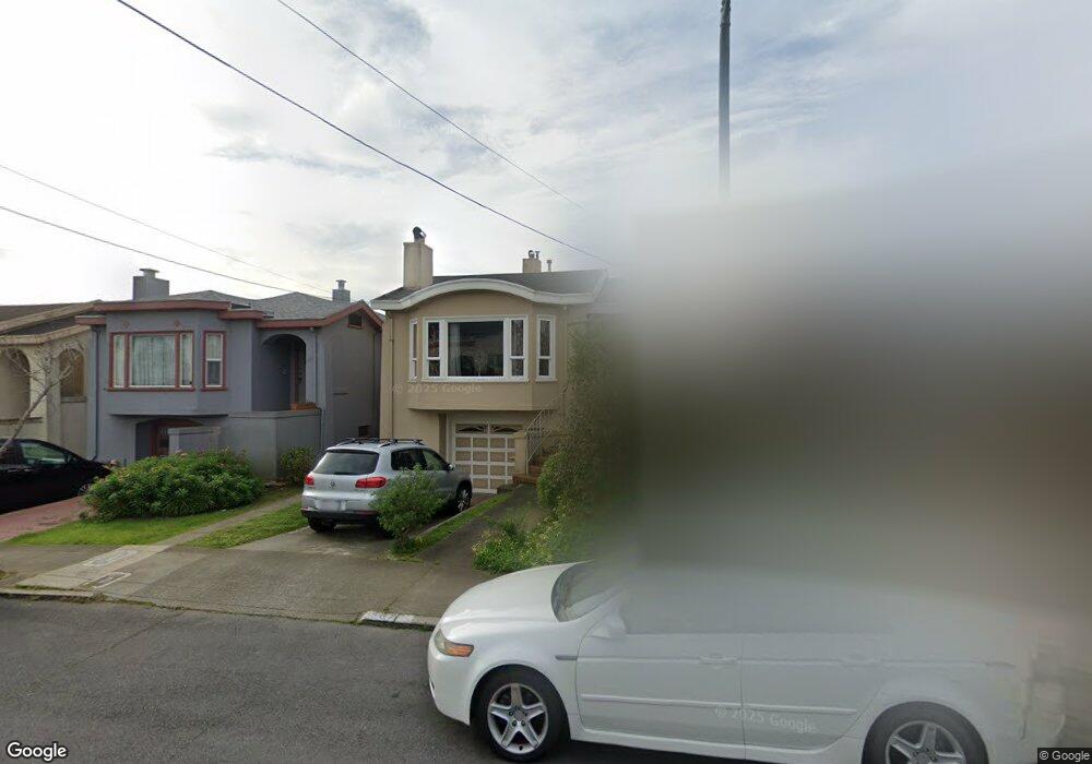
587 Flood Ave San Francisco, CA 94112
Westwood Park NeighborhoodEstimated Value: $1,271,000 - $1,752,512
Studio
1
Bath
1,006
Sq Ft
$1,492/Sq Ft
Est. Value
About This Home
This home is located at 587 Flood Ave, San Francisco, CA 94112 and is currently estimated at $1,500,878, approximately $1,491 per square foot. 587 Flood Ave is a home located in San Francisco County with nearby schools including Commodore Sloat Elementary School, Aptos Middle School, and Leadership High School.
Ownership History
Date
Name
Owned For
Owner Type
Purchase Details
Closed on
Oct 3, 2006
Sold by
Kosewic Holding Llc
Bought by
Maccloskey James E and Maccloskey Jennifer H
Current Estimated Value
Home Financials for this Owner
Home Financials are based on the most recent Mortgage that was taken out on this home.
Original Mortgage
$80,000
Interest Rate
6.14%
Mortgage Type
Credit Line Revolving
Purchase Details
Closed on
Jan 5, 2006
Sold by
Kosewic John Terrell
Bought by
Kosewic Holding Llc
Purchase Details
Closed on
Dec 3, 2003
Sold by
Kosewic John Terrell and Kosewic John Joseph
Bought by
Kosewic John Terrell
Create a Home Valuation Report for This Property
The Home Valuation Report is an in-depth analysis detailing your home's value as well as a comparison with similar homes in the area
Home Values in the Area
Average Home Value in this Area
Purchase History
| Date | Buyer | Sale Price | Title Company |
|---|---|---|---|
| Maccloskey James E | $800,000 | Chicago Title Co | |
| Kosewic Holding Llc | -- | -- | |
| Kosewic John Terrell | -- | -- |
Source: Public Records
Mortgage History
| Date | Status | Borrower | Loan Amount |
|---|---|---|---|
| Closed | Maccloskey James E | $80,000 | |
| Open | Maccloskey James E | $640,000 |
Source: Public Records
Tax History
| Year | Tax Paid | Tax Assessment Tax Assessment Total Assessment is a certain percentage of the fair market value that is determined by local assessors to be the total taxable value of land and additions on the property. | Land | Improvement |
|---|---|---|---|---|
| 2025 | $13,478 | $1,111,997 | $643,089 | $468,908 |
| 2024 | $13,478 | $1,090,195 | $630,480 | $459,715 |
| 2023 | $13,271 | $1,068,820 | $618,118 | $450,702 |
| 2022 | $13,012 | $1,047,865 | $605,999 | $441,866 |
| 2021 | $12,779 | $1,027,320 | $594,117 | $433,203 |
| 2020 | $12,842 | $1,016,788 | $588,026 | $428,762 |
| 2019 | $12,402 | $996,853 | $576,497 | $420,356 |
| 2018 | $11,983 | $977,309 | $565,194 | $412,115 |
| 2017 | $11,542 | $958,147 | $554,112 | $404,035 |
| 2016 | $11,346 | $939,361 | $543,248 | $396,113 |
| 2015 | $11,205 | $925,252 | $535,088 | $390,164 |
| 2014 | $10,238 | $850,000 | $510,000 | $340,000 |
Source: Public Records
Map
Nearby Homes
- 437 Staples Ave
- 930 Monterey Blvd
- 619 Monterey Blvd
- 270 Judson Ave
- 554 Mangels Ave
- 840 Faxon Ave
- 335 Yerba Buena Ave
- 170 Staples Ave
- 489 Bella Vista Way
- 270 Flood Ave
- 358 Los Palmos Dr
- 104 Dorado Terrace
- 221 Cresta Vista Dr
- 471 Joost Ave
- 1185 Monterey Blvd
- 299 Maywood Dr
- 300 Los Palmos Dr
- 20 Dorado Terrace Unit C
- 271 Granada Ave
- 841 Ocean Ave
- 583 Flood Ave
- 591 Flood Ave
- 579 Flood Ave
- 593 Flood Ave
- 575 Flood Ave
- 542 Staples Ave
- 548 Staples Ave
- 536 Staples Ave
- 556 Staples Ave
- 530 Staples Ave
- 54 Hazelwood Ave
- 571 Flood Ave
- 50 Hazelwood Ave
- 60 Hazelwood Ave
- 524 Staples Ave
- 594 Flood Ave
- 1 Ridgewood Ave
- 40 Hazelwood Ave
- 8 Ridgewood Ave
- 518 Staples Ave
Your Personal Tour Guide
Ask me questions while you tour the home.