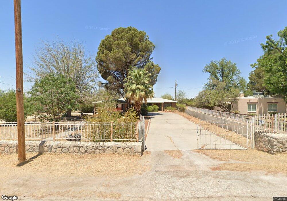
587 Fresno Dr El Paso, TX 79907
Shawver Park NeighborhoodEstimated Value: $217,000 - $258,808
--
Bed
2
Baths
2,514
Sq Ft
$95/Sq Ft
Est. Value
About This Home
This home is located at 587 Fresno Dr, El Paso, TX 79907 and is currently estimated at $238,702, approximately $94 per square foot. 587 Fresno Dr is a home located in El Paso County with nearby schools including Pasodale Elementary School, Rio Bravo Middle School, and Ysleta Middle School.
Ownership History
Date
Name
Owned For
Owner Type
Purchase Details
Closed on
Dec 18, 2006
Sold by
Prewitt Ted C
Bought by
Puentes Jose R and Puentez Maria Luz
Current Estimated Value
Home Financials for this Owner
Home Financials are based on the most recent Mortgage that was taken out on this home.
Original Mortgage
$15,000
Outstanding Balance
$8,813
Interest Rate
6.09%
Mortgage Type
Seller Take Back
Estimated Equity
$229,890
Create a Home Valuation Report for This Property
The Home Valuation Report is an in-depth analysis detailing your home's value as well as a comparison with similar homes in the area
Home Values in the Area
Average Home Value in this Area
Purchase History
| Date | Buyer | Sale Price | Title Company |
|---|---|---|---|
| Puentes Jose R | -- | None Available |
Source: Public Records
Mortgage History
| Date | Status | Borrower | Loan Amount |
|---|---|---|---|
| Open | Puentes Jose R | $15,000 |
Source: Public Records
Tax History Compared to Growth
Tax History
| Year | Tax Paid | Tax Assessment Tax Assessment Total Assessment is a certain percentage of the fair market value that is determined by local assessors to be the total taxable value of land and additions on the property. | Land | Improvement |
|---|---|---|---|---|
| 2025 | $2,494 | $215,855 | -- | -- |
| 2024 | $2,494 | $196,232 | -- | -- |
| 2023 | $2,494 | $178,393 | $0 | $0 |
| 2022 | $5,036 | $162,175 | $0 | $0 |
| 2021 | $4,792 | $155,119 | $25,993 | $129,126 |
| 2020 | $4,233 | $134,029 | $25,993 | $108,036 |
| 2018 | $4,142 | $133,191 | $25,993 | $107,198 |
| 2017 | $3,987 | $130,434 | $25,993 | $104,441 |
| 2016 | $3,987 | $130,434 | $25,993 | $104,441 |
| 2015 | $2,061 | $130,434 | $25,993 | $104,441 |
| 2014 | $2,061 | $133,939 | $25,993 | $107,946 |
Source: Public Records
Map
Nearby Homes
- 578 Cora Place
- 261 Columbia Ave
- 8141 Lowd Ave
- 8250 Mc Elroy Ave
- 7840 Mansfield Ave
- 8434 Villanova Dr
- 228 Harvard Ave
- 8405 Pinon St
- 8433 Independence Dr
- 8162 Josephine Cir
- 8165 Josephine Cir
- 227 Galvan Place
- 8041 Broadway Dr
- 8339 White Rd
- 7952 Broadway Dr
- 7920 Porche St
- 7925 Broadway Dr
- 337 Rodulfo Ln
- 8482 Alameda Ave
- 324 Valley Fair Way
- 8157 Cooley Ave
- 577 Fresno Dr
- 8153 Cooley Ave
- 8165 Cooley Ave
- 8149 Cooley Ave
- 8145 Cooley Ave
- 8141 Cooley Ave
- 377 Cooley Ave
- 589 Riverdale St
- 391 Tulane Dr
- 586 Fresno Dr
- 8137 Cooley Ave Unit A
- 8137 Cooley Ave Unit B
- 8137 Cooley Ave
- 373 Cooley Ave
- 8156 Cooley Ave
- 8160 Cooley Ave
- 8152 Cooley Ave
- 8164 Cooley Ave
- 582 Fresno Dr