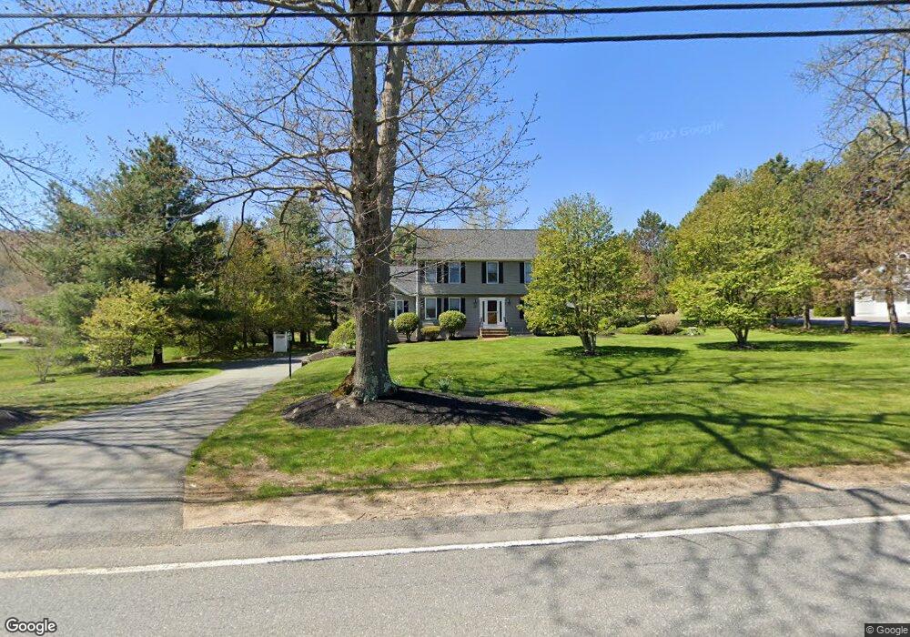
587 Johnson St North Andover, MA 01845
Estimated Value: $922,000 - $992,000
4
Beds
3
Baths
2,388
Sq Ft
$400/Sq Ft
Est. Value
About This Home
This home is located at 587 Johnson St, North Andover, MA 01845 and is currently estimated at $955,400, approximately $400 per square foot. 587 Johnson St is a home located in Essex County with nearby schools including Annie L Sargent Elementary School, North Andover Middle School, and North Andover High School.
Ownership History
Date
Name
Owned For
Owner Type
Purchase Details
Closed on
Sep 24, 2008
Sold by
Wells Fargo Bk
Bought by
Kim James J and Kim Terry Lee
Current Estimated Value
Home Financials for this Owner
Home Financials are based on the most recent Mortgage that was taken out on this home.
Original Mortgage
$405,025
Interest Rate
6.57%
Mortgage Type
Purchase Money Mortgage
Purchase Details
Closed on
May 21, 2008
Sold by
Ireton Frederick P
Bought by
Wells Fargo Bk
Purchase Details
Closed on
Mar 4, 1993
Sold by
Messina Dev Co Inc
Bought by
Barba Angela D
Create a Home Valuation Report for This Property
The Home Valuation Report is an in-depth analysis detailing your home's value as well as a comparison with similar homes in the area
Home Values in the Area
Average Home Value in this Area
Purchase History
| Date | Buyer | Sale Price | Title Company |
|---|---|---|---|
| Kim James J | $476,500 | -- | |
| Wells Fargo Bk | $320,000 | -- | |
| Barba Angela D | $255,000 | -- |
Source: Public Records
Mortgage History
| Date | Status | Borrower | Loan Amount |
|---|---|---|---|
| Open | Barba Angela D | $396,600 | |
| Closed | Barba Angela D | $396,550 | |
| Closed | Kim James J | $405,025 | |
| Previous Owner | Barba Angela D | $382,500 |
Source: Public Records
Tax History
| Year | Tax Paid | Tax Assessment Tax Assessment Total Assessment is a certain percentage of the fair market value that is determined by local assessors to be the total taxable value of land and additions on the property. | Land | Improvement |
|---|---|---|---|---|
| 2025 | $9,920 | $881,000 | $413,800 | $467,200 |
| 2024 | $9,439 | $851,100 | $392,000 | $459,100 |
| 2023 | $8,984 | $734,000 | $331,100 | $402,900 |
| 2022 | $8,552 | $632,100 | $287,500 | $344,600 |
| 2021 | $8,227 | $580,600 | $261,400 | $319,200 |
| 2020 | $7,887 | $574,000 | $254,800 | $319,200 |
| 2019 | $7,697 | $574,000 | $254,800 | $319,200 |
| 2018 | $8,340 | $574,000 | $254,800 | $319,200 |
| 2017 | $7,457 | $522,200 | $224,300 | $297,900 |
| 2016 | $7,141 | $500,400 | $226,500 | $273,900 |
| 2015 | $7,060 | $490,600 | $213,100 | $277,500 |
Source: Public Records
Map
Nearby Homes
- 73 Holly Ridge Rd
- 36 Kieran Rd
- 445 Salem St
- 61 Abbott St
- 674 Salem St
- 335 Salem St
- 71 Regency Place
- 991 Johnson St
- 124 Quail Run Rd
- 136 Quail Run Rd
- 88 Johnson St
- 42 Hewitt Ave
- 3 Great Pond Rd
- 224 Raleigh Tavern Ln
- 86 Andover St
- 50 Boxford St
- 204 Coventry Ln
- 38 Village Green Dr Unit 77
- 94 Boxford St
- 1 Stratford Rd
- 7 Holly Ridge Rd
- 573 Johnson St
- 19 Holly Ridge Rd
- 559 Johnson St
- 177 Rea St
- 35 Holly Ridge Rd
- 165 Rea St
- 30 Holly Ridge Rd
- 545 Johnson St
- 155 Rea St
- 51 Holly Ridge Rd
- 550 Johnson St
- 166 Rea St
- 63 Holly Ridge Rd
- 637 Johnson St
- 544 Johnson St
- 46 Holly Ridge Rd
- 40 Holly Ridge Rd
- 531 Johnson St
- 141 Rea St
Your Personal Tour Guide
Ask me questions while you tour the home.