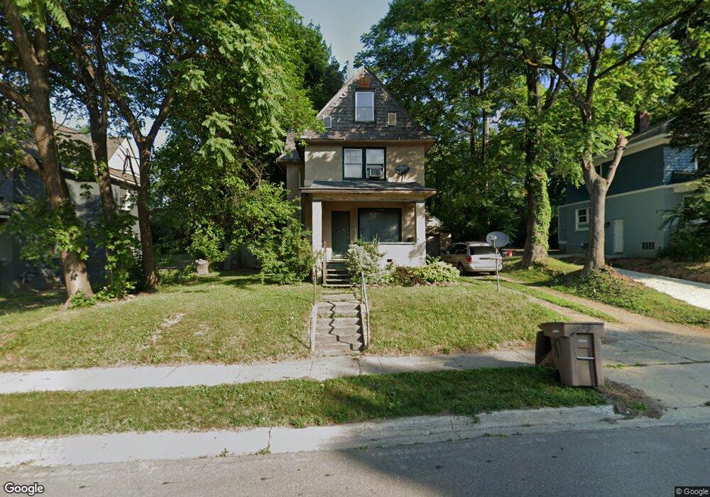
587 N Perry St Pontiac, MI 48342
Estimated Value: $121,755 - $140,000
3
Beds
1
Bath
1,058
Sq Ft
$123/Sq Ft
Est. Value
About This Home
This home is located at 587 N Perry St, Pontiac, MI 48342 and is currently estimated at $130,189, approximately $123 per square foot. 587 N Perry St is a home located in Oakland County with nearby schools including Herrington Elementary School, Pontiac Middle School, and Pontiac High School.
Ownership History
Date
Name
Owned For
Owner Type
Purchase Details
Closed on
Nov 30, 2005
Sold by
Shook Andrew
Bought by
Cobb Corry
Current Estimated Value
Home Financials for this Owner
Home Financials are based on the most recent Mortgage that was taken out on this home.
Original Mortgage
$64,000
Outstanding Balance
$36,211
Interest Rate
6.48%
Mortgage Type
New Conventional
Estimated Equity
$93,978
Purchase Details
Closed on
Mar 21, 2002
Sold by
Rivera Octavio
Bought by
Shook Andrew
Create a Home Valuation Report for This Property
The Home Valuation Report is an in-depth analysis detailing your home's value as well as a comparison with similar homes in the area
Home Values in the Area
Average Home Value in this Area
Purchase History
| Date | Buyer | Sale Price | Title Company |
|---|---|---|---|
| Cobb Corry | $80,000 | Title Source Inc | |
| Shook Andrew | $70,000 | -- |
Source: Public Records
Mortgage History
| Date | Status | Borrower | Loan Amount |
|---|---|---|---|
| Open | Cobb Corry | $64,000 |
Source: Public Records
Tax History Compared to Growth
Tax History
| Year | Tax Paid | Tax Assessment Tax Assessment Total Assessment is a certain percentage of the fair market value that is determined by local assessors to be the total taxable value of land and additions on the property. | Land | Improvement |
|---|---|---|---|---|
| 2024 | $802 | $41,820 | $0 | $0 |
| 2023 | $764 | $36,900 | $0 | $0 |
| 2022 | $801 | $31,910 | $0 | $0 |
| 2021 | $778 | $27,430 | $0 | $0 |
| 2020 | $695 | $24,570 | $0 | $0 |
| 2019 | $746 | $21,200 | $0 | $0 |
| 2018 | $712 | $18,910 | $0 | $0 |
| 2017 | $686 | $17,940 | $0 | $0 |
| 2016 | $712 | $15,710 | $0 | $0 |
| 2015 | -- | $13,510 | $0 | $0 |
| 2014 | -- | $11,890 | $0 | $0 |
| 2011 | -- | $18,750 | $0 | $0 |
Source: Public Records
Map
Nearby Homes
- 633 N Perry St
- 100 Oliver St
- 421 N Paddock St
- 669 N Perry St
- 141 Oliver St
- 431 Perry St
- 124 Kemp St
- 25 Elwood St
- 388 N Perry St
- 352 N Perry St
- 52 Whitfield St
- 80 Oakhill St
- 0 Cesar Chavez Rd Unit 50166552
- 37 Poplar Ave
- 514 Linda Vista Dr
- 11 Lexington Place
- 73 Poplar Ave
- 36 Clairmont Place
- 472 University Dr
- 111 Hamilton St
- 583 N Perry St
- 577 N Perry St
- 601 N Perry - Unit 603 St
- 601 N Perry - Unit 601 St
- 14 N Glenwood Ave
- 56 Oliver St
- 18 N Glenwood Ave
- 52 Oliver St
- 42 Oliver St
- 601 N Perry St Unit 605
- 601 N Perry St Unit 601
- 601 N Perry St Unit 607
- 601 N Perry St Unit 604
- 601 N Perry St Unit 603
- 601 N Perry St Unit 609
- 601 N Perry St
- 8 N Glenwood Ave
- 60 Oliver St
- 48 Oliver St
- 596 N Perry St