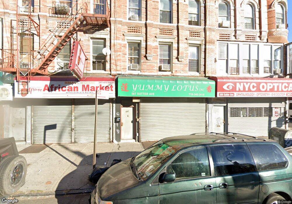
587 Sutter Ave Brooklyn, NY 11207
Brownsville NeighborhoodEstimated Value: $650,856
Studio
--
Bath
2,820
Sq Ft
$231/Sq Ft
Est. Value
About This Home
This home is located at 587 Sutter Ave, Brooklyn, NY 11207 and is currently estimated at $650,856, approximately $230 per square foot. 587 Sutter Ave is a home located in Kings County with nearby schools including P.S. 328 - Phyllis Wheatley, J.H.S 292 Margaret S. Douglas, and Brownsville Collegiate Charter School.
Ownership History
Date
Name
Owned For
Owner Type
Purchase Details
Closed on
Sep 8, 2011
Sold by
587-589 Sutter Avenue Llc
Bought by
587 King Realty Llc
Current Estimated Value
Purchase Details
Closed on
Aug 19, 2009
Sold by
Acosta Sonia
Bought by
587-589 Sutter Avenue Llc
Purchase Details
Closed on
Aug 13, 2007
Sold by
1945 Prospect Place Realty Co Inc
Bought by
Acosta Sonia
Create a Home Valuation Report for This Property
The Home Valuation Report is an in-depth analysis detailing your home's value as well as a comparison with similar homes in the area
Home Values in the Area
Average Home Value in this Area
Purchase History
| Date | Buyer | Sale Price | Title Company |
|---|---|---|---|
| 587 King Realty Llc | $350,000 | -- | |
| 587-589 Sutter Avenue Llc | -- | -- | |
| Acosta Sonia | -- | -- |
Source: Public Records
Tax History
| Year | Tax Paid | Tax Assessment Tax Assessment Total Assessment is a certain percentage of the fair market value that is determined by local assessors to be the total taxable value of land and additions on the property. | Land | Improvement |
|---|---|---|---|---|
| 2025 | $4,819 | $50,700 | $8,580 | $42,120 |
| 2024 | $4,819 | $47,340 | $8,580 | $38,760 |
| 2023 | $4,597 | $48,840 | $8,580 | $40,260 |
| 2022 | $4,234 | $42,240 | $8,580 | $33,660 |
| 2021 | $4,531 | $37,080 | $8,580 | $28,500 |
| 2020 | $4,323 | $37,680 | $8,580 | $29,100 |
| 2019 | $4,183 | $32,760 | $8,580 | $24,180 |
| 2018 | $3,845 | $18,864 | $5,929 | $12,935 |
| 2017 | $3,801 | $18,648 | $6,289 | $12,359 |
| 2016 | $3,606 | $18,040 | $7,308 | $10,732 |
| 2015 | $2,122 | $17,020 | $8,278 | $8,742 |
| 2014 | $2,122 | $16,663 | $7,588 | $9,075 |
Source: Public Records
Map
Nearby Homes
- 317 Pennsylvania Ave
- 353 Pennsylvania Ave
- 392 New Jersey Ave Unit 3921
- 444 New Jersey Ave
- 472 Sutter Ave
- 439 Vermont St
- 342 Wyona St
- 504 Vermont St
- 412 Bradford St
- 239 New Jersey Ave
- 440 Blake Ave
- 440 Miller Ave
- 243 Wyona St
- 443 Miller Ave
- 461 Miller Ave
- 200 New Jersey Ave
- 774 Blake Ave
- 45 Hinsdale St
- 537 Miller Ave
- 543 Miller Ave
- 583 Sutter Ave
- 589 Sutter Ave
- 581 Sutter Ave
- 300 Georgia Ave
- 579 Sutter Ave
- 577 Sutter Ave Unit 3
- 577 Sutter Ave
- 575 Sutter Ave
- 571 Sutter Ave
- 593 Sutter Ave
- 595 Sutter Ave Unit 3
- 595 Sutter Ave
- 569 Sutter Ave Unit 2C
- 569 Sutter Ave
- 299 Georgia Ave
- 599 Sutter Ave
- 567 Sutter Ave Unit 3B
- 567 Sutter Ave
- 567 Sutter Ave Unit 2
- 567 Sutter Ave Unit 1
Your Personal Tour Guide
Ask me questions while you tour the home.