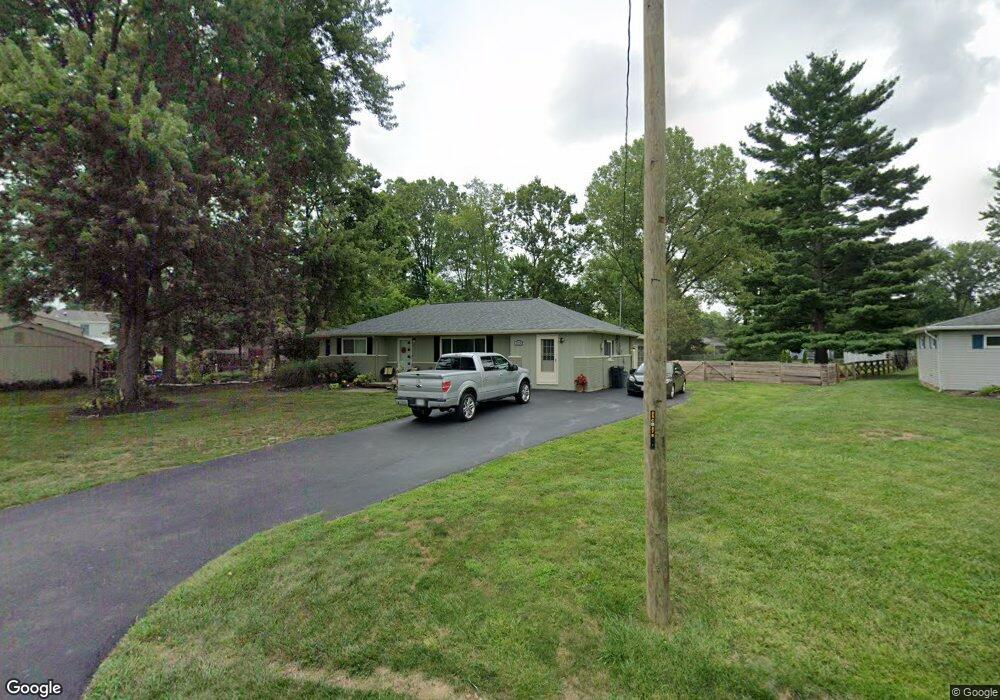
5874 Buckwheat Rd Milford, OH 45150
Estimated Value: $238,000 - $275,000
3
Beds
1
Bath
1,248
Sq Ft
$205/Sq Ft
Est. Value
About This Home
This home is located at 5874 Buckwheat Rd, Milford, OH 45150 and is currently estimated at $256,019, approximately $205 per square foot. 5874 Buckwheat Rd is a home located in Clermont County with nearby schools including Milford Senior High School, St. Mark's Lutheran School, and St. Andrew - St. Elizabeth Ann Seton School.
Ownership History
Date
Name
Owned For
Owner Type
Purchase Details
Closed on
Dec 28, 2018
Sold by
Dreyer Stephanie and Terry Stephanie S
Bought by
Terry Stephanie S and Terry Charles T
Current Estimated Value
Home Financials for this Owner
Home Financials are based on the most recent Mortgage that was taken out on this home.
Original Mortgage
$90,500
Outstanding Balance
$34,987
Interest Rate
4.7%
Mortgage Type
New Conventional
Estimated Equity
$221,032
Purchase Details
Closed on
Feb 11, 2008
Sold by
Dreyer Joel
Bought by
Dreyer Stephanie
Purchase Details
Closed on
Jan 1, 1987
Create a Home Valuation Report for This Property
The Home Valuation Report is an in-depth analysis detailing your home's value as well as a comparison with similar homes in the area
Home Values in the Area
Average Home Value in this Area
Purchase History
| Date | Buyer | Sale Price | Title Company |
|---|---|---|---|
| Terry Stephanie S | -- | Servicelink | |
| Dreyer Stephanie | -- | Attorney | |
| -- | $41,000 | -- |
Source: Public Records
Mortgage History
| Date | Status | Borrower | Loan Amount |
|---|---|---|---|
| Open | Terry Stephanie S | $90,500 |
Source: Public Records
Tax History Compared to Growth
Tax History
| Year | Tax Paid | Tax Assessment Tax Assessment Total Assessment is a certain percentage of the fair market value that is determined by local assessors to be the total taxable value of land and additions on the property. | Land | Improvement |
|---|---|---|---|---|
| 2024 | $2,901 | $63,670 | $15,790 | $47,880 |
| 2023 | $2,931 | $63,670 | $15,790 | $47,880 |
| 2022 | $2,734 | $45,220 | $11,200 | $34,020 |
| 2021 | $2,737 | $45,220 | $11,200 | $34,020 |
| 2020 | $2,623 | $45,220 | $11,200 | $34,020 |
| 2019 | $2,103 | $34,410 | $10,190 | $24,220 |
| 2018 | $2,103 | $34,410 | $10,190 | $24,220 |
| 2017 | $2,071 | $34,410 | $10,190 | $24,220 |
| 2016 | $2,065 | $30,730 | $9,100 | $21,630 |
| 2015 | $1,927 | $30,730 | $9,100 | $21,630 |
| 2014 | $1,927 | $30,730 | $9,100 | $21,630 |
| 2013 | $1,962 | $30,350 | $9,100 | $21,250 |
Source: Public Records
Map
Nearby Homes
- 1485 Foxtale Ct
- .6438 ac Buckwheat Rd
- .0288 ac Buckwheat Rd
- 5852 Monassas Run Rd
- 1382 Lela Ln
- 5818 Mount Vernon Dr
- 5818 Jeb Stuart Dr
- 1468 Corbin Dr
- 5811 Monassas Run Dr
- 5975 Buckwheat Rd
- 6049 Delfair Ln
- 1290 Michael Ln
- 1281 Piedmont Dr
- 6034 Delfair Ln
- 5942 Pinto Place
- 1399 Wade Rd
- 1197 Ronlee Dr
- 1201 Sorrel Ln
- 5778 Tall Oaks Dr
- 5761 Ashcraft Dr
- 5870 Buckwheat Rd
- 1339 Linden Creek Dr
- 5878 Buckwheat Rd
- 1341 Linden Creek Dr
- 1338 Lela Ln
- 1343 Linden Creek Dr
- 1487 Foxtale Ct
- 5864 Buckwheat Rd
- 1345 Linden Creek Dr
- 1486 Foxtale Ct
- 5880 Buckwheat Rd
- 1342 Lela Ln
- 1347 Linden Creek Dr
- 5860 Buckwheat Rd
- 1484 Foxtale Ct
- 1483 Foxtale Ct
- 1346 Lela Ln
- 1349 Linden Creek Dr
- 1338 Linden Creek Dr
- 1341 Lela Ln