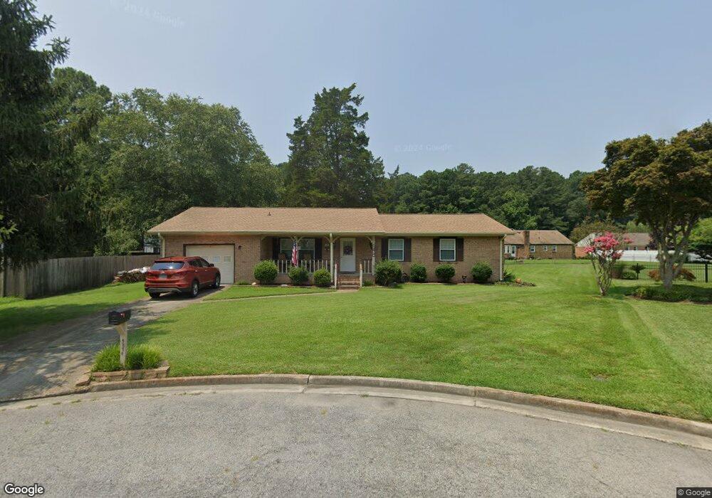
5874 Woodside Cir Portsmouth, VA 23703
Churchland NeighborhoodEstimated Value: $306,000 - $349,000
3
Beds
2
Baths
1,485
Sq Ft
$221/Sq Ft
Est. Value
About This Home
This home is located at 5874 Woodside Cir, Portsmouth, VA 23703 and is currently estimated at $327,786, approximately $220 per square foot. 5874 Woodside Cir is a home located in Portsmouth City with nearby schools including Churchland Primary/Intermediate School, Churchland Middle School, and Churchland High School.
Ownership History
Date
Name
Owned For
Owner Type
Purchase Details
Closed on
May 20, 2019
Sold by
Carlisle Gerald C and Carlisle Kristina M
Bought by
Vaughan Michael B and Vaughan Amy N
Current Estimated Value
Home Financials for this Owner
Home Financials are based on the most recent Mortgage that was taken out on this home.
Original Mortgage
$194,750
Outstanding Balance
$170,872
Interest Rate
4.2%
Mortgage Type
New Conventional
Estimated Equity
$156,914
Purchase Details
Closed on
Dec 4, 2014
Sold by
Mask Ruby H
Bought by
Carlisle Gerald C
Home Financials for this Owner
Home Financials are based on the most recent Mortgage that was taken out on this home.
Original Mortgage
$194,085
Interest Rate
3.93%
Mortgage Type
VA
Create a Home Valuation Report for This Property
The Home Valuation Report is an in-depth analysis detailing your home's value as well as a comparison with similar homes in the area
Home Values in the Area
Average Home Value in this Area
Purchase History
| Date | Buyer | Sale Price | Title Company |
|---|---|---|---|
| Vaughan Michael B | $205,000 | Advance Title & Abstract Inc | |
| Carlisle Gerald C | $190,000 | -- |
Source: Public Records
Mortgage History
| Date | Status | Borrower | Loan Amount |
|---|---|---|---|
| Open | Vaughan Michael B | $194,750 | |
| Previous Owner | Carlisle Gerald C | $194,085 |
Source: Public Records
Tax History Compared to Growth
Tax History
| Year | Tax Paid | Tax Assessment Tax Assessment Total Assessment is a certain percentage of the fair market value that is determined by local assessors to be the total taxable value of land and additions on the property. | Land | Improvement |
|---|---|---|---|---|
| 2025 | $3,850 | $303,640 | $102,600 | $201,040 |
| 2024 | $3,850 | $299,140 | $102,600 | $196,540 |
| 2023 | $3,458 | $276,640 | $102,600 | $174,040 |
| 2022 | $3,159 | $243,030 | $85,500 | $157,530 |
| 2021 | $2,794 | $214,890 | $57,360 | $157,530 |
| 2020 | $2,758 | $212,150 | $54,620 | $157,530 |
| 2019 | $2,660 | $204,650 | $54,620 | $150,030 |
| 2018 | $2,660 | $204,650 | $54,620 | $150,030 |
| 2017 | $2,660 | $204,650 | $54,620 | $150,030 |
| 2016 | $2,660 | $204,650 | $54,620 | $150,030 |
| 2015 | $2,563 | $197,150 | $54,620 | $142,530 |
| 2014 | $2,571 | $202,430 | $54,620 | $147,810 |
Source: Public Records
Map
Nearby Homes
- 4619 River Shore Rd
- 4444 Southampton Arch
- 21 Windy Pines Crescent
- 4726 River Shore Rd
- 5833 Hawthorne Ln
- 5728 Hawthorne Ln
- 4224 Burnham Dr
- 5693 Rivermill Cir
- 6750 Burbage Landing Cir
- 4232 Summerset Dr
- 8 Compass Ct
- 6602 James Point Ct
- 4200 Quince Rd
- 5606 Gregory Ct
- 4071 Long Point Blvd
- 17 Shoal Ct
- 5028 Bay Cir
- 4100 Mayfair Way
- 6832 Ivanhoe Ct
- 4028 Swannanoa Dr
- 5874 Woodside Cir
- 5870 Woodside Cir
- 4507 Twin Pines Rd
- 4505 Twin Pines Rd
- 5878 Woodside Cir
- 4509 Twin Pines Rd
- 5882 Woodside Cir
- 5866 Woodside Cir
- 4628 Southampton Arch
- 4626 Southampton Arch
- 4503 Twin Pines Rd
- 5862 Woodside Cir
- 4511 Twin Pines Rd
- 4624 Southampton Arch
- 5858 Woodside Cir
- 5886 Woodside Cir
- 5854 Woodside Cir
- 4622 Southampton Arch
- 4501 Twin Pines Rd
- 4506 Raintree Ln