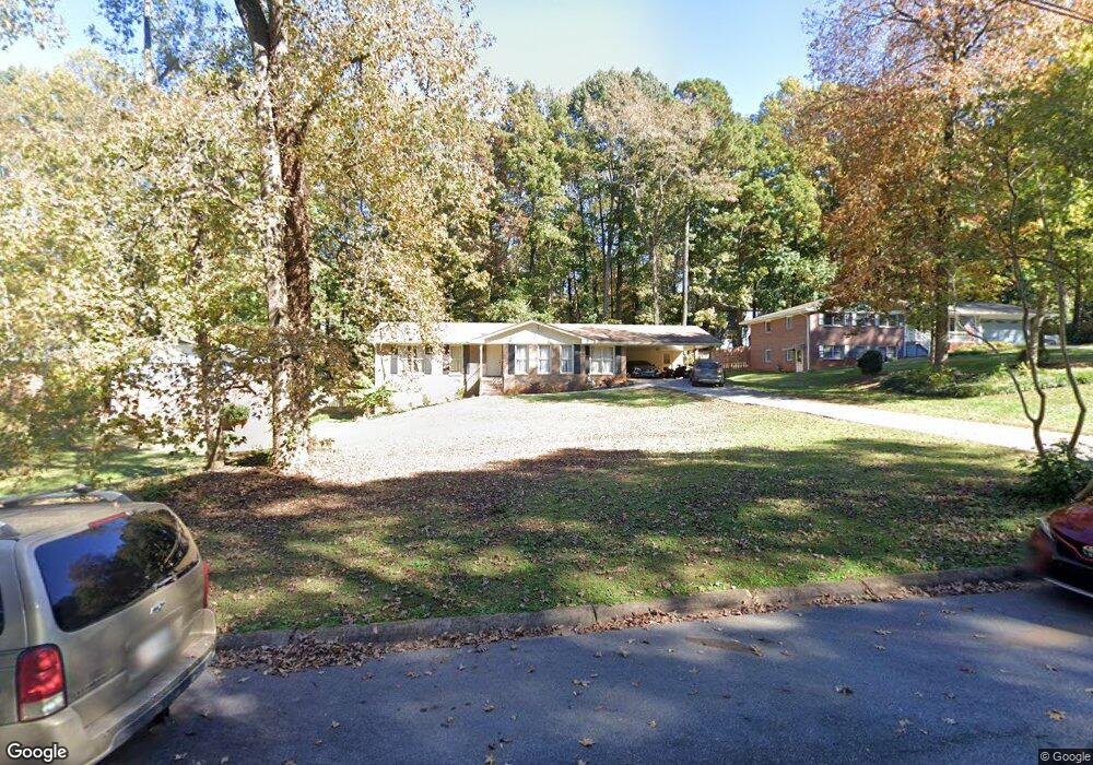
5878 Ohara Dr Unit 2 Stone Mountain, GA 30087
Smoke Rise NeighborhoodEstimated Value: $332,829 - $375,000
3
Beds
2
Baths
1,865
Sq Ft
$189/Sq Ft
Est. Value
About This Home
This home is located at 5878 Ohara Dr Unit 2, Stone Mountain, GA 30087 and is currently estimated at $353,207, approximately $189 per square foot. 5878 Ohara Dr Unit 2 is a home located in Gwinnett County with nearby schools including Camp Creek Elementary School, Trickum Middle School, and Parkview High School.
Ownership History
Date
Name
Owned For
Owner Type
Purchase Details
Closed on
Feb 21, 2006
Sold by
Hutchinson Irvin P
Bought by
Marshall Denise M
Current Estimated Value
Home Financials for this Owner
Home Financials are based on the most recent Mortgage that was taken out on this home.
Original Mortgage
$31,980
Interest Rate
5.84%
Mortgage Type
New Conventional
Create a Home Valuation Report for This Property
The Home Valuation Report is an in-depth analysis detailing your home's value as well as a comparison with similar homes in the area
Home Values in the Area
Average Home Value in this Area
Purchase History
| Date | Buyer | Sale Price | Title Company |
|---|---|---|---|
| Marshall Denise M | $159,900 | -- | |
| Marshall Denise M | -- | -- |
Source: Public Records
Mortgage History
| Date | Status | Borrower | Loan Amount |
|---|---|---|---|
| Previous Owner | Marshall Denise M | $31,980 | |
| Previous Owner | Marshall Denise M | $127,920 |
Source: Public Records
Tax History
| Year | Tax Paid | Tax Assessment Tax Assessment Total Assessment is a certain percentage of the fair market value that is determined by local assessors to be the total taxable value of land and additions on the property. | Land | Improvement |
|---|---|---|---|---|
| 2025 | $3,751 | $135,720 | $22,200 | $113,520 |
| 2024 | $3,886 | $136,320 | $22,200 | $114,120 |
| 2023 | $3,886 | $131,040 | $24,000 | $107,040 |
| 2022 | $3,374 | $113,400 | $24,000 | $89,400 |
| 2021 | $2,773 | $82,680 | $17,200 | $65,480 |
| 2020 | $2,548 | $82,680 | $17,200 | $65,480 |
| 2019 | $2,548 | $74,920 | $14,000 | $60,920 |
| 2018 | $2,461 | $70,960 | $14,000 | $56,960 |
| 2016 | $2,306 | $62,800 | $14,000 | $48,800 |
| 2015 | $2,164 | $56,800 | $14,000 | $42,800 |
| 2014 | $1,868 | $48,240 | $14,000 | $34,240 |
Source: Public Records
Map
Nearby Homes
- 292 Old Rosser Rd
- 353 Old Rosser Rd
- 507 Castleaire Dr Unit 1
- 2360 Ivey Oaks Place
- 262 Harmony Grove Rd
- 2393 Flintlock Dr Unit 19
- 127 Old Rosser Rd SW
- 5825 Golden West Trail SW
- 450 Shay Lind Ct SW
- 4969 Dufour Dr
- 5781 Four Winds Dr SW Unit 1B
- 5013 Oakwood Dr
- 5005 Oakwood Dr
- 5011 Oakwood Dr
- 5015 Oakwood Dr
- 2173 Spencers Way
- 29 Lankford Rd
- 263 Devant Place SW
- 5618 Fern Creek Dr SW
- 5776 Princeton Run Trail
- 5872 Ohara Dr
- 5882 Ohara Dr Unit 2
- 5815 Mcgowan Cir
- 5868 Ohara Dr
- 5824 Mcgowan Cir
- 5899 Ohara Dr
- 5888 Ohara Dr
- 351 Nalley Dr
- 5892 Ohara Dr
- 5862 Ohara Dr
- 361 Nalley Dr
- 5814 Mcgowan Cir
- 5898 Ohara Dr
- 341 Nalley Dr
- 5903 Ohara Dr Unit 2
- 371 Nalley Dr Unit 2
- 371 Nalley Dr
- 5869 Ohara Dr
- 5858 Ohara Dr Unit 2
- 5902 Ohara Dr
Your Personal Tour Guide
Ask me questions while you tour the home.