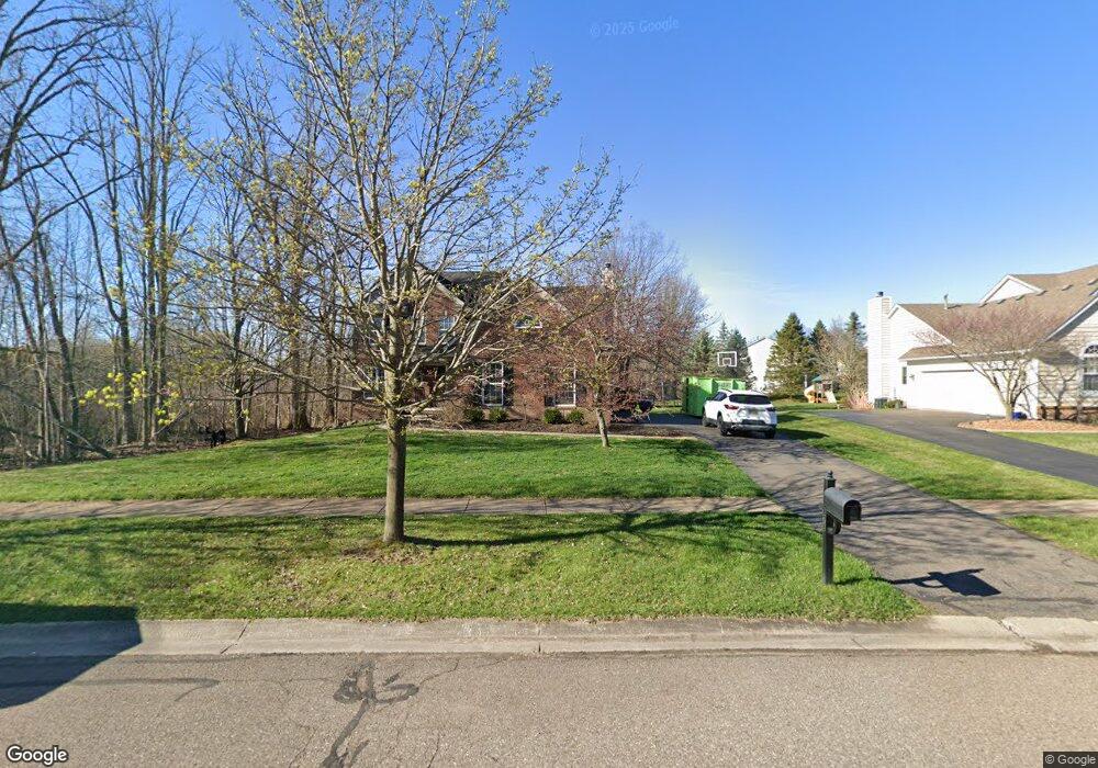
5878 Pine Trace Ct Unit Bldg-Unit Howell, MI 48843
Estimated Value: $480,000 - $524,000
4
Beds
4
Baths
2,226
Sq Ft
$228/Sq Ft
Est. Value
About This Home
This home is located at 5878 Pine Trace Ct Unit Bldg-Unit, Howell, MI 48843 and is currently estimated at $508,446, approximately $228 per square foot. 5878 Pine Trace Ct Unit Bldg-Unit is a home located in Livingston County with nearby schools including Hartland High School.
Ownership History
Date
Name
Owned For
Owner Type
Purchase Details
Closed on
Mar 9, 2018
Sold by
Cregar Adam J
Bought by
Geer Terry L and Geer Anna M
Current Estimated Value
Purchase Details
Closed on
May 28, 2014
Sold by
Heydenburg Kurt M and Beacon Heydenburg Leah M
Bought by
Cregar Adam J
Purchase Details
Closed on
Feb 19, 2002
Sold by
Bingham Woodland Llc
Bought by
Heydenburg Kurt M and Beacom Heydenburg Leah M
Purchase Details
Closed on
May 10, 2001
Sold by
Chemung Forest Llc
Bought by
Bingham Woodland Llc
Create a Home Valuation Report for This Property
The Home Valuation Report is an in-depth analysis detailing your home's value as well as a comparison with similar homes in the area
Home Values in the Area
Average Home Value in this Area
Purchase History
| Date | Buyer | Sale Price | Title Company |
|---|---|---|---|
| Geer Terry L | $299,000 | -- | |
| Cregar Adam J | $265,000 | -- | |
| Heydenburg Kurt M | $285,429 | Metropolitan Title Company | |
| Bingham Woodland Llc | $60,000 | -- |
Source: Public Records
Tax History
| Year | Tax Paid | Tax Assessment Tax Assessment Total Assessment is a certain percentage of the fair market value that is determined by local assessors to be the total taxable value of land and additions on the property. | Land | Improvement |
|---|---|---|---|---|
| 2025 | $3,045 | $244,700 | $0 | $0 |
| 2024 | $2,958 | $235,700 | $0 | $0 |
| 2023 | $2,826 | $194,600 | $0 | $0 |
| 2022 | $3,936 | $156,000 | $0 | $0 |
| 2021 | $3,811 | $165,200 | $0 | $0 |
| 2020 | $3,920 | $158,700 | $0 | $0 |
| 2019 | $3,858 | $156,000 | $0 | $0 |
| 2018 | $3,347 | $143,600 | $0 | $0 |
| 2017 | $3,204 | $143,600 | $0 | $0 |
| 2016 | $3,182 | $134,900 | $0 | $0 |
| 2014 | $2,349 | $111,900 | $0 | $0 |
| 2012 | $2,349 | $96,700 | $0 | $0 |
Source: Public Records
Map
Nearby Homes
- 1716 S Hughes Rd
- 5832 Glen Echo Dr
- 1700 S Hughes Rd
- 562 S Hughes Rd
- 1794 S Hughes Rd
- 1146 Sunrise Park St
- 5570 Golf Club Rd
- 1575 Kellogg Rd
- 1068 Sunrise Park St
- 612 Sunrise Park St
- 2125 Candy Ln
- 6421 Breezeway
- 6538 Biscayne Blvd E
- 4324 Hampton Ridge Blvd
- 4404 Willow View Ct
- 453 N Hughes Rd
- 4450 Golf Club Rd
- VL E Grand River N
- 3186 Aspen Ridge Ct
- 5910 Cedar Knoll Dr
- 5878 Pine Trace Ct Unit 114
- 5860 Pine Trace Ct Unit 113
- 5863 Pine Trace Ct Unit 77
- 1089 Chemung Forest Dr Unit 112
- 5914 Pine Trace Ct
- 1070 Chemung Forest Dr Unit 86
- 1127 Chemung Forest Dr Unit 111
- 5915 Pine Trace Ct Unit 27
- 981 Chemung Forest Dr Unit 76
- 5837 Pine Trace Ct Unit 79
- 1088 Chemung Forest Dr Unit 87
- 1174 Catherines Way
- 00000 Pine Trace Ct
- 1151 Chemung Forest Dr
- 5932 Pine Trace Ct
- 1106 Chemung Forest Dr Unit 88
- 5929 Pine Trace Ct Unit Bldg-Unit
- 5929 Pine Trace Ct
- 1192 Catherines Way Unit Bldg-Unit
- 1192 Catherines Way
Your Personal Tour Guide
Ask me questions while you tour the home.